| Summary: |
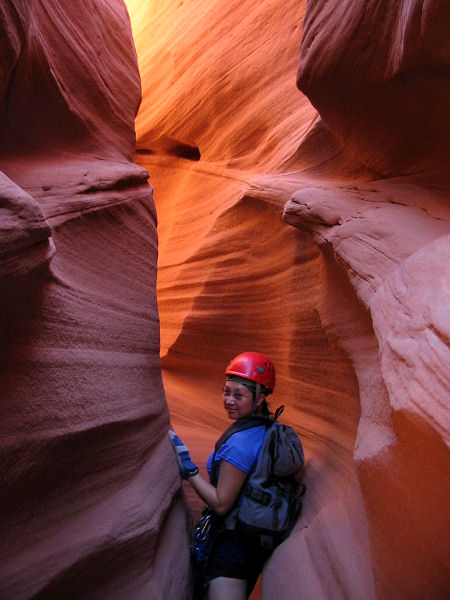
Two forks of a pretty good
technical canyon with a few rappels and some
short narrows. Short sections of wading may be
required, but you should not have do do any
swimming. To complete this canyon you will
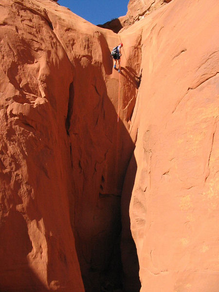
need enough rope for a 130 ft rappel
(conservative), webbing, harness & descending
gear. Leave the bolt kit at home, the canyon is
not bolted and should be kept that way. Natural
anchors may be used at all drops. |
| Directions: |
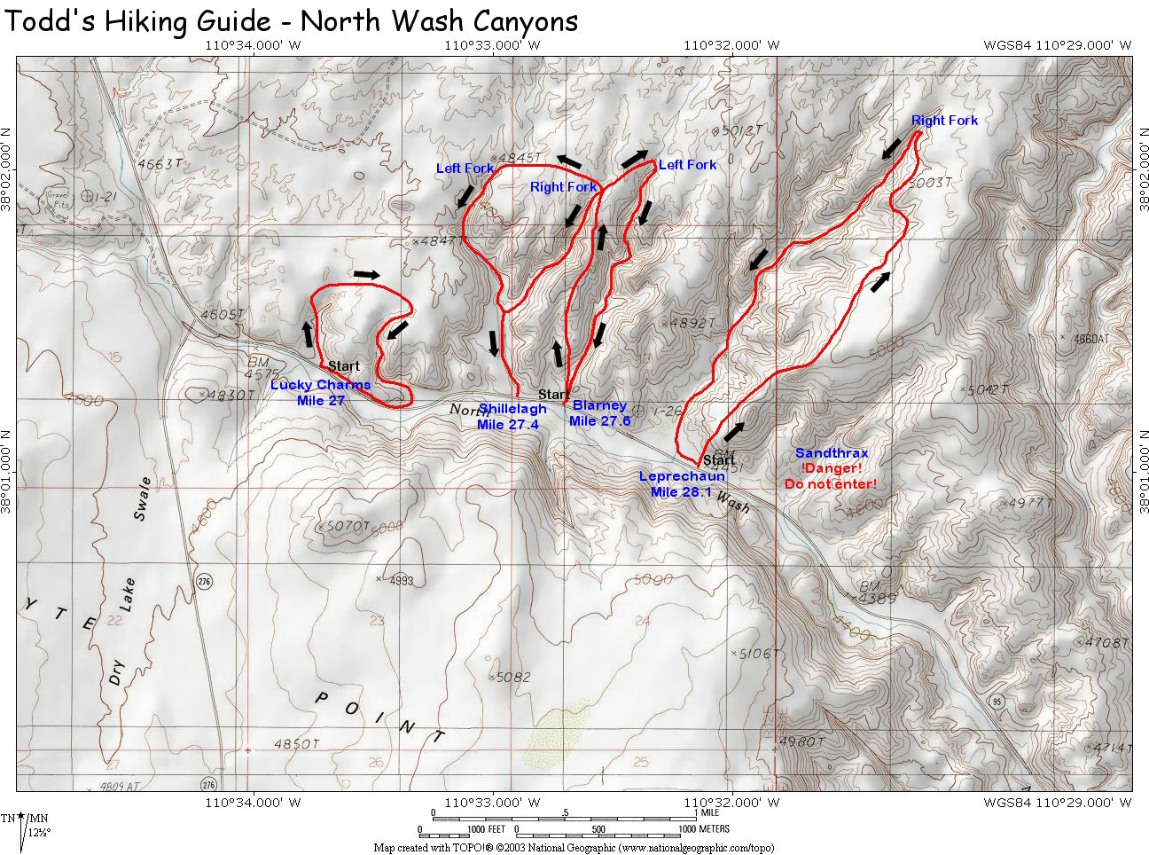
North Wash is
located off of Highway 95, south of Hanksville,
UT and north of the Hite Marina on Lake Powell.
Drive on Highway 95 to between mile posts 27 &
26 (about mile 27.6). Pull off the pavement onto a short
dirt road located on the east and park at the
end
(UTM
0539961mE,
4208163mN).
The drainage just to the left of this parking
spot is Blarney. |
| Road Conditions: |
Passenger Car |
| Navigation: |
Moderate - a GPS is useful |
| Length: |
~2 hours each fork |
| Date Hiked: |
October,
2003 |
| Weather Conditions: |
Warm and Sunny |
|
Required Skills: |


 |
| Hike Description: |
From the car
park, walk left across the wash and work your
way up the slickrock. Once on top you'll see
that you are on an arm between two drainages.
Blarney is on your
right (east) Shillelagh is on your left (west).
When you reach the top of the mesa you should be
able to pick up a developing trail which leads
north to the heads of both of these canyons.
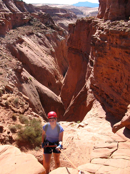
Right Fork:
From the mesa, head left and route find
your way down into the head of the drainage at (UTM
0540215mE 4209577mN). You will soon reach two
drop offs to get into the canyon below. The
first requires a rappel of 55 ft from a sling
around a boulder, the second rappel is 100 ft
next to a nice chute from a sling around a
boulder on the left. Once in the canyon bottom,
you will be faced with a few down climbs and
short narrows before you reach the junction with
the left fork of the canyon. The drainage widens
below this point & it's an easy walk back to
your car.
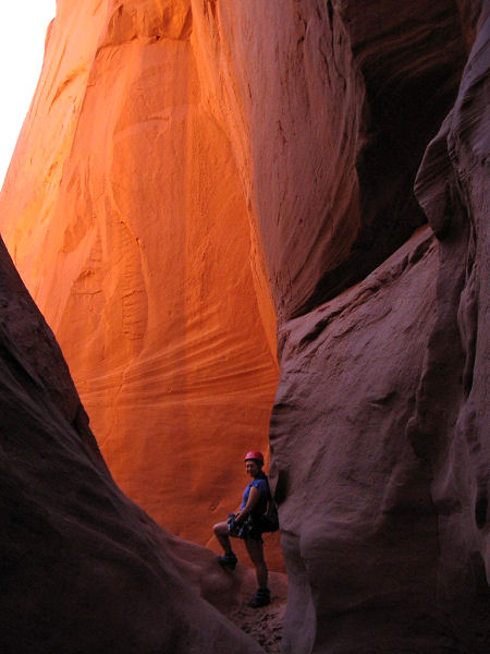
Left Fork:
Continue around the drainage of the right fork
and continue west into the head of the left fork
at (UTM 539645mE 4209676mN). Walk down the shallow wash
then down climb a short drop off on the left
side to reach the first rappel point. Rap #1 is
25 ft (though we used 130 ft of rope since
anchor was back from the edge) from a sling
around a boulder. Rap #2 is 60 ft from a sling
around a rock at the top of the drop. The next
obstacle is a 30 ft chute which can be down
climbed, but you might want to belay the less
experienced members of your group. A bit of
walking through short narrows and a few down
climbs over choke stones will bring you to the
confluence with the right fork. A short walk
down the wide drainage will bring you back to
your car. |
| Rating (1-5 stars): |

The author, his wife and a friend completed
these hikes as a group of 3 in under 2 hours in
each fork. |
|
Books: |
Technical Slot Canyon
Guide to the Colorado Plateau - Michael R.
Kelsey |
| Maps: |
Click
here for a
map of the area |
| Photos: |
Click picture for larger view, click your browser's 'Back' button to return to this page. |
