| |
Manns and Tomaski Peaks - Manti-La Sal
National Forest
| Summary: |
A strenuous
half-day hike to two prominent peaks in the La Sal Mountains with incredible
360 degree views of the La Sal Mountains and beyond. The route follows a
trail to Burro Pass, then heads cross country to the summits. It's best to
avoid the peaks and ridgelines in the afternoon during the summer
thunderstorm season due to the danger of lightening strikes. |
| Directions: |
From the town of Moab, UT head south out
of town on Highway 191 and turn left onto Old Airport Road at the sign for
the La Sal Mountain Loop Road. Drive 0.5 miles to the end of this road to a
'T' junction and turn right. Follow this paved road for 12 miles, then turn
right onto Geyser Pass Road, which is also Forest Road (FR) #071, at the
sign pointing towards Gold Basin. The road becomes well graded dirt as it
winds its way up into the mountains. After 5.6 miles FR #0421 branches
right. Continue straight a few more miles to Geyser Pass and turn left at
the sign for the Moonlight Meadows Trail #179 and Burro Pass Trail #315.
Follow this road for 1.2 miles to FR #0240 and sign for the Burro Pass Trail
(0.5 miles) on the left. Those with passenger cars will want to park here.
Those with high clearance or 4-WD can head up this road as far as you dare
(it is very steep) and park. |
| Road
Conditions: |
Passenger Car (high clearance or 4-WD will get you
slightly closer) |
| Navigation: |
Easy |
| Length: |
~4 miles |
| Date
Hiked: |
July, 2007 |
| Weather
Conditions: |
Warm and sunny |
|
Required Skills: |
 |
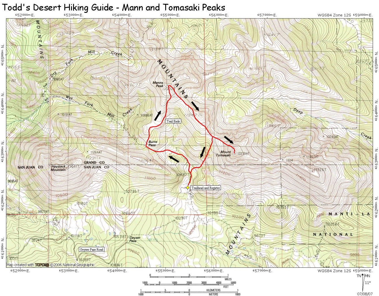
| Hike
Description: |
From the wherever you parked, walk up the
road to the Burro Pass Trailhead and register (10,420 feet). Follow the well
maintained path as it travels at a moderately steep grade up the mountain
through forest and meadows to eventually reach a junction at Burro Pass.
Turn right at the junction and follow the trail a short distance to a
forested basin below Manns Peak, which you will see above you to the left.
The trail fades at this point. Simply begin climbing a route of your own
choosing to eventually top out at Manns Peak (12,272 feet). From here you
will be able to easily see the prominent rocky point of Mount Tomasaki to
the southeast. To get there, simply follow the ridgeline between the two
points, circling around an intervening hill to the south along the way. The
easiest route to the top of Mount Tomasaki is to head straight up from the
ridgeline. As you climb, a distinct trail will form. Watch your footing as
you climb, the hill consists of piles of loose plate-shaped rocks which
clatter and rock beneath your feet as you climb. The summit (12,239 feet)
provides an ideal place from which to scout your trip down to the trailhead.
You could either return the way you came via Burro Pass, or choose a more
direct route down the hill from the ridgeline below Tomasaki. If you choose
the latter route, be aware that the hillside is quite steep in places. |
| Rating
(1-5 stars): |

The author, his wife and two friends completed the hike described
above in about 5 hours. |
| Maps: |
Latitude 40° Maps - Moab East Utah Trails Recreation Topo
Map
Click here for a map of the hike. |
| Books: |
Utah Mountaineering Guide 3rd Edition
- Michael Kelsey |
| Photos: |
Click picture for larger
view, click your browser's 'Back' button to return to this page. |
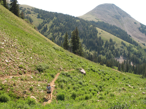 |
 |
| Following the trail to Burro
Pass. |
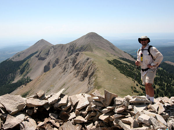
Mount Tomasaki as seen from
Manns Peak. |
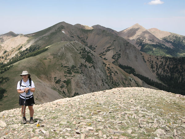 |
 |
Manns Peak
and Mount Waas
as seen from Mount Tomasaki. |
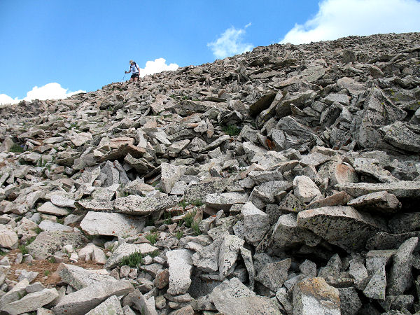
Descending Mount Tomasaki. |
|
|
