| Hike Description: |
From the car
park and trailhead sign, begin walking down the
road to the second wide sandy wash that crosses
the road. Turn left and follow this second wash
up canyon. It's a sandy slog at first, then the
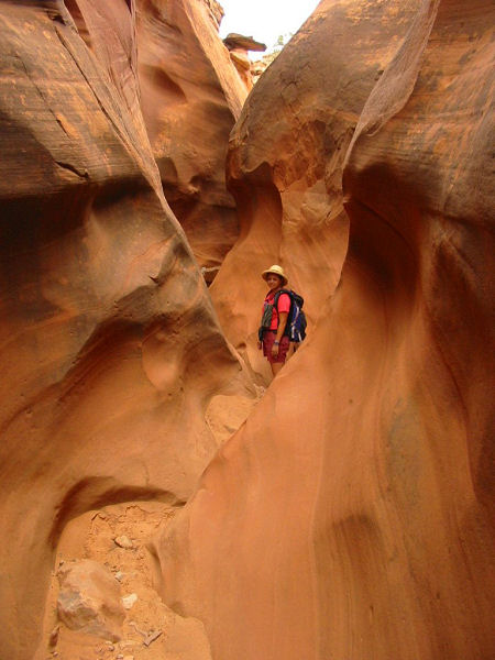
canyon eventually enters some shallow narrows.
Soon you will hit a 35 foot dry fall. You can
either climb directly up the rock, or turn back and
look for a cairned path around on the right
(facing down canyon). Just above the dry fall,
the canyon forks (in case you have a gps, this
point is: UTM 470061mE, 4166686mN). Stay to the
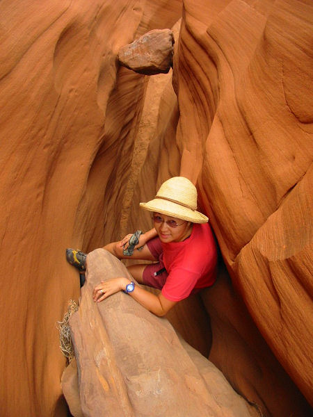
right. The canyon soon becomes a nice slot
canyon. There are several choke stones that you
will have to chimney up to continue, but I did
not find any of the climbs particularly
difficult. Eventually you will reach a point
where the canyon appears to bend left. If you
continue up this left bend you will encounter a
small natural bridge and a 25 foot dry fall.
Note: There is a long tight
slot above this dry fall. I was able to climb
the drop and went all the way through the
narrows (walking sideways most of the time). In
the upper portion of the slot, there is a
boulder pile that blocks your path. It is
possible to climb this obstacle (I did with some
difficulty), but it's not really worth the
effort since the canyon widens shortly
afterwards.
When ready, back track out of
this side canyon and climb the white sandstone
slick rock just to the right (facing up canyon)
of this side drainage (UTM 469876mE, 4168949mN).
You will find that the main fork of Red Breaks
Canyon continues above. Stay up on the slick
rock bench on the left side of the canyon to
avoid a series of pot holes and dry falls in the
upper section. As you reach the head of the
canyon, walk towards the prominent dome shaped
rock you see ahead of you. To do a semi-loop,
walk due east (right) up and over a slick rock
ridge and drop down into the drainage
immediately on the other side. This drainage is
easy slick rock walking and will bring you back
to a point about mid-way through the Red Breaks
drainage you came up earlier (note: there is a
15' down climb with an 8 foot slide at the end
that is a bit dangerous and should only be
attempted by good climbers; a belay is
recommended). Another route (see M. Kelsey's
book below), would be to continue east, up and
over a second slick rock ridge into the second
drainage to the east. This wash eventually meets
up with a sandy road that will take you back to
the Harris Wash Trailhead (though be aware that
I have not hiked this route). If you took the
first wash like I did, slide back down into Red
Breaks (without breaking your ankle) and retrace
your steps back to your car. |