| Summary: |
A long loop
hike connecting two very pretty canyons with a
long sandy slog in between. |
| Directions: |
From the
small town of Cannonville
drive south on Cottonwood Rd. Turn right (southwest)
on Skutumpah Rd. at the sign for Bull Valley
Gorge 9 miles, Kanab 61 miles (this is also
Forest Road #500). Follow this pretty good dirt
road south. In 6.3 miles you will cross the perennial
Willis Creek (parking and trail register on the
right). Another two miles will bring you to Bull
Valley Gorge (some small one car pull offs in
the area). |
| Road Conditions: |
Passenger Car
in dry weather if you go slow |
| Navigation: |
Easy |
| Length: |
~15
Miles |
| Date Hiked: |
November,
1999 & November 2002 |
| Weather Conditions: |
Cold |
|
Required Skills: |


 |
| Hike Description: |
Most people probably just
hike down a ways then back out of each of these
canyons, but I will describe them as a loop. If
doing an out and back trip in Bull Valley Gorge,
make sure you don't climb down something you
can't get back up.
From the Bull Valley Gorge bridge, walk on the
trail up canyon (on the right side facing up
stream), through the stile & past the trail
register. In about 15 minutes the canyon will
become shallow enough to climb down into it.
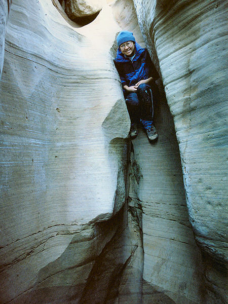
Head down canyon. You will encounter a few drop
offs in the upper section that will require
decent climbing skills to negotiate safely and
possibly a few puddles (be aware that if water
is present the canyon can be very muddy, making
climbing considerably more difficult). The
canyon deepens quickly into a nice and pretty
slot. The yellow/gray walls aren't great for
photography, but they are nicely sculpted. As
you pass under the Skutumpah Rd. bridge, look up
and check out the old pick up truck wedged in
the slot over your head. This was the scene of a
1954 car wreck that claimed the lives of 3 men
(the second Michael Kelsey reference below
recounts the story of this incident). Continue
hiking and rock hopping your way down canyon.
Eventually the canyon will widen and you will
reach the confluence with Sheep Creek. There is
nothing terribly interesting about this wide
drainage and it is full of deep sand. You may
find vehicle tracks in the middle from ranchers
or 4-WD enthusiasts. Nothing to do except pick a
tire track, head left and begin slogging your
way up Sheep Creek (the puns are all too easy). Remember to look up once in a
while and scan the left (west) wall for the
prominent drainage of Willis Creek (if you miss
it, don't worry, you'll wind up back at Skutumpah Rd. either way). Once you find Willis,
turn left and head up canyon. There will be
water in the bottom, but it is fairly easy to
hop over it when you need to, and you can keep
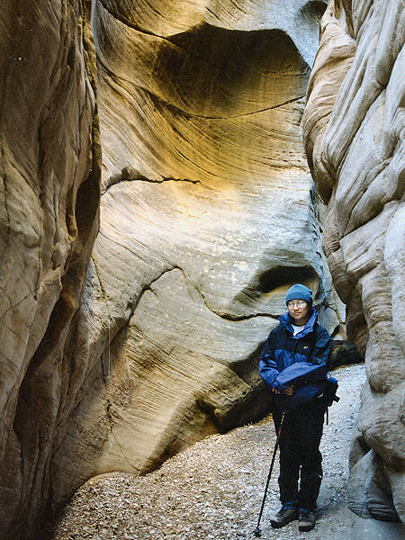
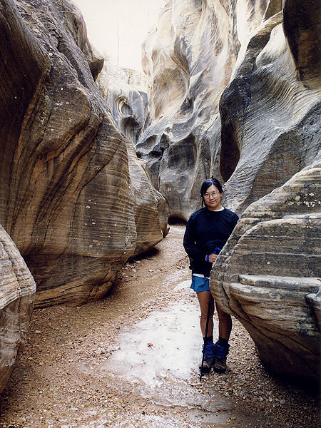
your feet dry. Willis is nice all the way
through with no major obstacles. As you hike, the
canyon becomes more and more narrow as you
approach Skutumpah Rd. Once you reach the road
turn left and it's a short half an hour road
walk
back to your car. |
| Rating (1-5 stars): |

On their first trip to this area, the author
and his wife completed the loop described above
in about 8 hours. We returned in 2002 but Bull
Valley Gorge was wet and muddy and too cold for
wading. We went down canyon a ways before
backtracking. |
| Maps: |
Trails Illustrated - Canyons of the Escalante |
| Books: |
Canyon
Hiking Guide to the Colorado Plateau -
Michael Kelsey
Hiking and
Exploring the Paria River -
Michael Kelsey |
| Photos: |
Click picture for larger view, click your browser's 'Back' button to return to this page. |