| |
Cottonwood Canyon Trail, AZ Trail - Tonto National Forest
| Summary: |
A short out and back hike
through a canyon with a spring just south of
Roosevelt Marina. The Cottonwood Trail #120 is a
short section of the AZ trail which connects
Roosevelt Lake and the bridge over the Salt
River with the Two Bar Ridge Trail. |
| Directions: |
From Phoenix
drive east on Highway 60 almost to Globe. Turn
left (north) on Highway 188 (also listed as 88
on maps) and drive to just past milepost 239 and
turn left on Forest Road 83. After 2.3 miles on
good dirt road you'll reach a sign indicating
the Cottonwood Canyon Trail is 2 miles to the
left. Follow this rough 4-Wheel Drive road 2
miles to the signed junction with a short, right
branching spur road for the Cottonwood Canyon
Trail. Park at the end next to a concrete stock
tank. |
| Road Conditions: |
4-Wheel Drive |
| Navigation: |
Easy |
| Length: |
6
miles |
| Date Hiked: |
January 2005 |
| Weather Conditions: |
Cloudy and cool |
|
Required Skills: |
None |
| Hike Description: |
From the parking area, pick
up the Cottonwood Canyon Trail #120 as it heads
north down a somewhat overgrown path past a
wooden sign: Cottonwood Spring - 1 mile, Forest
Road 341 - 3 miles. The path soon enters a dry
wash which you'll follow, more or less, for the
rest of the hike. The wash is gravel at first,
but the rocks become larger as you hike. There
are short stretches of cairned trail on one side
of the wash or the other, but these are often
overgrown to the point that it's often easier
just to remain in the wash. After 30 minutes
you'll enter a forested area with some
cottonwood trees and some old farm junk (a fence
and trough). Further to the north, water
eventually surfaces (at least that was the case
when I was here in January, I am not sure if
water is present during the warmer months) and a
more defined path appears on the right side of
the stream. Eventually, just after crossing the
wash to the left side, the path ends at a large
metal tank and Forest Road 341. Return the way
you came.
|
| Rating (1-5 stars): |

Not a very interesting hike. The author and
his wife completed the trip in 2.5 hours. |
| Maps: |
Tonto
National Forest Map |
| Photos: |
Click picture for larger view, click your browser's 'Back' button to return to this page. |
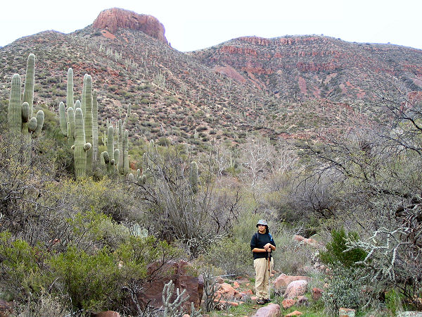 |
Typical view along the
Cottonwood Canyon Trail. |
|
|
