| |
Christopher Creek Gorge - Tonto National Forest
| Summary: |
This hike can be done as
either a short stroll to the
nice gorge & water hole, or as a more
exciting canyon hike. This area is
a popular weekend hangout during warmer months of the
year. There's a lot of broken glass about, so be
sure to wear good shoes even if you're basking
on the rocks or wading in the stream. This hike
is best done in warm weather since the water is
chilly (or carry a wet suit if attempting it
earlier in the season). Good climbers can do the
canyon hike described without any specialized
gear by bypassing one short section of canyon
(or jumping, though I don't recommend it, canyon
conditions change all the time) or better yet,
bring a 100' rope, webbing and a harness to
complete 2 short rappels. I'd also suggest
having at least one good climber in the group
who can belay less experienced members down the
more difficult down climbs. |
| Directions: |
From Phoenix
drive northeast on State Highway 87 (Beeline
Highway) to Payson. In downtown Payson turn
right (east) on Highway 260 for about 19 miles.
Just past mile marker 271 park at a pull out on
the right side of the road.
Note: as of 6/05 there are now no parking signs
and a dirt berm at the traditional pull off for
this hike. I'm not sure what the highway
department is trying to accomplish or where they
want people to park (seems to me like they are
forcing people to walk across the busy, high
speed highway on a blind corner, which doesn't
strike me as good public safety policy). Anyway,
most people seem to ignore the signs and park at
the traditional pull off without any problems. |
| Road Conditions: |
Passenger Car |
| Navigation: |
Easy, except for those doing
the canyon hike who will need to pay close
attention to identify the proper exit point
(I've also provided the GPS coordinate below). |
| Length: |
1-2
miles |
| Date Hiked: |
December 2003, June 2005 |
| Weather Conditions: |
Cold in December; warm, but
not warm enough in June |
|
Required Skills: |
No skills required to hike to the
gorge and play in the water.


 - for the canyon trip
described.
- for the canyon trip
described. |
| Hike Description: |
From the car park walk
through the fence and pick up the wide, flat
trail as it heads south towards the creek. Some
well intentioned nitwit has painted orange
blazes on the trees for those that are route
finding challenged. Soon the path splits, what
do you do?! Don't panic, the helping hand of our
thoughtful vandal is there to guide you. Orange
dots mark the path to the left, the word 'BOX'
emblazon the path ahead (I suppose another
symbol, like say a square, was considered too
esoteric for a route marking task as serious as
this one). Pick your poison, both paths are
short and easy. I suppose the 'BOX' route is
quicker if you're a busy executive, on the go
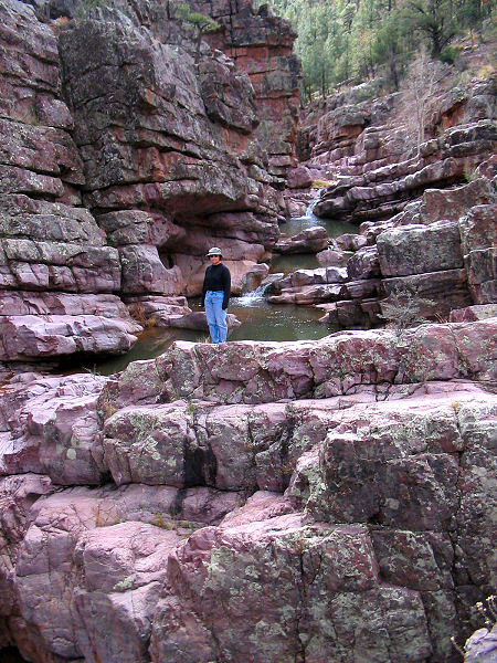
type. Down at the creek bed you'll be greeted
with a pleasant red rock canyon and small water
falls. Heading downstream, you'll be faced with
wading, swimming and climbing on the polished
quartzite rock (which is smooth and slick). The
geography is tilted in a way that the rock
layers are angled upwards in the downstream
direction. The implication for the hiker is that
you often find a nice clear slab to follow which
brings you further above the creek the further
downstream you hike, until you're eventually
cliffed out. For the most part it's best to stay
near the creek. Heading down canyon there are
multiple falls, swims and down climbs. There are
also a few opportunities to jump (just be sure
to assess the water depth beforehand, in no case
should you jump if the water is cloudy and you
can't see the bottom). Though I can't describe
every little obstacle encountered on the hike,
here are a few of the more prominent ones. The
first trouble spot is a cliff band that requires
a 15' down climb. If descending this cliff is
daunting, this is a good place to turn around.
Further down canyon, progress will be blocked by
a drop off that reaches to both canyon walls.
The easiest way down is to do a 4' jump
into the water from a narrow platform in front
of a boulder on the right (you can also jump
from a higher point if water levels allow). The
next drop off requires a sketchy down climb and
jump. This one is best avoided by climbing
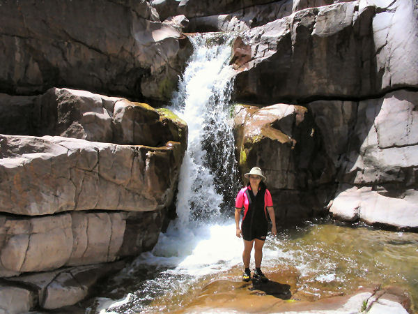
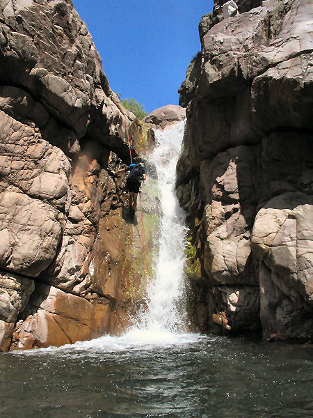
around on canyon right. Just beyond is a nice
35' waterfall. Those with gear can rappel the
falls by rigging from a large fallen log to the
right of the falls, otherwise you'll have to
climb around in the brush on the right. Those
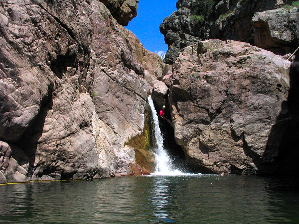
that rappelled the falls will find themselves in
a nice water filled box canyon. Swim downstream
to arrive at rappel #2, a 20' drop next to a
waterfall. The anchor is the chockstone at the
head of the falls, and is a little tricky due to
a rather awkward start. There's another short
section of pretty canyon below and soon after
you'll see a prominent side canyon which enters
from the right (north). From this point, looking
down canyon, you'll see that the quartzite rock
fades away (indicating that the rocky gorge
gives way to a more typical meandering stream.
The right branching side canyon is labeled
Spring Creek on the map and is the exit route
(if you have a gps the coordinates are:
UTM 493958mE, 3796673mN).
Walk up Spring Creek (or climb up a rocky slope
and drop into the creek above) and follow it
upstream for ~15 minutes or so to a point where
the creek bends right at a drop off and pool.
Climb the rocky slope to the left of the drop
off (keeping to the open, non-brushy areas)
heading in a north-easterly direction. The slope
is cairned in places, and power lines become
visible as you climb higher on the slope. At the
top of the hill (assuming you've gone in the
right direction) you'll reach a short dirt spur
road that can be followed to Highway 260. Turn
right and follow the highway about 0.5 miles
back to the trailhead and your car. |
| Rating (1-5 stars): |

The author and his wife hiked down to the
gorge. Then followed it above and along the bank
climbing high on the cliffs when necessary
avoiding the pools (in December wading was out
of the question). Total hike time was about 1.5
hours.
At a later date we returned and completed the
canyon hike described above. |
|
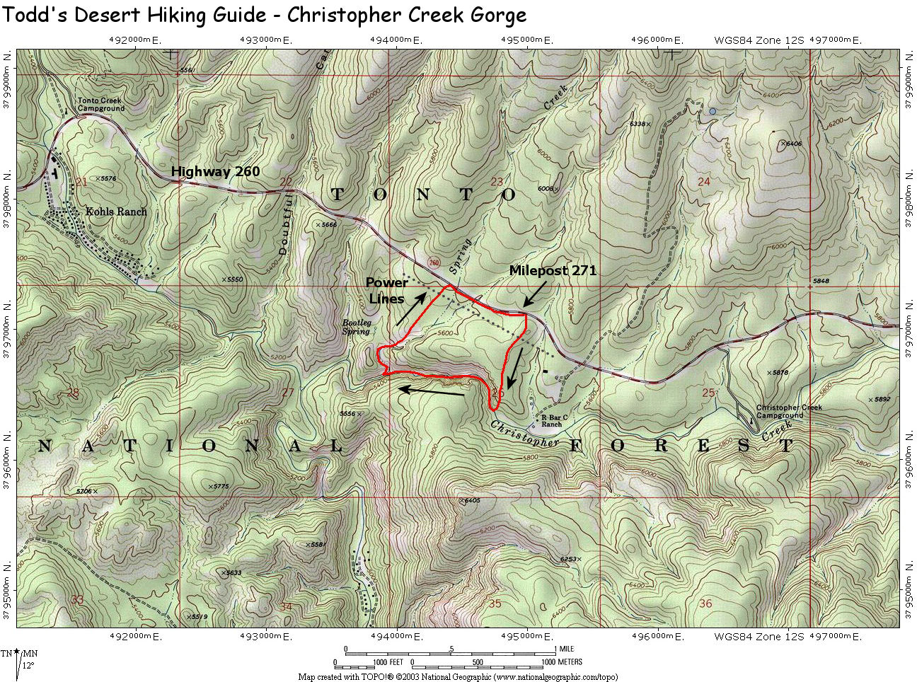
Map: |
Click
here for a map of this
hike. |
| Photos: |
Click picture for larger view, click your browser's 'Back' button to return to this page. |
|
|
