| |
First Water Loops - Tonto National Forest
| Summary: |
Easy hiking through typical Upper Sonoran
Desert with very little elevation change. Four loop hikes from this trail
head described below. Lots of options here. |
| Directions: |
From Phoenix take US 60 east. Exit
at Apache Junction and drive northeast on State Highway 88. Follow
88 about a mile past Lost Dutchman State Park and look for the brown sign
on the right for the First Water Trail Head (FR 78). Follow this
well graded dirt road 3 miles to the trailhead. Be sure to stop and
pay the outrageous $4 per car load fee at the machine on the left just
before the road end. Gotta support the construction of more
bathrooms at these trailheads. |
| Road
Conditions: |
Passenger Car |
| Navigation: |
Easy - with a few sections of mildly
indistinct trail in the Boulder Canyon Section |
| Length: |
Loop 1: 9 miles
Loop 2: 11 miles
Loop 3: 13.7 miles
Loop 4: 15.5 miles |
| Date
Hiked: |
January 2001 |
| Weather
Conditions: |
Nice - highs in the
mid 60's |
|
Required Skills: |
 |
| Hike
Description: |
I'll describe this hike traveling counter
clockwise, though unsurprisingly enough you can hike it any way you wish.
See the map below for trails. From the First Water Trailhead begin
walking on the extra wide Dutchman Trail. After 0.3 miles you will
come to an intersection with the left branching Second Water Trail (0.3
miles), continue straight on the Dutchman Trail. This 3.9 mile long
section of trail winds it's way through typical upper Sonoran desert
vegetation (hopbush, prickly pear, cholla, mesquite, palo verde, scrub oak
etc.) for a few miles. Once you reach an area labeled as Parker Pass
on the Bear Tooth Map you will catch your first glimpse of Weaver's Needle
and Black Top Mesa. The trail descends gradually from here down to
an intersection with the Black Mesa Trail (4.2 miles).
Loop 1: Turn left onto the 3 mile long Black Mesa Trail which
ascends moderately to the top of Black Mesa (what else?), then descends
gradually passing through a nice section of chain fruit cholla forest
along the way until it meets the Second Water Trail at a 'T' junction (7.2
miles). Take the left fork of the Second Water Trail which descends
gradually to level ground and follow it 1.5 miles back to the Dutchman
Trail (8.7 miles). Turn right and stroll the remaining 0.3 miles
back to your car (9 miles).
Loop 2: From the junction of the Dutchman and Black Mesa Trails,
stay straight continuing on the Dutchman trail. After 0.1 miles you
will come to the left branching Boulder Canyon Trail (4.3 miles).
You can turn left and follow the Boulder Canyon Trail 3.2 miles to it's
intersection with the Second Water Trail (described below), then turn left
and follow the Second Water Trail 3.5 miles back to the trailhead for a
11mile loop. OR throw in a loop around Black Top Mesa:
Loop 3: From the Dutchman/Boulder Trail junction, stay straight on
the Dutchman Trail. After 0.2 miles (4.5 miles) you will reach a
junction with the left branching Bull Pass Trail, continue right on the
Dutchman. Hike 0.8 miles (5.3 miles) passing the right branching
Peralta Trail, then up and over a small shoulder another 1 mile past the
right branching Terrapin Trail (6.3 miles) then another 0.8 miles to the
junction with the Bull Pass Trail (7.1 miles). Turn left on this
trail which climbs up to a low pass (with an unsigned use trail branching
left if you'd like to climb to the top of Black Top Mesa with good views
& a nice spot for lunch), then drops down meeting the Dutchman Trail
once again (8.6 miles). Hike the Dutchman Trail 0.3 miles, passing
the Boulder Canyon Trail (see Loop 4) along the way (8.9 miles), then
follow the Black Mesa Trail/Second Water Trail described in Loop 1 back to
your car (13.7 miles).
Loop 4: From the Dutchman/Boulder Canyon Trail intersection (8.8
miles), turn right onto the Boulder Canyon Trail. Follow this
fainter, mildly overgrown trail on one side of the dry stream bed or
another, crossing sides frequently (look for cairns at these crossings,
they are occasionally somewhat confusing since the rocks lining the
streambed obscure the trail). After 0.8 miles you will pass a small
canyon on the right that is worth poking your head into (similar to La
Barge Canyon, but not as deep or narrow), another mile further brings you
to the right branching Cavalry Trail (10.6 miles). Continue on the
Boulder Canyon Trail which becomes easier to follow at this point and walk
1.4 miles until you hit the intersection with the Second Water Trail (12
miles). Turn left on the Second Water Trail which follows the stream
bed a ways, then begins a gradual climb up to Black Mesa which is quite
flat on top (like most mesas I guess). You will reach the junction
with the left branching Black Mesa Trail after 1.7 miles (13.7 miles),
continue straight and walk the remaining 1.8 miles back to your car (15.5
miles).
|
| Rating
(1-5 stars): |
 
The author has hiked all of these trails on numerous occasions.
There are no really spectacular views to be seen on this hike and you will
see a bunch of people & horses, but the walking is easy & the
scenery is nice. On his latest trip he walked loop 4 in just about 6
hours. |
| Maps: |
Beartooth Maps -
Superstition Wilderness Topographic Map |
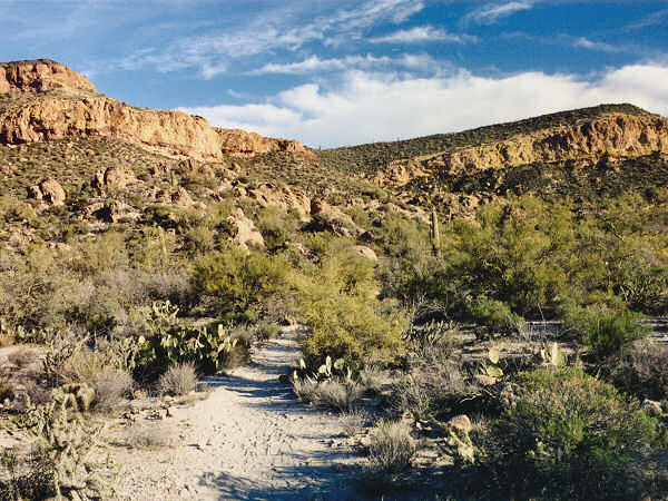
| Photos: |
Click picture for larger
view, click your browser's 'Back' button to return to this page. |
 |
 |
| Map of First Water area. |
Black Mesa as seen from
the Dutchman Trail. |
|
|
