| Summary: |
A nice loop hike in a
lesser visited section of the Superstitions. |
| Directions: |
From Phoenix take US 60
east. Exit at Apache Junction and drive northeast on State Highway 88. Follow
88 to the end of the pavement (about 25 miles) then a few miles further until you reach
the signed parking area for Tortilla Trailhead on the right hand side. Those with
passenger cars may park here for the out and back hike (see hike 2 below) or with a high
clearance 4-wheel drive vehicle follow the rough dirt road (FR 213) three additional miles
to it's end (see hike 1 below). |
| Road
Conditions: |
Passenger Car - ok to get
to the car park off of Highway 88.
4-Wheel Drive - required to reach the Tortilla road end, the first 1/4 mile
has some rough sections. |
| Navigation: |
Moderate - sections of
faint trail |
| Length: |
Loop Hike - 16.1 miles
Out & Back - 19.0 |
| Date
Hiked: |
Loop - March 2000
Out & Back - April 1998 |
| Weather
Conditions: |
Nice - highs in the upper
70's |
|
Required Skills: |

 |
| Hike
Description: |
Hike 1 (Loop):
From the Tortilla Trailhead look for the steel windmill (Aeromotor, Chicago) and tank.
Walk past these structures to the signed beginning of the Peter's Trail. The
trail follows the stream (flowing water both times the author was there) on one side or
the other, then begins climbing steeply up the ridge to the left of Tortilla Mountain to
an unnamed saddle. The trail then winds through the chaparral before dropping down
and crossing a stream bed. After a moderate climb to the top of Peter's Mesa, the
trail then winds through an ocotillo forest before dropping down to the signed
intersection with the Dutchman's Trail (6.5 miles) at the bottom of LaBarge Canyon.
Turn left onto the Dutchman's Trail and follow this level horse path as it winds through
the scrub oak beside the stream bed. After 1.0 mile (7.5 miles) you will reach the
signed intersection with the Red Tanks Trail, the Dutchman's Trail branches right, stay to
the left and continue on the Red Tanks Trail. The trail remains a horse path as it
continues beside the stream bed. The path is sometimes a little confusing where it
crosses the stream bed, look for cairns or failing to find any, continue up the stream bed
until you can pick up the trail once more. After two miles (9.5 miles) you will
arrive at the intersection with the right branching Whiskey Springs Trail. Continue
straight on the Red Tanks Trail into Upper LaBarge Box Canyon. Despite the fact that
La Barge Canyon is fairly far from any trailhead, I always run into people in this section
- it may have something to do with the fact that though there are no perennial water
sources in the Superstitions, Upper LaBarge often has water when many other streams are
dry. After a short walk the trial turns left and crosses the stream bed where a bent
tree crosses the path, then climbs the left bank of the canyon and winds it's way along
this slope for the remainder of the trail. An additional 1.5 miles (11.0 miles) will
bring you to the intersection with the Hoolie Bacon Trail, turn left onto this
trail. The 4.3 miles long Hoolie Bacon Trail doesn't see as much use as other trails
in the area & is somewhat faded and overgrown with Cat's Claw in places. Take
your time and look for cairns & you shouldn't have too much trouble. For the
first few miles on the Hoolie Bacon Trail you will be moderately ascending through rolling
hills typical of the eastern portion of the Superstitions. After a few miles the
trail reaches a shoulder then descends more steeply back down the other side before
leveling out in a wash. An easy walk on level ground brings you to the intersection
with the right branching JF Trail (15.3 miles). Stay left and hike this faded jeep
track the remaining 0.8 miles back to the car park (16.1 miles).
Hike 2 (Out & Back): From the car park off of Highway 88 complete
the three mile road walk on foot (3 miles), follow the Peter's Trail to it's end at the
intersection with the Dutchman's Trail (9.5 miles). Return the way you came (19
miles). |
| Rating
(1-5 stars): |

This is a nice hike in which you are unlikely to see many people. The
hike passes through some very pretty areas, with the exception of the 2.5 mile section
before Upper LaBarge which seems to be seeing an increased amount of horse/mule traffic
with the corresponding degradation/odor. |
| Maps: |
Beartooth Maps -
Superstition Wilderness Topographic Map |
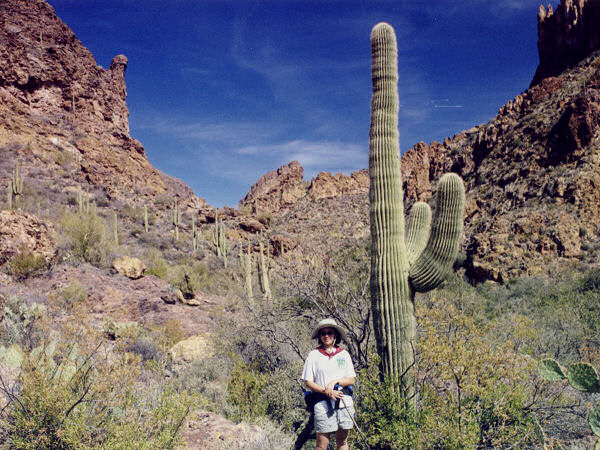
| Photos: |
Click picture for larger
view, click your browser's 'Back' button to return to this page. |