| |
Tule Trail - Tonto National Forest
| Summary: |
A moderately steep hike in
the eastern Superstitions along the Tule Trail
to its junction with the Two Bar Ridge Trail. |
| Directions: |
From Phoenix
drive east on Highway 60 almost to Globe. Turn
left (north) on Highway 188 (also listed as 88
on maps) and drive for 20.4 miles. Immediately
after you see a sign pointing right for School
House Recreation Area between mileposts 235 -
236, there will be a brown sign pointing left
for the J-P Road. Turn left on the well graded,
dirt J-P Road which is also Forest Road (FR)
#449. There is a large sign a short distance in
for Tule Trailhead (2 miles), Cross P Ranch (2.5
miles), Upper Horrell Place & Reavis Gap Trail
(8 miles). After 2 miles you'll come to a fork,
turn right and drive one mile to the Tule
Trailhead. |
| Road Conditions: |
Passenger Car |
| Navigation: |
Moderate |
| Length: |
9.4
miles |
| Date Hiked: |
January 2005 |
| Weather Conditions: |
Cloudy and cool |
|
Required Skills: |
 |
| Hike Description: |
From the parking area, pick
up the Tule Trail #122 which starts just to the
right of the large brown Forest Service sign (0
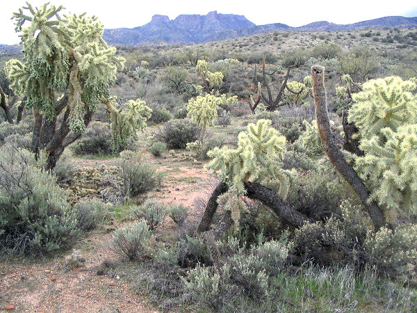
miles, 2800 ft). The path heads through a cattle
chewed area consisting of typical Sonoran Desert
vegetation including: cholla, prickly pear,
hedgehog cactus, palo verde, yucca, jojoba, and
a few saguaro as it winds its way in and out of
4 minor drainages. The path then drops into a
much larger drainage and passes through a white
metal gate at a corral. Walk directly across
this drainage following the corral fence to a
wooden Superstition Wilderness sign. The cattle
trodden trail heads up and out of the drainage
just to the right of the sign, then bends right
to follow the drainage a ways up stream. The
area is highly cow trodden as well, so keep your
eyes open so that you don't mistake a cow path
for the trail, there are also quite a few cairns
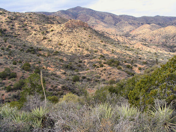
to help with navigation. The path then leaves
the side of the wash and begins climbing gently
at first, then more moderately. Eventually the
path descends a short distance at a basin, then
begins climbing steeply along the left side of
an unnamed wash. At the top of the climb, the
trail reaches a broad ridge and bends right,
passing an earthen stock tank, to travel along
the crest at a gentle to moderate grade. The
path is faint to non-existent in places, so keep
your eyes open for cairns which have been placed
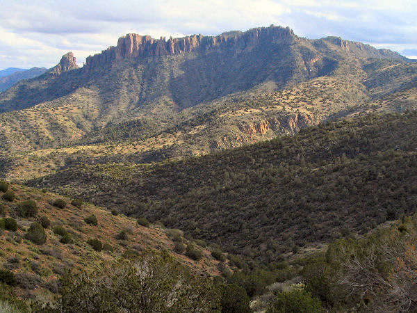
at fairly frequent intervals. As you continue
climbing, you'll have some intermittent good
views of the craggy ridge of Two Bar Mountain to
the south. Eventually, after a few false
summits, the path tops out at Two Bar Ridge and
the signed junction with the Two Bar Ridge Trail
(4.7 miles, 4800 ft). You can use this as your
turn around point, or utilize the Two Bar Ridge
Trail to explore further into the Superstitions. |
| Rating (1-5 stars): |

The author completed this hike solo (Tule to
Two Bar Ridge junction and back again), at a
fast pace, in 3.5 hours. |
| Maps: |
Beartooth Maps - Superstition Wilderness Topographic Map |
| Photos: |
Click picture for larger view, click your browser's 'Back' button to return to this page. |
|
|