| |
Reynolds Creek Trail - Sierra Ancha Wilderness, Tonto National Forest
| Summary: |
A steep out and back hike along the Reynolds Creek Trail
to the Murphy Ranch Trailhead. Along the way you will pass Reynolds Falls.
|
| Directions: |
From Phoenix
drive east on Highway 60 almost to Globe. Turn
left (north) on Highway 188 (also listed as 88
on maps) and drive 14.4 miles to Highway 288.
Turn right on 288 which is paved at first and
after a short distance crosses the Salt River on
a single lane bridge. After 12.2 miles you will
come to an intersection with left branching A
Cross Road. Continue straight on Highway 288 for
another 15 miles to the sign and turn off on the
left for Reynolds Trailhead and camp. Continue a
short distance past the camp on Highway 288 to a
sign for Reynolds Creek Trail #150 and Forest
Road 410 pointing right. There are 2 roads on
the right, the leftmost road is FR 410. Follow
FR 410 for 2.2 miles to a fork, stay to the
right on FR 410. Continue up the steep road to
the 4 mile point to a parking area for the
Reynolds Creek Trail.
|
| Road
Conditions: |
High Clearance Vehicle |
| Navigation: |
Easy |
| Length: |
8 miles |
| Date
Hiked: |
April 2006 |
| Weather
Conditions: |
Warm and Sunny |
|
Required Skills: |
 |
| Hike
Description: |
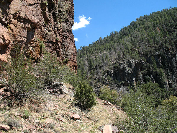
From the parking area, pick up the Reynolds Creek Trail
#150 which soon crosses the creek to reach a sign indicating that the Coon
Creek fire has created hazardous conditions due to flash floods and tree
fall. Beyond the sign the trail climbs moderately to steeply for 0.75 miles
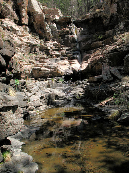
to Reynolds Falls which can be accessed via a short spur trail on the right.
The upper falls features a pleasant grotto and pool followed by a
precipitous plunge of 100+ feet through a basalt cliff band into a pool
below. Continuing along the path 0.5 miles later you will arrive at a signed
junction with the Center Mountain Trail which branches left. Stay straight
on the Reynolds Trail as the path continues ascending steeply to travel
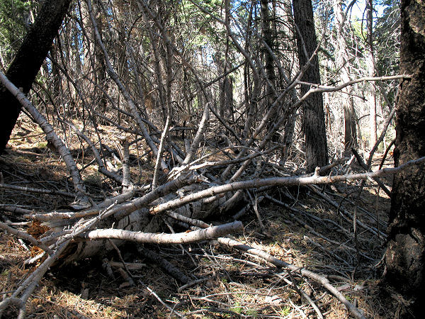
beside a wash choked with fallen trees, eventually topping out at a ridge.
The trail drops down the other side of the ridge through an area littered
with many dead trees. The path is thankfully free from trees, though, thanks
to trail crews who have done a great job in clearing the trail. The path
drops down, then ascends a short distance to eventually reach the Murphy
Ranch Trailhead and junction with the left branching Murphy Ranch Trail #141
(4 miles). When ready, return the way you came (8 miles). |
| Rating
(1-5 stars): |

The author completed the hike to the Murphy Ranch and back at a fast pace in
3.5 hours. |
|
Books: |
None used. |
| Photos: |
Click picture for larger
view, click your browser's 'Back' button to return to this page. |
|
|