| |
Cooper Forks Canyon - Sierra Ancha Wilderness, Tonto National Forest
| Summary: |
A pleasant hike to some very well preserved 700 year old ruins.
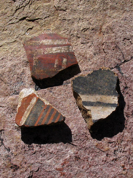
Remember, ruins are fragile and irreplaceable, please leave the area as you
found it. It is also illegal to remove artifacts (such as potsherds) from
these historic sites (though some in the Forest Service manage to get away
with it by calling it 'science'). |
| Directions: |
From Phoenix
drive east on Highway 60 almost to Globe. Turn
left (north) on Highway 188 (also listed as 88
on maps) and drive 14.4 miles to Highway 288.
Turn right on 288 which soon crosses the Salt
River on a single lane bridge. After 6.7 miles,
turn right onto the well graded, dirt Cherry
Creek Road (which is also Forest Road 203).
After 8.8 miles at the sign for Coon Creek FR
#203 bends right and crosses the creek (straight
will take you onto private ranch property). At
the 13.3 mile point you reach a sign for the
left branching Bull Canyon Road (FR #203A), stay
straight on FR #203. After passing the Ellison
Ranch, the road becomes considerably rougher and
rockier and soon you'll reach a Forest Service
sign which reads:
| "Sierra Ancha Cliff Dwellings:
Prehistoric cliff dwellings are located in
several of the rugged canyons within and near
the Sierra Ancha Wilderness. They were built
between 1280 and 1350 AD by indians known
presently as the 'Salado'. Why they chose to
utilize this challenging environmental
zone is not yet fully understood. Cliff
dwellings are fragile and irreplaceable.
Please do not climb on the walls, or roofs
or cause any other form of injury or
disturbance. Violators are subject to
arrest, fines and or imprisonment."
|
| At the 22
mile point on the Cherry Creek Road you'll drive
down a steep embankment and cross Devils
Chasm Creek. Drive another 1.5 miles to a
point where the road makes a sharp left
turn, park at the small pull off with fire
ring on the right (the gps coordinates are UTM
0512429mE, 3744368mN). |
|
| Road
Conditions: |
4-Wheel Drive |
| Navigation: |
Moderate |
| Length: |
4-6 hours |
| Date
Hiked: |
December 2003 |
| Weather
Conditions: |
Cool and Sunny |
|
Required Skills: |

 |
| Hike
Description: |
From the parking area, walk back down the road (south) a
short distance and look for an old disused road on the north that leads down
to Cherry Creek (which I believe flows year round). Route find upstream
(north) along Cherry Creek on one side or the other for about a mile until
you reach the prominent side drainage of Coopers Fork which enters from the
right. Don't walk up Coopers Fork, instead look for a faint path that begins
just north of the creek mouth. Take the time to locate this trail since it
will make the hike considerably easier. The path is quite steep in places as
it gains 1000+ feet in the next mile or so. It is also somewhat difficult to
follow in places, particularly where it crosses or climbs rock strewn
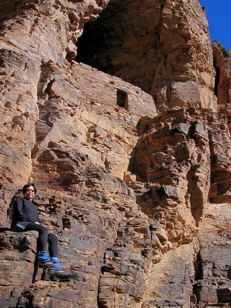
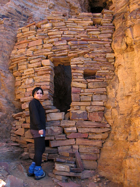
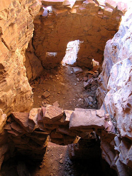
slopes. Once at the ruins you will find several well preserved structures as
well as a few crumbling walls. Potsherds litter the ground, so be very
careful where you walk. At the risk of nagging, do not climb on the walls to
enter the structures, there's nothing in them anyway. If you are unable to
control your curiosity, and are willing to risk a fall, you can do a bit of
fancy footwork to climb on the nearby rocks and get a glimpse into the
buildings. When ready, return the way you came. |
| Rating
(1-5 stars): |
 
The author and his wife scouted out the route from below and chose poorly.
We ended up scaling a steep scree slope before picking up a faint use trail
to the ruins. We spent an hour or so carefully looking around before
returning to our car. Total hike time was 4.5 hours. |
|
Books: |
'Ruins
Seldom Seen' by Dave Wilson |
| Photos: |
Click picture for larger
view, click your browser's 'Back' button to return to this page. |
|
|