| |
Copper Camp Loop - Tonto National Forest
| Summary: |
A long semi-loop hike, on and
off trail, into a little visited section of the
Mazatzal Wilderness. This hike can be done as a
day hike, but due to the length and difficulty,
it is better suited to a 2+ day backpacking
trip. Strong hiking ability, good route finding
skills and a tolerance for thorny plants are a
must. |
| Directions: |
From Phoenix
drive northeast on State Highway 87 (Beeline
Highway) towards Payson. Just past mile marker
222 you'll see a sign for Mt. Ord (right)
Sycamore Creek (left). Turn left, crossing the
divided highway towards Sycamore Creek onto a
paved road. Drive 1.1 miles then turn right,
crossing a cattle guard, onto gravel Forest Road
(FR) 201. Drive 1.2 miles on FR 201 to a split
in the road just past a cattle guard. Turn left
onto the rockier, gravel FR 25 (high clearance
desirable). After 2.6 miles the road splits
again with FR 25A going straight and FR 25 to
the left. Turn left, remaining on FR 25 as it
climbs 2.2 miles up a series of switchbacks to
an old corral and the Mormon Grove Trailhead. |
| Road Conditions: |
High Clearance Vehicle |
| Navigation: |
Difficult |
| Length: |
20.4 miles (5800 ft elevation
change) |
| Date Hiked: |
February 2006 |
| Weather Conditions: |
Sunny and warm |
|
Required Skills: |


|
| Hike Description: |
Pick up the 'trail' (really
an old road) next to the corral and begin
following it up the hill
(GPS Point CC1, 0 miles, 4900 ft). After 10
minutes you'll reach a signed junction: Saddle
Mountain Trail #91 heads straight, the Little
Saddle Mt Trail #244 goes left. Stay straight on
the Saddle Mt Trail as it ascends steadily up to
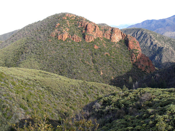
the base of Saddle Mountain (a landmark you'll
see at regular intervals throughout the hike).
Ignore a use trail which takes off to the left
(I believe this leads to the Saddle Mt Spring)
and stay on the main trail as levels off and
skirts the base of the mountain on the east
side. A bit of hiking will bring you to a signed
junction with the Sheep Creek Trail #88 which
heads left, while the Saddle Mt Trail continues
straight (3.5 miles). Turn left on the Sheep
Creek Trail as it drops down to cross a dry
wash, then travels along a chaparral covered
slope before dropping steeply down into the
forested drainage of McFarland Canyon (with a
nice, if dry, campsite) and the junction with
the right branching Thicket Spring Trail #95
(4.4 miles, 4920ft). Stay straight on the Sheep
Creek Trail as it makes a gentle and pleasant
ascent of McFarland Canyon. After about a mile
you'll reach an old corral. Walk right through
the corral to pick up the trail on the other
side and shortly afterwards you'll arrive at a
signed junction with the Copper Camp Trail #87
(GPS Point CC2) which stays straight, the Sheep
Creek Trail (which you'll be using for the
return trip) branches right (5.2 miles, 5170
ft). Stay straight on the Copper Camp Trail as
it continues up McFarland Canyon a while, then
climbs out of the canyon on the right to travel
through a scrubbier area, becoming somewhat
fainter as it does so. The path eventually
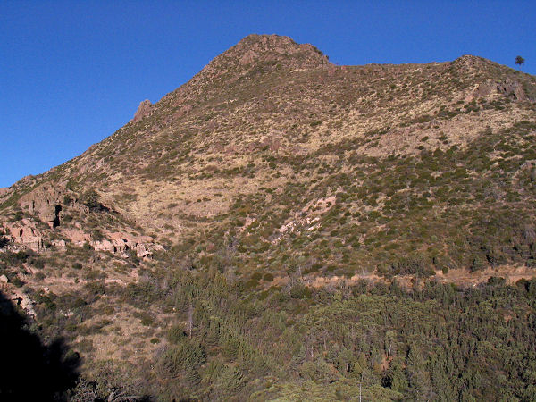
climbs to a grassy ridge with nice views down to
the right of Saddle Mt, the rugged wilderness
area to the north and Horseshoe Reservoir in the
distance. After traveling the ridge a while the
trail begins a long descent along the grassy
slope of the ridge, becoming rather faint near
the bottom where it crosses an area of shale
(keep an eye open for cairns which occur at
frequent intervals). As you near the wash below
the trail bends left to cross a minor wash, then
travels along the right hand bench along a faint
trail that is overgrown with cats claw (ouch!).
The path only deteriorates as it continues down
the drainage of Copper Camp Creek winding its
way in or beside the drainage (as a landmark,
you'll pass an old chimney in this area). Water
soon appears under foot and when the brush
becomes very thick, look for the trail to climb
out of the drainage on the right and form a more
distinct track on the bench (the cats claw
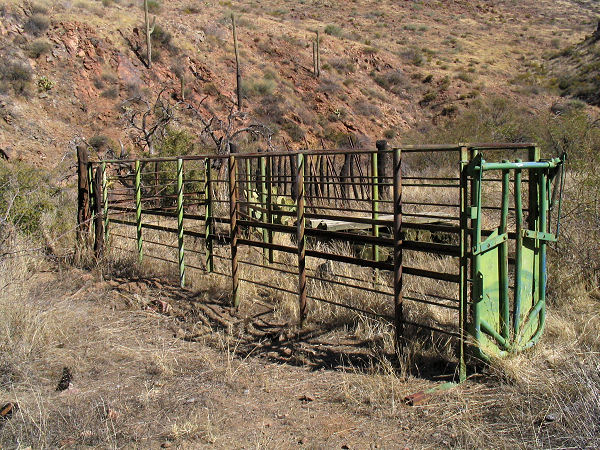
remains an issue, however). Eventually you'll
pass a few signs of human encroachment (metal
fence posts, rusted barrels) and soon afterwards
you'll reach Copper Camp with the remains of a
corral (GPS Point CC3, 9.7 miles, 3170 ft). It's
here that the cross country portion of the
journey begins (this route is shown on the
Forest Service map referenced below, though
little of the old route remains). From the
corral look directly across Copper Camp Creek to
the opposite bank. Your route is the easiest
path along the obvious ridge that climbs to the
ridge far above. If you are carrying a GPS, you
can set it to 'Go To' GPS Point CC4. Cross the
stream and climb the hillside to gain the ridge
and begin hiking in a northeasterly direction.
The path levels off somewhat where the ridge
bends to the east (stay on the path of least
resistance), then begins climbing even more
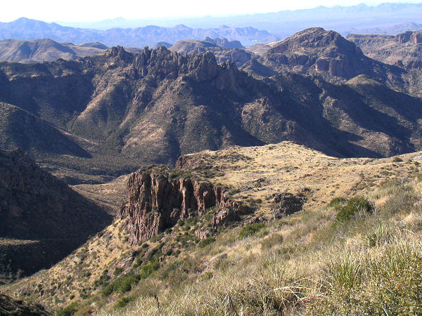
steeply to the northeast. Near the top of the
ridge you will see 3 rocky sections, which are
progressively larger the further they are up the
hill. Climb directly over the first hump. At the
second, a faint section of the original route
exists to the left of the rocky section that
provides a relatively easy path through. Stay to
the right of the 3rd and largest rocky outcrop
where another section of the faint route may be
found. Eventually, after considerable effort,
the top of the ridge is gained (GPS Point CC4,
11.3 miles, 4870 ft) at a large cairn. At this
point you'll be overlooking a grassy basin,
dotted with a few juniper trees. Walk down into
the basin in a northeasterly direction roughly
aiming for a point on the map to the left of
Sheep Creek Seep (left of GPS CC5). The best
route in this section is the one that avoids the
brush. After descending a while, the large
drainage of Sheep Creek will come into view with
two drainages coming off of Cypress Ridge (that
meet below you to the left) in the way. Cross
these drainages at the most shall point you can
find, above the point where they meet. After
climbing out of the second drainage, head more
to the east (right) aiming for a point where two
forks of Sheep Creek join. At the junction you
will find the remains of an old corral and the
Sheep Creek Trail (GPS Point CC5, 13.4 miles,
3950 ft). Turn right on the Sheep Creek Trail
(if you don't see it immediately, don't worry,
it crosses Sheep Creek several times, walk up
the creek and you'll eventually pick it up).
There was water in the creek when I was here and
a few pools, though several of them were thick
with algae. Though it obviously sees little use,
the Sheep Creek Trail is easy to follow.
Initially the path is overgrown with cats claw,
but as you ascend the drainage becomes less
brushy, more forested and the path more
pleasant. The nice hike soon comes to an end,
however, as the trail climbs out of the drainage
on the right and begins climbing at a very steep
and relentless grade. The path climbs the
hillside beside the drainage, gaining elevation
all the while. At one point a saddle is reached
and the path levels off for a short distance,
only to begin its brutal ascent once again. It's
here that this hike officially kicked my butt. I
believe I was even heard to whimper a little
bit, before the path mercifully leveled out
after gaining some 1600 ft of elevation. The
trail then descends at a moderate grade along a
series of ridges covered with manzanita, dwarf
pines and juniper, eventually making a steep
descent into McFarland Canyon and the junction
with the Copper Camp Trail (GPS Point CC2, 16.2
miles, 5170 ft). Turn left on the Sheep Creek
Trail and retrace your steps the remaining 5.2
miles back to the Mormon Grove Trailhead and
your car (20.4 miles, 4900 ft).
GPS Coordinates
(UTM):
CC1 = 453596mE 3755502mN
CC2 = 451896mE 3759002mN
CC3 = 445842mE 3758763mN
CC4 = 447381mE 3759767mN
CC5 = 449212mE 3761849mN |
| Rating (1-5 stars): |
 
The author completed this
hike solo at a fast pace (becoming ever slower
as the day wore on) in 9.5 hours. If doing this
hike as an overnight backpacking trip, Copper
Camp might make a good place to camp since there
is running water, and the steep off trail ascent
could be done first thing the next morning,
rather than in the middle of the day when temps
are at their highest. |
|
Books: |
Hiking Arizona's Superstition and Mazatzal
Country
- Grubbs,
Bruce |
|
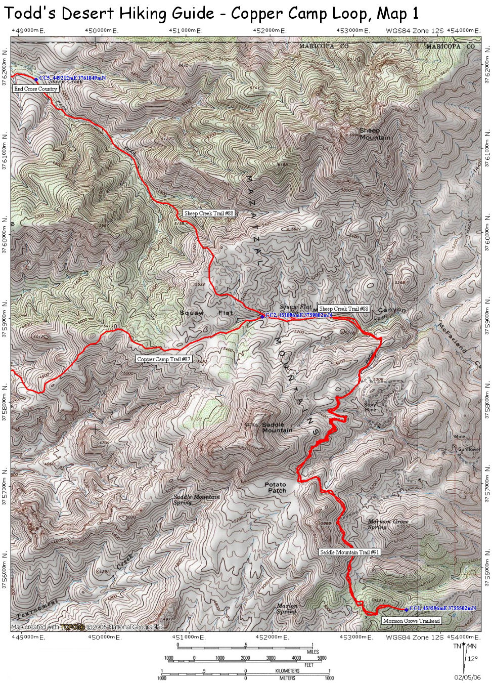
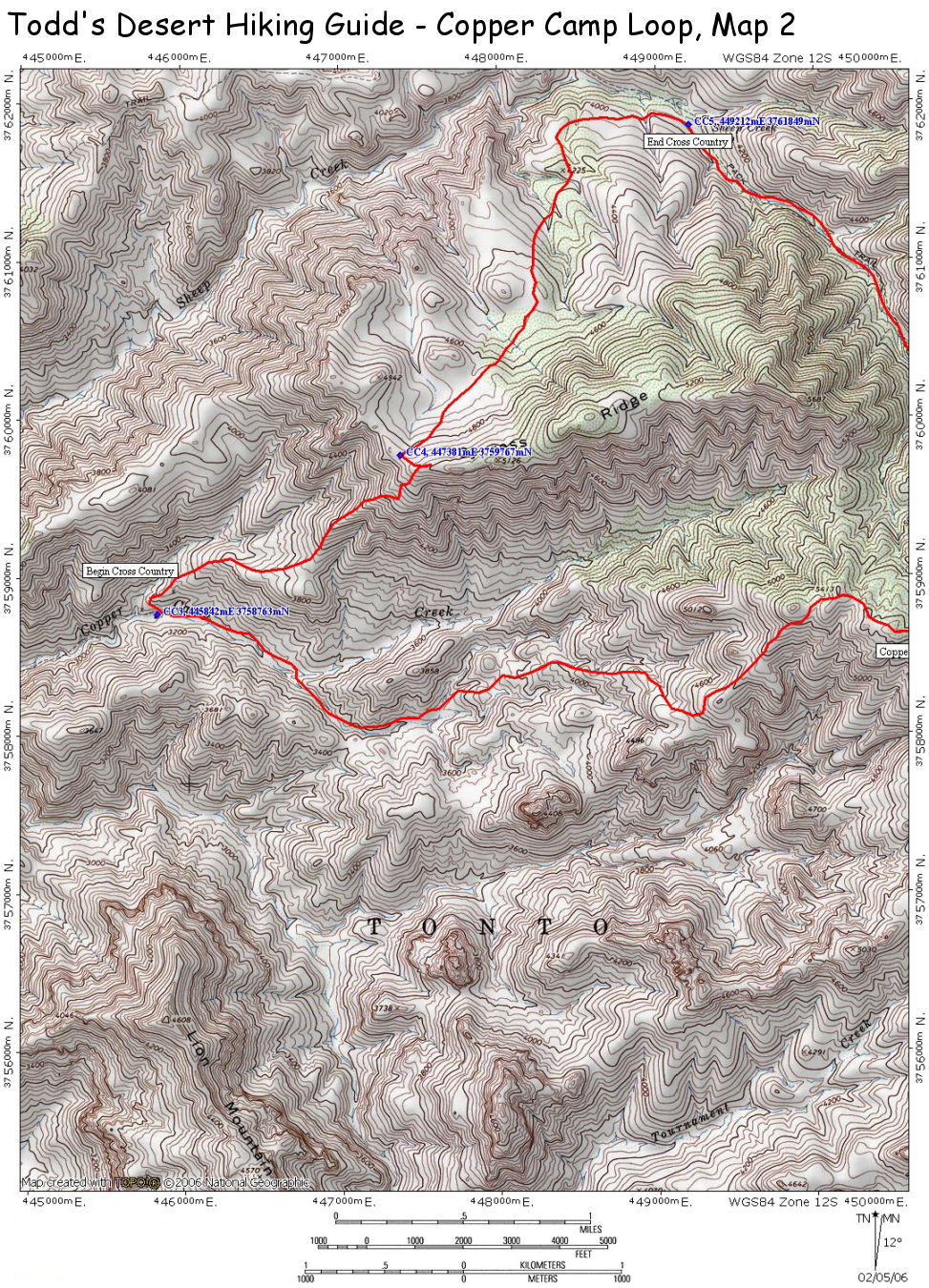
Maps: |
Map of this route.
Map 1 (east),
Map 2 (west)
Mazatzal Wilderness Tonto National Forest, USFS |
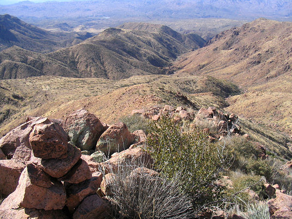
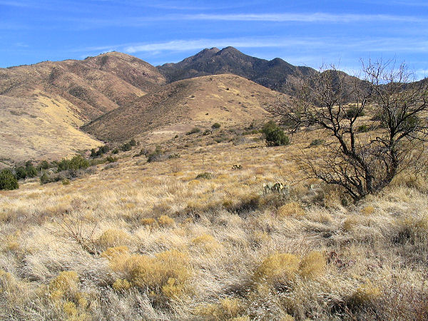
| Photos: |
Click picture for larger view, click your browser's 'Back' button to return to this page. |
|
|
