| |
Ballentine Trail - Tonto National Forest
| Summary: |
The lower Ballentine
trailhead is located just east of Phoenix on
Highway 87 and offers several hiking options
from a casual 3 mile loop to a grueling 23 mile
adventure. On the way to the upper trailhead,
the path passes from a lower desert life zone to
chaparral to pine forests. |
| Directions: |
Drive east
out of Phoenix on the Bee Line Highway (Highway
87) to just past mile marker 210 to a parking
area on the right (south) side of the road.
You can get to the upper
trailhead by taking Highway 87 to Forest Road
#143. Turn right (south) on FR #143 and follow
it several miles to the trailhead parking on the
left (I'm not more specific since I did not
drive this route). |
| Road Conditions: |
Passenger Car |
| Navigation: |
Moderate |
| Length: |
3 miles - Pine Creek Loop
11.5 miles - Entire length of the Ballentine
Trail (requires a car spot)
23 miles - Out and back along the Ballentine |
| Date Hiked: |
October 2004 |
| Weather Conditions: |
Pleasant and sunny |
|
Required Skills: |


|
| Hike Description: |
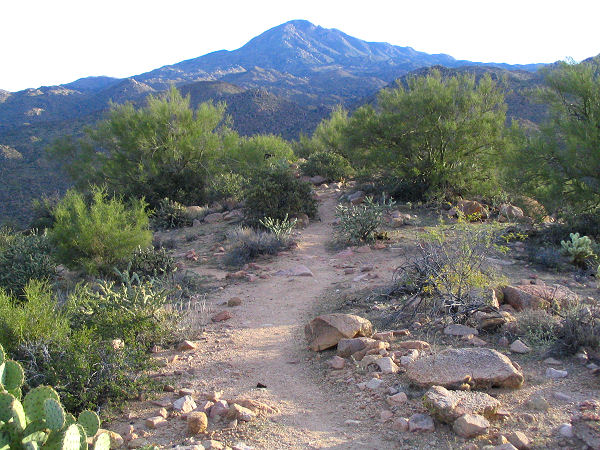
From the parking area, walk
through the fence to the start of the trail (0
miles).
There is a sign pointing left for the Pine Creek
Loop Trail #280 (1.5 miles to the Ballentine
junction). The right path is the Ballentine
Trail #283 (though the sign is missing). We'll
take the right path which heads east a short
distance beside the highway before bending left
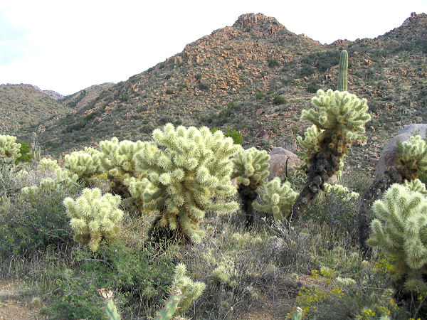
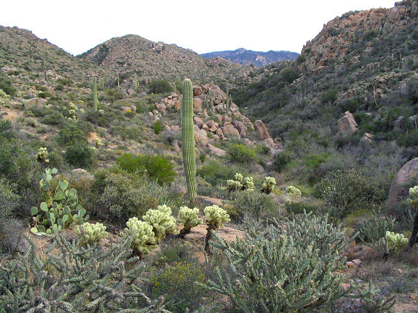
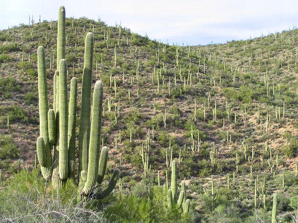
to climb moderately up to a ridgeline. The gravel covered path in this section
is easy to follow, though deeply eroded in
sections, as it travels through typical low
desert terrain consisting of of: saguaro,
prickly pear, cholla, palo verde, mesquite,
brittlebush and rabbit brush. The trail tops out
at a ridge then drops down to a signed junction
with the Pine Creek Loop trail which heads left
(1.5 miles).
Those wishing to do a short and sweet loop can
take this path back to the car; we, however, will
head straight on the Ballentine Trail towards:
Boulder Flat 3 miles, Rock Tank 7 miles, Kline
Trailhead 11 miles. The path begins climbing at
a steady grade as it winds through some low
hills dotted with interesting rock formations.
The path eventually climbs up to a flat basin
where it splits into several tracks (this is
Boulder Flat, 4.5 miles). There was evidence of
off road vehicle tracks when I was here, which
I'm guessing is the cause of these rogue paths.
Stay on the center trail, then straight again 50
feet beyond where another track splits off to
the right. If you've managed to remain on the
Ballentine Trail, you'll reach an old trail sign
confirming this fact after another 150 feet. The
path beyond Boulder Flat doesn't see as much use
as the lower section and is somewhat overgrown
in places, becoming increasingly more so the
further you go. If you happen to be wearing long
pants, you'll be glad to have them since your
legs will be snagged by cat's claw, scrub oak
and manzanita. The path heads up a wide valley
and continues climbing. There are quite a few
cairns at first which help guide you forward
when the path becomes a bit faint. The trail
eventually climbs up to a grassy spot, skirts
this area to the left, then passes through a
fence. As you continue up the drainage, look for
cairns that mark an abrupt right turn marking a
spot where it crosses the dry wash, before it
resumes its upward progress. The path continues
up the wash, to a point near the head of the
drainage where it leaves it to the left and
begins climbing steeply on a deeply eroded path
up to the ridgeline above. Once on the ridge,
the trail bends right and becomes somewhat
challenging to follow as it travels through
thick stands of scrub oak and manzanita. Take
your time through this section to ensure you
stay on the faint trail. Eventually the route
descends a short distance into a shallow
drainage and crosses it to enter a pine forest.
Here the underbrush thankfully fades away, and
although the path is still rather faint, it
becomes much easier to follow. The trail heads
up through the woods, crossing the stream
several times before climbing more steeply up to
the right to a flat area with some nice (if dry)
campsites. The path eventually breaks out of the
trees and begins dropping down a wide valley on
a rocky trail (which looks more like a dry
stream bed at first rather than a trail), keep
an eye out for cairns. The trail eventually
becomes less steep and less rocky as it winds
its way through the desert chaparral towards a
road in the distance. You'll know you're getting
close to the upper trailhead (about 20 minutes
out) when you pass through a fence, then about 5
minutes from the end you'll reach a cement
trough and fence. With little fanfare, the path
reaches FR #143 at a pull off littered with
typical redneck detritus (beer cans, styrofoam
cups, cigarette boxes, shotgun shells and bullet
casings - sounds like a party - yee haw!). If
you were smart and spotted a car here, your trip
is complete (11.5 miles). If not, turn around
and begin the long slog back. Be sure to take
the Pine Creek Loop trail on the return. It
branches to the right at the signed junction you
passed earlier and contours along a slope to the
left of Pine Creek. There are some views across
the creek of the saguaro dotted hills beyond.
Just before reaching the highway, the path bends
left and travels west above the highway back to
the parking lot where you began your adventure
(23 miles). |
| Rating (1-5 stars): |
 
The author hiked from the
lower Ballentine trailhead to the upper and back
again, using the Pine Creek Loop on the return, traveling solo at a fast pace in just
under 9 hours. |
|
Books: |
None |
|
Maps: |
Tonto
National Forest Map |
| Photos: |
Click picture for larger view, click your browser's 'Back' button to return to this page. |
|
|