| |
Hellsgate Trail - Tonto National Forest
| Summary: |
A hike through forest and
chaparral to the gates of Hell. Not really, but
if you do this hike on a hot August day like I
did, it may feel that way. The destination
features a perennial stream, swimming hole and
tall cliffs. |
| Directions: |
From Payson,
drive east on Highway 260 for 11 miles to mile
marker 263. Turn right just past the mile marker
and drive 0.5 miles on a well graded dirt road
to a clearing on the right. There is a large
Forest Service sign next to a fence for
the Hellsgate Wilderness. |
| Road Conditions: |
Passenger Car |
| Navigation: |
Easy |
| Length: |
15 miles |
| Date Hiked: |
August 2004 |
| Weather Conditions: |
Hot and sunny with afternoon
thunderstorms |
|
Required Skills: |

 |
| Hike Description: |
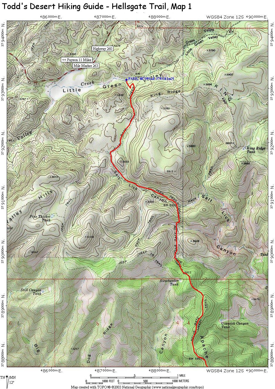
The sign at the trailhead
reads: Hellsgate Wilderness, welcome to this
trailhead which accesses the Hellsgate
Wilderness via trail #37, all visitors should
remember this is a special area, please remove
all traces of your visit, caution the last half
mile of the trail into Hellsgate, Tonto Creek is
unsuitable for horses. Begin walking along the
road which leads through the fence, bends left,
then right and begins climbing fairly steeply up
a hill. At the top of the hill the path/road
levels out for while, passing a sign labeled
893, which I'm assuming is the forest road
you're following. After 30 minutes of walking
you'll reach a sign for the Hellsgate Trail
pointing left. There are a few short cairned
side paths along the route, these detours
provide shortcuts to the road you are following
and are recommended. Eventually the path reaches
a second steep climb which tops out at a
shoulder before dropping down the other side.
The path becomes more trail-like at this point
as it descends and climbs a series of low ridges
heading south. After about 2 hours of hiking
you'll pass through a gap in a fence (only foot
travel and horses allowed beyond this point) and
5 minutes later you'll reach a sign marking the
boundary of the Hellsgate Wilderness. It's all
down hill from this point as the gravel strewn
path follows a ridge to the south. When you
reach a large stock pond, skirt it on the right
and look for a well defined and cairned path
that continues south. A short distance beyond
the pond you'll catch sight of the prominent
drainage of Tonto Creek. The trail heads towards
the creek through open grassland, then bends
right to skirt a prominent side drainage of the
creek. The last half mile to the creek is steep
and rocky with plenty of loose gravel to keep
you on your toes. Once in drainage there is a
good camp site just across the stream and
another on stream right about 5 minutes down
stream. You can explore up or down the creek
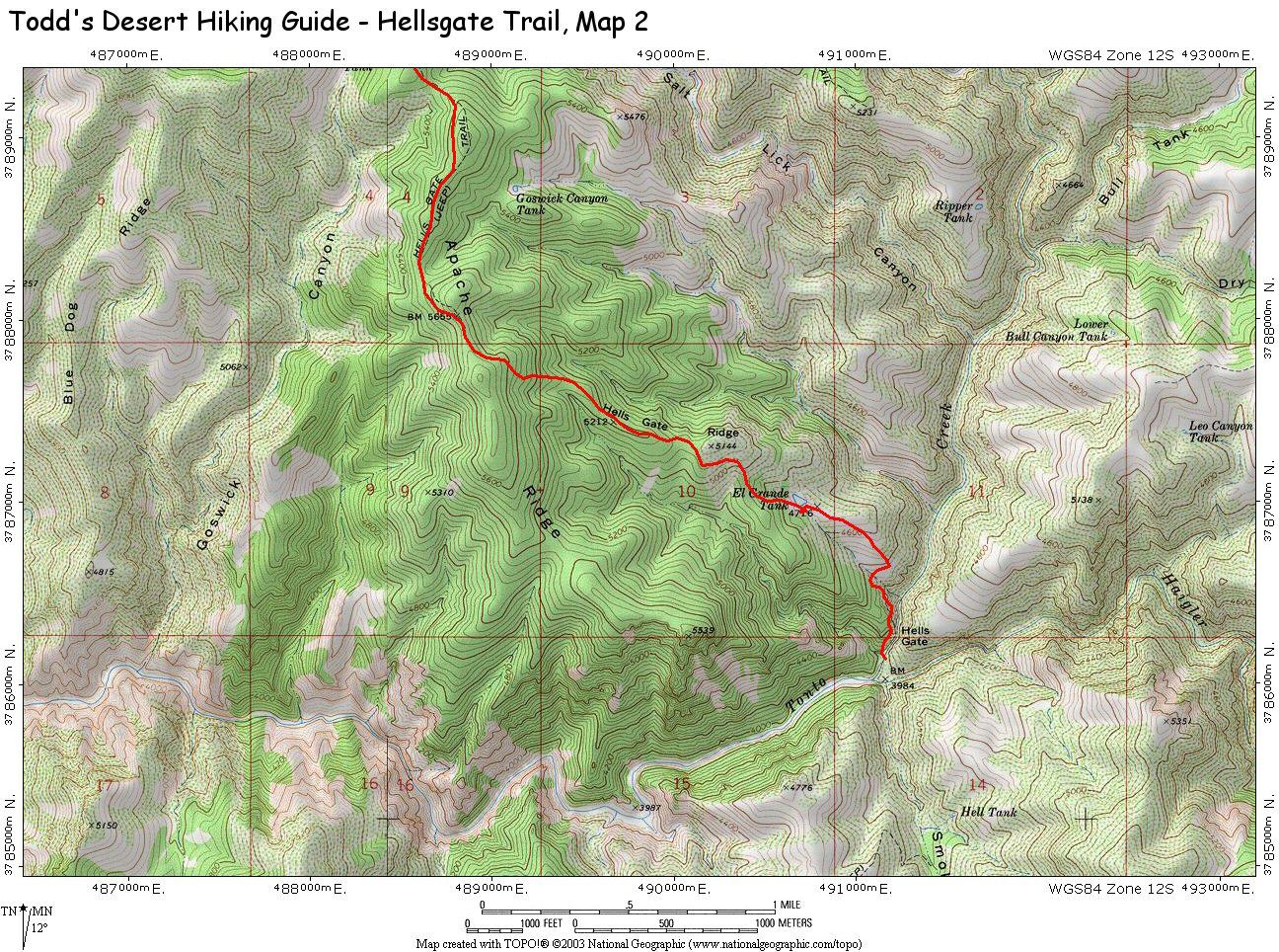
from this point. Hellsgate, for which the area
is named, is just up canyon and will require one
moderately long swims to visit. When you've
summoned the enthusiasm for the long climb out,
return the way you came. |
| Rating (1-5 stars): |

The author and his wife planned this trip as a
two day through hike of Tonto Creek (ending at
the small town of Gisela). When we reached the
creek we found that recent rains had turned the
water
a murky brown, making
wading extremely difficult and slow. We decided
with these conditions that our itinerary was too
aggressive and instead decided to turn the trip
into a day hike instead and spend some time
exploring Hellsgate. The hike back to the
trailhead was extremely hot. Total hike time was
9 hours. |
|
Maps: |
Hellsgate:
Map 1,
Map 2 |
|
Books: |
Canyoneering Arizona -
Tyler Williams |
| Photos: |
Click picture for larger view, click your browser's 'Back' button to return to this page. |
 |
 |
|
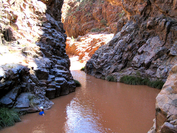
Swimming in Hellsgate. |
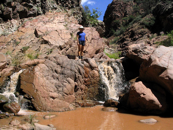
Small falls just around the corner. |
 |
 |
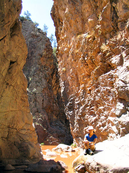
Steep cliffs and murky
brown water. |
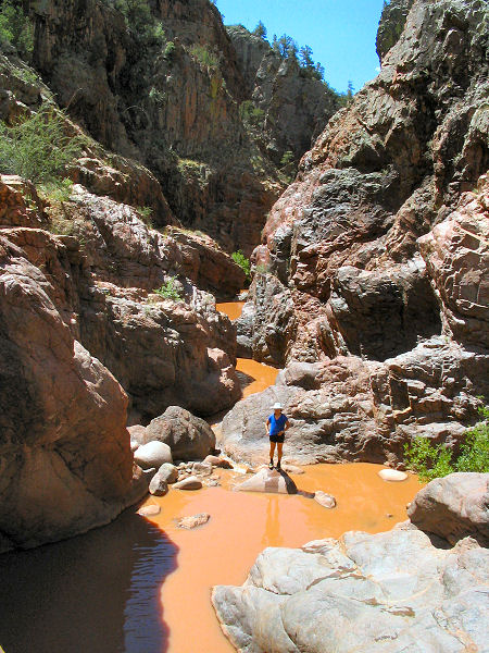
More walls and pools. |
|
|
