| Summary: |
A gentle, then steep climb up a nice
canyon to some view points in the Catalina Mountains. |
| Directions: |
From Phoenix drive south
on I-10 to Tucson. Take the exit for Ina Rd. Drive east until you reach North
Oracle Rd (U.S. 89). Turn north (left) on North Oracle and drive a quarter mile to
Magee Rd. Turn right on Magee and follow to the car park at the end. |
| Road
Conditions: |
Passenger Car - paved all
the way |
| Navigation: |
First 5.6 miles are Easy
after that the trail becomes Moderate to Difficult to follow. |
| Length: |
6.4 miles for an easy out and back hike
10.2 miles to Pima Saddle
14.2 miles to the summit of Mt. Kimball |
| Date
Hiked: |
April, 2000 & February, 2001 |
| Weather
Conditions: |
Lower 60's & sunny |
|
Required Skills: |

 |
| Hike
Description: |
From the parking lot hop
on the Pima canyon trail which winds between fenced in private property for a while before
entering the canyon. Basically just follow the moderately ascending trail as it
parallels the stream bed on one side or the other. There are a few tricky sections
to follow where the trail crosses the stream bed, but by walking up the stream you're
bound to pick up the trail eventually anyway. After 3.2 miles you will
come to an area where a major drainage comes in from the right. From
this point on the trail becomes steep, so you can turn around here if you
don't want to climb. For those continuing onward, walk across the
side drainage and pick up the trail as it ascends on the right side of the
main Pima Canyon drainage. For the next 2.4 miles the path is
unrelentingly steep as you make your way to the head of the canyon.
Along the way you will cross the stream a few times as you enter a more
forested area of oak and pine. Near the head of the canyon the trail
climbs the left hand ridge past shear rock walls to the signed junction
with the short side trail to Pima Saddle. Turn left at this junction
if you wish to visit the saddle, which has nice views to the north (5.6
miles). Those that haven't had enough climbing yet can continue
another 1.5 miles along the Pima Canyon Trail to the summit of Mt.
Kimball. From the junction with the saddle trail, the path bends
right bending around the head of Pima Canyon, then climbing a steep ridge
and winding around to the right to enter a side drainage to the main
canyon (all the while climbing steeply of course). The trail climbs
up the left side of this side drainage, bends to the right then hits a
forested ridge line which it follows for the remaining distance to the
summit. This section gets little use and is fairly faint, though the
author had no difficulty following it (the lower ends of the canyon which
get tons of traffic and fading use trails is more difficult in my
opinion). Once on top of the mountain, look for the use trail
branching left which leads to an outcropping of rocks with good views to
the north of Window Rock, Cathedral Rock and Mt. Lemmon (7.1 miles).
When ready return the way you came (14.2 miles). |
| Rating
(1-5 stars): |
 if you're
going to the saddle or summit,
for
lower Pima Canyon
if you're
going to the saddle or summit,
for
lower Pima Canyon
Lower Pima Canyon is really sort of nasty and crowded (since it's very
flat and easy no doubt). Once you begin to climb up and away from
the crowds, however, it's really quite nice. The upper part of the
canyon is quite rugged and pretty. There are also good views from
the summit (facing away from Tucson into the heart of the Catalina
range). When the author did this hike to Mt. Kimball in February,
there was a foot of snow in the upper elevations, though the air
temperature was quite pleasant. |
| Maps: |
Santa Catalina Mountains
- Rainbow Expeditions Inc. |
| Books: |
'Arizona Trails - 100
Hikes in Canyon and Sierra' by David Mazel |
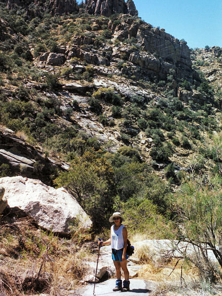
| Photos: |
Click picture for larger
view, click your browser's 'Back' button to return to this page. |