| |
Pine Canyon, Santa Catalina
Mountains
| Summary: |
A technical canyoneering trip through a boulder filled
canyon in the Santa Catalinas that requires a bit of hiking on slippery
water polished rocks. Gear required: helmet, webbing (30 ft), shoes with
good traction, harness, descender, and 2x200' ropes (or a 200' rope and 200'
pull cord). This trip is suitable for intermediate canyoneers familiar with
evaluating and using natural anchors. A car shuttle is required. |
| Directions: |
From Phoenix drive south on I-10 to
Tucson. Take the Grant Rd exit and drive east (left) on Grant for 8.7
miles. Turn left onto Tanque Verde and drive 3.4 miles to the Catalina
Highway. Turn left onto the Catalina Highway and drive to the fee station
located at the 5 mile point, $5 per car if you plan on stopping at any of
the trailheads, view points or to use a public toilet along the highway.
Spot a car at the lower trailhead, then continue onward to the upper to the
start of the hike.
Lower Trailhead: Continue up the Catalina Highway to the turnoff into
the Gordon Hirabayashi Recreation Area (Old Prison Camp) beyond milepost 7.
Turn left and follow the road either to a closed gate or beyond if it is
open. Low clearance vehicles should park at the last building slab in the
prison camp. The Sycamore Reservoir Trail #39 is located at the end of the
parking area.
Upper Trailhead: Continue to Organization Ridge Road just downhill
from the Palisade Visitor Information Center. Turn left and drive a quarter
mile down the Organization Ridge road to the Palisade Trail #99 parking area
on the right (note: the sign is sort of subtle). Trailhead parking is not
available in the boy scout campground. In winter, Organization Ridge Road is
closed, so youll have to hike about a quarter mile to the trailhead. |
| Road Conditions: |
Passenger Car - as long as there is no snow |
| Navigation: |
Moderate |
| Length: |
6-9 hours |
| Date Hiked: |
December 2005 |
| Weather Conditions: |
Sunny & cool |
|
Required Skills: |


 |
| Hike Description: |
From the trailhead for the Palisade Trail #99, begin walking on the
path as it winds its way downhill along the side of Palisade Canyon. Soon
you'll pass a side trail that branches left to the Boy Scout camp, stay
straight. Stay on the trail for about 2 miles to a point where it passes
within 50 feet of Pine Canyon (where Mud Spring is marked on the map). Leave
the trail at this point and begin walking down the canyon. The drainage
consists of white granite boulders that have been polished smooth over time
by water. When I was here there were a few puddles and pools, which were all
easy to avoid. Use care at all times during this hike, the rock is extremely
slick. Continuing down canyon, there are a few downclimbs and spots where
you'll have to walk around on one side or the other to find a reasonable
route down or avoid a small pool. Eventually you'll arrive at a drop off and
rappel #1. We used a fairly large, but not terribly alive tree a short way
down on canyon right. There are many other options for anchors if this one
doesn't appeal to you. From where we rigged the rappel was ~60 ft. Pack up
your rope and continue down canyon and about 20 minutes later you'll arrive
at rappel #2, a 150 footer from an obvious juniper tree at the top of the
rappel (it's a short ways back from the lip, which is why I recommend a 200'
rope). Remove your harness and it's more of the same as you rock hop your
way down canyon. The last obstacle occurs in an area where the canyon forms
a 'V' with a 20 ft drop off formed by a choke stone. We were able to
downclimb on the right, but I slipped and almost fell (which could have been
very unpleasant). I definitely recommend a belay at this point. Continue
down canyon to a point where the drainage begins to level out and takes an
obvious bend to the right. At this point you can either stay in the drainage
and continue down to a point where you run into the lower end of the
Palisades Trail (the long way, be aware I did not take this route so be sure
to have a map), or simply scan the hillside to the left of Pine Canyon. The
Sycamore Reservoir Trail can be seen a short ways up the left slope of the
canyon. It's a short, and somewhat unpleasant, hike up to the trail. If you
follow the latter route, you'll then head UP (this will either be right or
left, depending on where you hit the trail) the Sycamore Reservoir Trail.
The path climbs up a ways, then travels beside Sycamore Creek to Sycamore
Reservoir (which is now filled with sand). Sycamore Reservoir was originally
constructed to supply water to the old prison camp (a Japanese internment
camp during WWII) along the Catalina Highway. After crossing a sandy wash
(look for cairns) the path begins climbing once again, eventually
paralleling a 4-wheel drive road. The trail climbs up to a saddle, then
descends gently into a wash, which it follows a short distance to the old
Prison Camp and the vehicle you spotted earlier. |
| Rating (1-5 stars): |

The author and a friend completed the trip in 6.5 hours, we lost about 30
minutes when I realized I had left my camera at the bottom of the first
rappel and had to run back and get it. |
| Maps: |
Santa Catalina Mountains - Rainbow
Expeditions Inc., available in the Sabino Canyon Visitor Center ($6).
Recommended! |
| Books: |
None used |
| Photos: |
Click picture for larger
view, click your browser's 'Back' button to return to this page. |
 |
 |
 |
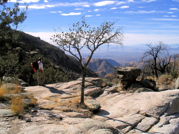
| The top of rappel #1. |
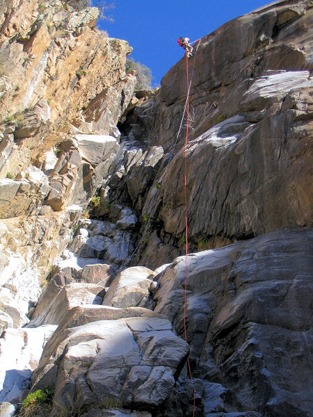
Rappel #2. |
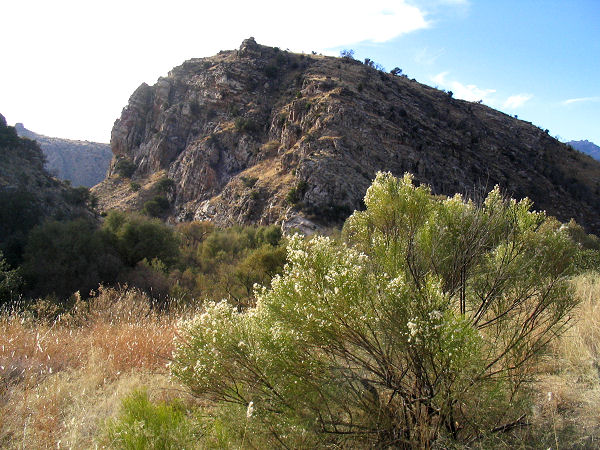
View along the Sycamore
Reservoir Trail.. |
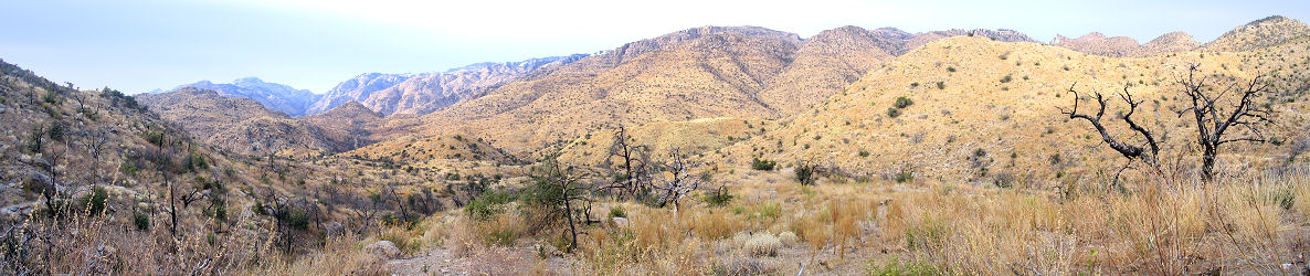 |
| Panorama view
along the Sycamore Reservoir Trail on the
hike out. |
|
|
