| |
Loy Canyon - Sedona
| Summary: |
An out and back hike to an old homestead
cabin in the Secret Mountain Wilderness. This trail was initially used in
the 1880's by the Samuel Loy family to move cattle from the rim to the
valley (sorry I didn't research this exciting fact, I just read this off
of the sign at the trailhead). |
| Directions: |
From Phoenix take I-17
north, exit onto highway 88A and drive west into Sedona. After 3.1 miles turn
right at milepost 371 onto Dry Creek Rd. and drive 2 miles to a right turn
onto the unpaved Forest Road #152. Pull into FR #152 and pick up a Red
Rock Pass at the automated machine ($5 per day per car). Pull back onto
the paved road and continue to the fork. Turn left at the 'T' with Forest Service Road #152C & drive 1.6 more miles.
At the next stop sign turn left onto the unpaved Boynton Pass Road (bumpy but ok for passenger cars).
Follow this road to the end and turn right onto Red Canyon Road. A short
distance later you will come to a signed intersection with: Loy Butte,
Honanki Ruins (4.5 miles, FR #525) to the left, and Palatki Ruins 1.5
miles FR #795 to the right (note: a Red Rock Pass is available at the
Palatki Ruins). Turn left towards Loy Butte. After 1.2 miles you will come
to a signed intersection Bradshaw Road (left) FR #525D, Loy Butte (3
miles, right) FR #525, turn right and follow this road 2.2 miles to the
trailhead (on the right), parking on left. |
| Road
Conditions: |
High Clearance Vehicle
would be best though in dry weather a Passenger Car will make it if you take it
slow (the author drove it in a passenger car). |
| Navigation: |
Easy |
| Length: |
~12 miles |
| Date
Hiked: |
April 2001 |
| Weather
Conditions: |
Warm & sunny |
|
Required Skills: |
None |
| Hike
Description: |
From the signed trailhead begin walking
on the wide sandy path past the fence line of Hancock Ranch. Within the
first 5 minutes of your hike you will realize that your trip will be
accompanied by the steady drone of aircraft noise from the overflight
touring companies. A noise survey is available at the trail register, if
inclined please complete the survey to document your disgust with those
businesses (if you can get the aircraft number off of the fuselage, so
much the better). The first part of the trail passes through a wide sunny
canyon flanked by manzanita, arizona cypres and emory oak. Sections of
this trail consist of deep sand stretches which make walking difficult.
Evidence of Sinaguan habitation can be seen in the few stone walls that
remain on the west side of the canyon, though they are not particularly
exciting. Eventually the trail becomes more forested with conifers and the
foot path more stable as you head gradually up the shady canyon. At the
four mile point the trail begins to ascend steeply up the left side of the
canyon gaining 1000 ft during the next mile as it travels up the sunny
manzanita covered slope. There are a few good view points along the way as
the trail switch backs up the side of the hill then follows the contour
towards a saddle at the head of Loy Canyon. A sign at the saddle marks the
intersection with the Secret Mountain Trail. Turn right onto this path and
climb a short distance through the Ponderosa Pines to summit, then the
trail begins a gradual descent past a few stock ponds created by concrete
and stone damns in the stream bed to the remains of the Secret Cabin and
coral. You can either continue on from here to one of several view points
which overlook the valley (check your map for directions) or return the
way you came. |
| Rating
(1-5 stars): |
 
The author and his wife completed the hike to the cabin and back in about
6 hours. We initially planned on a longer hike, however I was not feeling
terribly well on this day so we used the cabin as our turn around point. |
| Maps: |
Bear Tooth Maps: Sedona |
| Books: |
none |
| Photos: |
Click picture for larger
view, click your browser's 'Back' button to return to this page. |
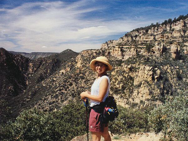 |
View into Loy
Canyon climbing
towards it's head. |
|
|
