| |
Castle Creek Wilderness - Prescott National
Forest
| Summary: |
A nasty
hike through thickets of cat's claw. Wear long pants & bring
gloves if you attempt this hike. |
| Directions: |
From
Phoenix drive north on I-17. Exit at 248 for Bumblebee, drive under
the highway and along 59, shortly the pavement ends and you will continue
on a well graded dirt road for 4 miles. Just before mile post 4 and
a cattle guard, turn left onto FR-684 (4-wheel drive), there is a small
faded sign for 684 on the left side. Follow the most well used roads
and the occasional signs to the end. Along the way you will pass a
ratty mine claim trailer, signs for Black Canyon Trail and two
gates. Park next to the steel tank. |
| Road
Conditions: |
4-wheel
drive |
| Navigation: |
Difficult |
| Length: |
~16 miles |
| Date
Hiked: |
October,
2000 |
| Weather
Conditions: |
Nice |
|
Required Skills: |

 |
| Hike
Description: |
From the
sign for Castle Creek Trail #239 begin climbing up towards the two white
outcroppings above. The trail is moderately distinct at this point,
but becomes more visible as you climb. The trail climbs a ways, then
levels off before dropping down into a wash. A short climb on the
other side brings you to a sign for the Wilderness Boundary and a signed
trail junction (1.5 miles). Straight ahead is the continuation of
#239 (Horsethief Basin & Senator Road (SR) #52, 5 miles), the right is
for #240 (Bench Well 0.25 miles, Two Peaks Trail 2 miles), turn right onto
#240. After 0.25 you come to an old sign for Bench Well (dry when
the author was there) and a steel windmill of the type you often see
around AZ. Cross the wash and bend right (look for cairns). At
this point the trail becomes very crappy and overgrown with cat claw and
scrub oak, a trend that continues for the majority of the hike. The
trail is also quite faded and difficult to follow, cairns and flagging
tape mark the way (though at some points you will have to push your way
through thickets of scrub to proceed). After a few miles you will
come to Cow Springs (3.5 miles) which was dry when the author was
there. The trail continues climbing towards the right, then bends to
the left and travels up a dry wash. Look for a cairn and flagging
tape on the left hand side for the continuation of the trail through the
brush. Eventually you will come to a shoulder and a fence. Go
through the fence and turn left (looks like there used to be a trail sign
at this point but it has been trashed). The first part is a little
tricky, but the trail becomes more distinct and there is a respite from
the brush for a while. The trail climbs up towards one of the two
peaks then skirts it to the right at the last minute. Continue
hiking and you will come to a signed junction: Twin Peaks Trail #240
continues straight and Senator Road #52 to the left, turn left towards
SR-52 (8.5 miles). The trail descends then becomes quite wide as it
travels through a nice Ponderosa Pine forest (this part of the hike is
actually nice, though it's the only nice part). The trail dumps you
out straight onto FR #679, continue straight following #679 until you
reach a major junction. Turn left at the junction towards the sign
for the "Yellow Helispot", there is also a sign somewhat hidden
in the brush on the right for Trail #239 (9.5 miles). At the end of
the road just past the register look on the right for two cairns marking
#239, just beyond is a gate and a Wilderness Boundary sign. Begin
descending through a trail very similar to that you came up (not quite so
overgrown, but bad enough). Follow the cairns as you descend.
When you finally come to a corral the trail fades into multiple use
paths. Climb over the fence into the corral and stay to the right
and you will pick up the cairns once again. A short distance beyond
is the trail junction you passed by earlier (14.5 miles). Turn right
and hike the remaining 1.5 miles back to your car (16 miles). |
| Rating
(1-5 stars): |
Zero stars
The author performed this hike in shorts and his legs became shredded by
cat claw. The result was quite painful since the brush was
unrelenting. My suspicion
is that years of historic cattle grazing has promoted woody plant growth
and the result is that the Castle Creek area is now dominated by cat claw
and scrub oak. I can not recommend this hike, though it might be
nice to drive to near the summit and walk around in the pine forest. |
| Maps: |
Prescott
National Forest map - not very good |
| Books: |
None |
| Photos: |
Click picture for larger
view, click your browser's 'Back' button to return to this page. |
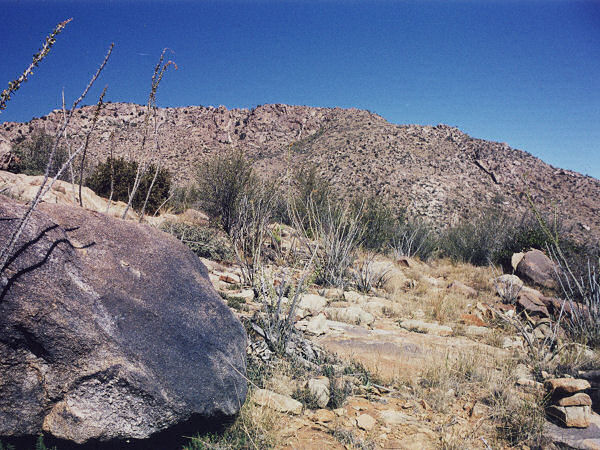 |
Typical
view in Castle Creek, looking
down the trail(?), notice the cairn
in the lower right of the frame. |
|
|
