| |
White Tanks Mountain Regional Park
| Summary: |
Some decent hikes in a nice desert
setting just west of Phoenix. Most paths are
multiple use, which means you'll have to share
them with mountain bikers and an occasional
horse. Entry fee is $5 per carload or you can
buy an annual pass for $75. |
| Directions: |
From Phoenix, take I-10 west
to exit 124 for Highway 303. Drive north on 303
to the intersection with Olive Ave. (the
intersection has traffic lights, railroad tracks
and a big sign for the Park). Turn left (west)
on Olive Ave and drive 4.5 miles to the end and
the entry station for the Park. |
| Road Conditions: |
Passenger Car - paved all the
way |
| Navigation: |
Easy |
| Length: |
Waterfall Trail: 1.8 miles
round trip
Waddell/Ford Canyon/Mesquite Canyon Trail Loop:
9.9 miles
Goat Camp/Willow Canyon Trail Loop: 12.7 miles |
| Date Hiked: |
October 2005
December 2005 |
| Weather Conditions: |
Sunny and warm |
|
Required Skills: |
None |
| Hike Description: |
Waterfall Trail: From
the parking lot and trailhead, walk along the
wide flat path as it meanders through the
desert. As you stroll, look for boulders (mainly
on the right) side of the path that are marked
with petroglyphs. These designs were pecked into
the rock 700-800 years ago (or more) by Hohokam
Indians. Soon the trail enters a box canyon and
climbs a short distance to a double dry fall
(the waterfall for which the trail is named,
though it only flows after periods of heavy
rain). When ready, return the way you came.
Waddell / Ford Canyon / Mesquite Canyon Trail
Loop: I'll describe this
path traveling counter-clockwise from the
Waddell Trailhead (at the end of Ramada Rd.,
where the amphitheater is marked on the map).
From the trailhead walk a short distance to a
signed junction with the Mesquite Trail. Stay
straight on the Waddell trail which is easy flat
walking as it heads in a northerly direction
through nice desert scenery consisting of
saguaro, mesquite, brittlebush, cholla, creosote
bush palo verde and grasses. After 0.9 miles,
you'll reach a 'T' junction with the Ford Canyon
Trail. Turn left and continue the pleasant
stroll. After a time you'll reach a sign warning
hikers that "hazardous travel conditions" exist
beyond. The trail becomes steeper past this
point as it climbs up the left side of a rocky
drainage. The path becomes steep as it nears the
head of the canyon, then drops into the wash
above. The trail becomes un-maintained at this
point, but it's hard to get lost. Simply follow
the main channel of the wash as it ascends
between low hills, the path is infrequently
marked by cairns, but otherwise feels rather
remote. You'll cross sections of white granite
slickrock in which you may find pockets of water
- these are the White Tanks for which the area
is named. Continue to follow the wash and
eventually you'll reach a low wall that crosses
the streambed (the remains of an abandoned dam).
The wash bends to the left above the wall and
becomes more sandy. After about 30 minutes of
walking from the dam, the path leaves the wash
on the left and begins ascending moderately
along a series of broad switchbacks through low
grassy hills. The trail tops out at a shoulder
(with views into a grassy basin and up to a
mountain covered with antennas), then drops down
the other side into the basin to reach a signed
junction with the left branching Willow Canyon
Trail (5.7 miles). You can shave 0.7 miles off
the hike by taking the Willow Canyon Trail, we
however will continue along the Ford Canyon
Trail as it begins ascending once again to reach
another shoulder 0.9 miles later (6.6 miles) at
a signed junction with the Goat Camp Trail
(which heads right) and the Mesquite Canyon
Trail (which heads left). Turn left on the
Mesquite Canyon Trail which descends steeply
along a rocky track at first, eventually
becoming more gentle as it winds its way down to
a junction with the other end of the Willow
Canyon Trail (8.1 miles). Stay right, continuing
along the Mesquite Canyon Trail as it continues
its descent on the right side of a drainage.
After a bit the path leaves the drainage to the
right, climbs a low ridge and drops into the
next drainage over, which it follows the
remainder of the way to the parking lot and
trailhead (9.9 miles).
Goat Camp / Willow Canyon Trail Loop:
I'll describe this path traveling clockwise
beginning on the Bajada Trail (starting at this
trailhead instead of the Goat Camp Trailhead
will save a little road walking at the end of
the hike). From near the restroom, pick up the
Bajada trail on the west side of the road as it
winds its way through the desert. It's easy
walking for the first 0.9 miles to the junction
with the Goat Camp Trail. Turn right on the Goat
Camp Trail as it continues through the desert to
the junction with the left branching South Trail
(1.3 miles). Continue straight on the Goat Camp
Trail, which soon begins climbing gently, then
more moderately as it enters a prominent
drainage. When it switches from the right to the
left side of the drainage, the path becomes
rather steep until it eventually tops out in a
wide basin. The trail then climbs at a more
moderate grade as it winds up the middle of the
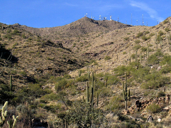
basin towards a hill covered with antennas,
eventually crossing the wash to the right to
climb up to a shoulder. The path then becomes
quite level and easy as it travels below the
antenna array through grassy, rocky hills. It
performs two wide arcs as it winds around the
drainages of Yellow Bull Canyon then Dripping
Spring Canyon to eventually reach a junction
with the Mesquite Canyon Trail, which heads
right, and the Ford Canyon Trail, which goes
left (6.9 miles). You can shave about a mile off
the hike by turning right on the Mesquite Canyon
Trail, however, we'll stay left on the Ford
Canyon Trail as it drops down the hillside at a
moderate grade to cross a wash at the junction
with the right branching Willow Canyon Trail
(7.8 miles). Turn right on the Willow Canyon
Trail as it descends moderately to a metal tank
and small corral at Willow Spring. It's well
worth it at this point to take a short detour
along use trails behind the tank to pay a visit
to the spring, a very pleasant spot with a pour
over and pools. When ready, continue descending
along the Willow Canyon Trail which descends
along the hillside to the right of the drainage.
Eventually it leaves the drainage to the right
and descends to a junction with the Mesquite
Canyon Trail which branches left and right (9.5
miles). Stay left and continue heading down
along the Mesquite Canyon Trail as it descends
on the right side of a drainage. After a bit,
the path leaves the drainage to the right,
climbs a low ridge and drops into the next
drainage over, which it follows to a junction
with the left branching Waddell Trail (11.2
miles). Continue straight on the Mesquite Trail
as it travels through the desert on a level,
easy track. At the second road crossing turn
right and begin walking along the White Tank
Mountain Road south (11.7 miles). You can follow
the road all the way back to the Bajada
Trailhead and your car, or if you so desire, you
can do a short detour along the way around the
Black Rock Short Loop (a flat easy nature trail
with interpretive signs), you can also avoid a
bit of road walking near the end by picking up
the Bajada Trail behind the Visitors Center
since it leads right back to the restroom and
your car. |
| Rating (1-5 stars): |
 
The author and his wife completed both of the hikes listed
at a moderate pace in about 5 hours. It was a
little early in the season for the area with day
time temps around 90F. White Tanks is a better
choice for a winter hike. The author returned at
a later date and hiked the Goat Camp Loop hike
described above at a quick pace in 4.5 hours. |
| Maps: |
Maps of the area may be
found
here or
ask for a map at the Park entrance
when you pay your fee. |
| Photos: |
Click picture for larger view, click your browser's 'Back' button to return to this page. |
 |
 |
|
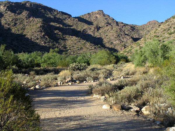
Waddell Trail. |
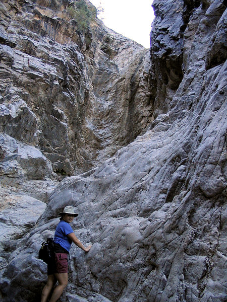
Ford Canyon. |
 |
 |
|
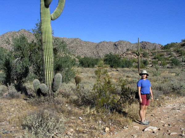
Goat Camp Trail. |
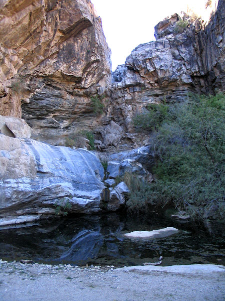
Willow Spring. |
|
|