| Summary: |
A Phoenix area park with 11
miles of trails open to hiking, mountain bikes
and horses. The park also features camping
facilities with showers ($18 per night) and
horseback rides ($30 per hour) and ranger led
activities. Click
here for more specific park events. |
| Directions: |
From Phoenix,
drive north on I-17 to exit #223 and head east
on the Carefree Highway. Drive about 7 miles
then turn north on 32nd Street. Enter the Park
at a self service fee station ($5 per car load
per day). |
| Road Conditions: |
Passenger Car - paved all the
way |
| Navigation: |
Easy - wide, well marked
trails throughout |
| Length: |
0 - 15 miles |
| Date Hiked: |
December 2003 |
| Weather Conditions: |
Cool and sunny |
|
Required Skills: |
None |
| Hike Description: |
All hikes pass through
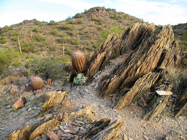
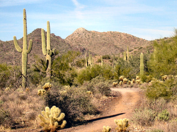
vegetation typical of the Upper Sonoran Desert.
Along the way you'll see: saguaro cactus, cholla,
prickly pear, palo verde, ironwood, brittle
bush, jojoba, ocotillo and mesquite.
Go John Trail (4.7 mile loop): The
longest loop in the park, the trail begins at
the parking lot for the Go John Trailhead. The
trail circumnavigates a prominent ridge, passing
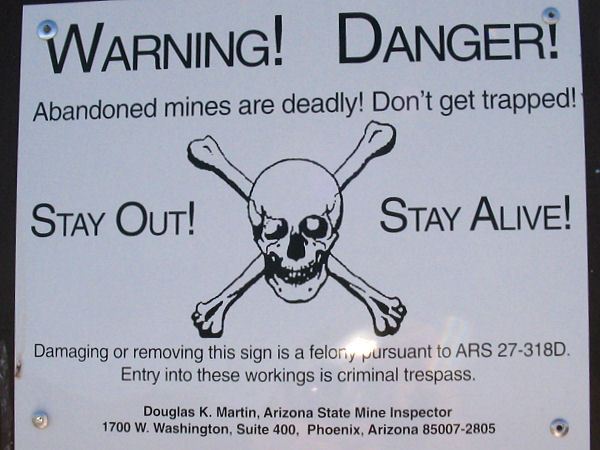
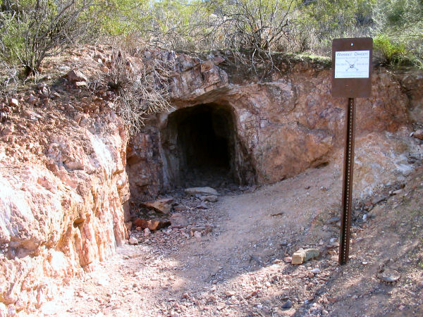
several abandoned mine sites along the way.
There is one moderately steep, if short, hill
which is found just north of the trailhead.
Overton Trail (2.1 mile loop): This hike
may be started from either the Go John or
Overton Trailheads. This hike forms a loop
around another prominent hill in the park.
Clay Mine Trail (0.8 miles one way):
This trail leads from a parking lot along Jasper
Way along a ridge line to connect with the
Overton Trail. Along the way it passes the Clay
Mine, which you can walk into about 50 feet.
Slate Trail (1.6 miles one way): A
mostly flat trail which leads from the horse
stables at the Go John Trailhead to the park
boundary. Seems to be mostly used by mountain
bikes and horses.
Flume Trail (1.5 miles one way): Despite
it's rather exciting sounding name the Flume
Trail just follows a dry wash southeast to an
old rocky road. Also seems to be traveled mostly
by mountain bikes and horses.
Jasper Trail (0.2 miles one way): Not
much of a trail really. This short path provides
a connection between the Go John and Slate
Trails. |
| Rating (1-5 stars): |

Nothing exceptional, but an ok place to hike
if you don't have time to get away. Not sure if
my experience was typical, but I only saw a few
horses and mountain bikes on the hike. The
author hiked all the trails in the park (since
some were out and back this was about 15 miles)
in about 5 hours. |
| Maps: |
Click
here for
a Cave Creek Recreation Area map |
| Photos: |
Click picture for larger view, click your browser's 'Back' button to return to this page. |