| |
Kofa National Wildlife Refuge
| Summary: |
Kofa National
Wildlife Refuge was established in 1939 and is
managed by the U.S. Fish and Wildlife Service.
The refuge encompasses 665,400 acres of pristine
desert that is home to the desert bighorn sheep
and the California palm, the only native palm in
Arizona. Two hikes in this large area are
described below. A steep climb to Signal Peak,
the highest point in the area, and a short, on
trail, hike up Palm Canyon. In case you were
interested, the name 'Kofa' comes from a
contraction of 'King of Arizona', which is the
name of a profitable gold mine in the area which
was operated between 1896 - 1910. |
| Directions: |
From Phoenix, take I-10 west about 120 miles to
the strange little town of Quartzite (RV and
snowbird capital of the world). Head south on US
95 for about 18 miles to between mile markers
86-85 and turn left (east) at the sign for Palm
Canyon. Drive 3.3 miles on this good dirt road
to the entry sign and information kiosk.
Palm Canyon: Continue straight on the good dirt
road for 4 miles to its end.
Signal Peak: Turn left just past the entry sign
at the sign for Queen Canyon Road #19 (zero your
odometer here). The road is in decent shape for
the first 4.6 miles, then becomes 4WD where it
bends left to enter a rocky wash. Drive another 3
miles in the wash (the road is braided in
places, choose the route that looks best to you) and park next to a rock cairn
at the mouth of Ten Ewe Canyon (see below for gps coordinates). |
| Road Conditions: |
Palm Canyon: Passenger Car
Signal Peak: 4-Wheel Drive |
| Navigation: |
Palm Canyon: Easy
Signal Peak: Moderate |
| Length: |
Palm Canyon: 1
mile
Signal Peak: 3 miles |
| Date Hiked: |
January 2006 |
| Weather Conditions: |
Sunny and Nice |
|
Required Skills: |
 |
| Hike Description: |
Palm Canyon: From
the road end, simply walk up the well defined
trail into the canyon. There is a sign 0.5 miles
up the path pointing into a side drainage where
a cluster of palm trees (the only native palms
in Arizona) are located. There are two theories
as to why these California Fan Palms exist in
the desert.
1) They are descendents of palms growing in the
region during the last periods of North American
glaciation. As the climate warmed to desert
conditions, the trees spread into protected
canyons, the only place they were able to
survive.
2) The trees were spread from other palm groves
by birds or coyotes carrying seeds in their
digestive tracts.
I vote for the 'bird poop' theory. There doesn't
seem to be a large enough population of the
palms to have allowed them to survive as an
isolated group for so long (but what do I know).
When ready, return the way you came.
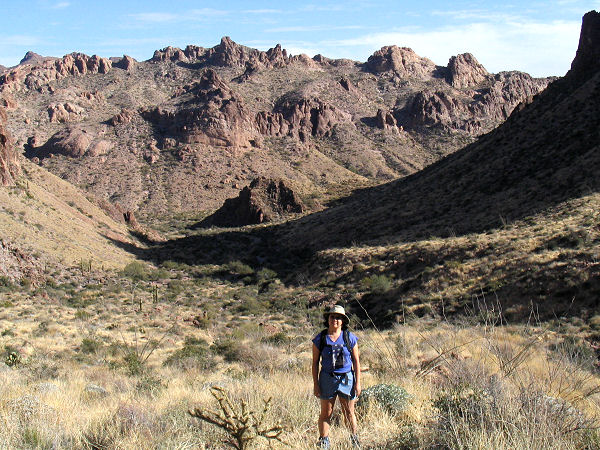
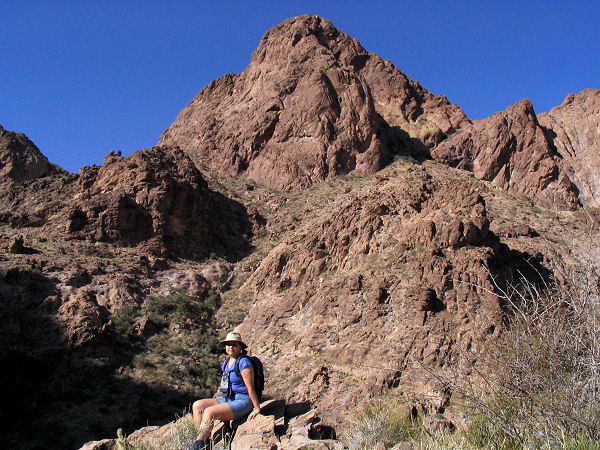
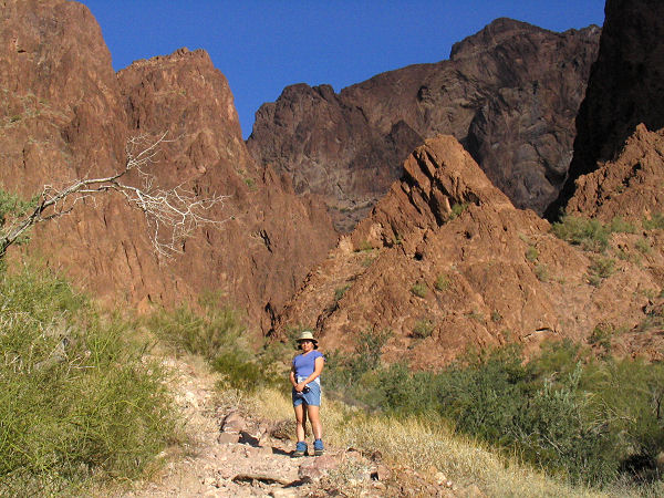
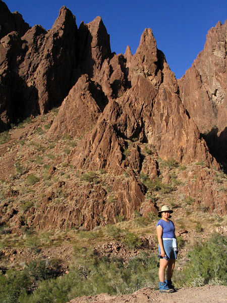
Signal Peak: There is no maintained trail to the
top of Signal Peak, but hikers have created a
fairly well defined path that is marked at
frequent intervals with cairns. This hike is
best suited to those familiar with off trail
hiking and route finding. The route is steep
(climbing 2000 feet in 1.5 miles with sections
of loose rock. Be careful of your footing,
particularly during the descent. From the mouth
of Ten Ewe Canyon, hike up the dry wash for 5-10
minutes looking for a cairn on the right side
(GPS point S1). Climb
out of the main wash to the right and begin
ascending moderately beside minor dry wash
(which will be on your left). The path becomes
more defined as you ascend and soon begins
climbing steeply, eventually bending to the
right to reach a flat spot above Indian Canyon
which will be on your right (S2). Looking
upwards you be faced with a large amphitheater
shaped drainage. The trail ascends up the left
side of this drainage aiming for a spot to the
right of Ten Ewe Mountain (the large blocky
mountain above you and to the left). The path
becomes rockier as you ascend and there may be a
few spots where you have to use your hands. Near
the top of the drainage the trail bends right to
reach a saddle overlooking a bowl shaped
drainage (S3). The path drops down slightly as
it contours the bowl clockwise to the left.
After crossing a dry wash the path begins
climbing steeply again to the left of another
wash. Eventually, the path drops into the wash
before climbing out on the right to follow yet
another dry wash (at this point Ten Ewe Mountain
will be behind you and a large unnamed
triangular rock peak will be on your right). As
you leave the brush and enter a rocky section,
the path fades away. Continue straight up the
dry rocky wash and soon you'll locate a few
cairns and faint sections of trail. The trail
becomes more defined as it climbs up to a saddle
(S4). From here, it's relatively easy walking as
the trail skirts the shorter of the two peaks of
the hill then climbs
the remaining short distance to the top of
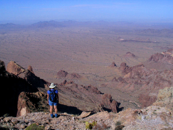
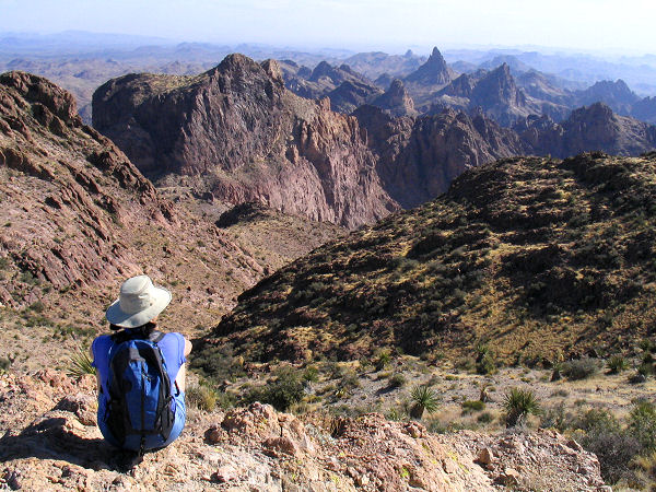
Signal Peak (S5, 4877 ft). From the summit you'll
have terrific 360
degree views of the Kofa Mountains to the east
and the barren expanse of the La Posa Plains to the
west. When ready, return the way you came.
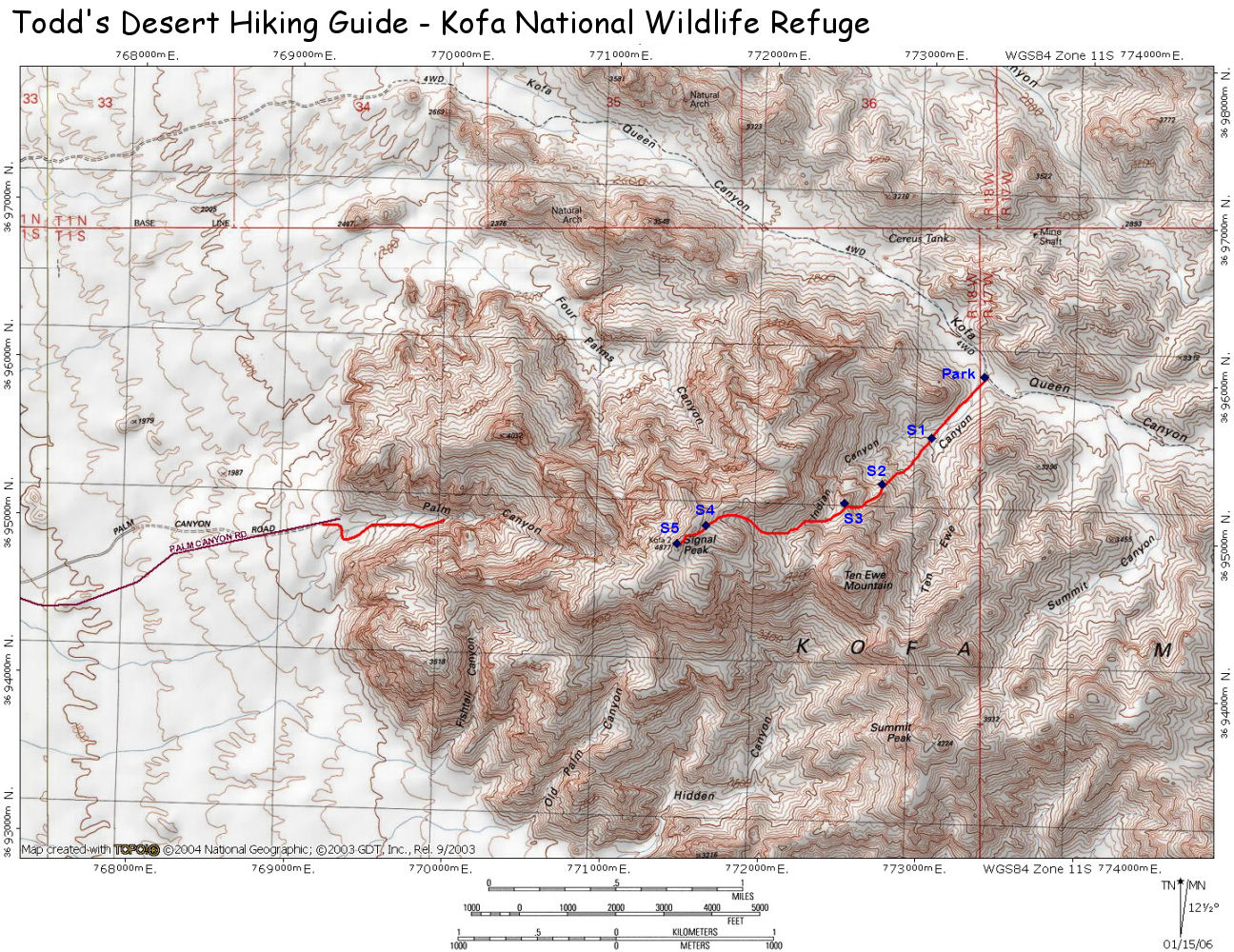
Signal Peak GPS
Coordinates
(UTM):
Park: 773361 mE, 3696019 mN
S1: 773037 mE, 3695626 mN
S2: 772734 mE, 3695323 mN
S3: 772495 mE, 3695201 mN
S4: 771622 mE, 3695031 mN
S5: 771442 mE, 3694915 mN |
| Rating (1-5 stars): |

The author and his wife hiked to the top of
Signal Peak in ~2 hours, spent a half hour on
top and returned (4.5 hours total). We then
drove around and hiked up Palm Canyon and back
in about 30 minutes. |
| Maps: |
Click here
for a map of the area. |
| Photos: |
Click picture for larger view, click your browser's 'Back' button to return to this page. |
|
|
