| |
Deer Creek Narrows - Grand Canyon National
Park
| Summary: |
A short technical canyon deep within the Grand Canyon. To
get to the narrows you can follow my hiking directions for Deer Creek found
here. To complete the narrows you will need: 60
foot rope, 200 foot rope, 200 foot pull cord, harness, descender, helmet,
webbing cows tail or sling, carabineers and wet suit. A whistle is also
nice, since the noise of the water makes communication difficult. |
| Directions: |
Because of all the extra gear you must carry, this hike
is best done from Monument Point, via the Bill Hall Trail. There are many
ways to drive there, here's one option:
Take I-89A to it's intersection with state highway 67 at Jacob Lake. Follow
67 south past the Kaibab Lodge. About a mile past the lodge turn right on
Forest Road 422 (the sign is labeled 22). All roads in this area are
prominently labeled so you shouldn't have much trouble - the Arizona Road
and Recreation Atlas is a good investment as reference book for routes
on Forest Service roads like this one. Follow 422 for 10.5 miles until you
reach FR (Forest Road) 206, turn left on 206. After 3.6 miles, keep an eye
out for FR-214 on the right, turn right on FR-214. Drive for 2.7 miles,
when you reach a branch with FR-272, turn right on FR-272. After 6.6 miles
turn left onto FR-292 which leads a short distance to Monument Point.
|
| Road
Conditions: |
Passenger Car |
| Navigation: |
Easy |
| Length: |
9 miles from the rim to Deer Creek, the narrows is
probably only 0.2 miles long |
| Date
Hiked: |
May, 2003 and October, 2004 |
| Weather
Conditions: |
Sunny and nice |
|
Required Skills: |


 |
| Hike
Description: |
From the nice camp site under the cottonwood trees next
to Deer Creek, follow the trail down canyon a short distance to a slickrock
bench at the head of the narrows. This makes a nice staging area to begin
your adventure. Put on your wet suit and climbing gear and cross the stream
to the south side (left side of the canyon). Walk down canyon a short
distance below the first two falls to where a rock fin protrudes into the
stream bed. This is your entry point. The down climb is a little tricky and
some might want a hand line or belay. Once in the canyon, begin splashing
your way down stream. The nice narrows begin immediately. Soon you will
reach the first rappel - a 15 footer from a single old bolt and rusty hanger
on the right (should probably be backed up by a newer bolt at some point).
There is also another newer bolt in a shallow alcove on the right just
downstream from this old bolt, getting to it would involve a short, but very
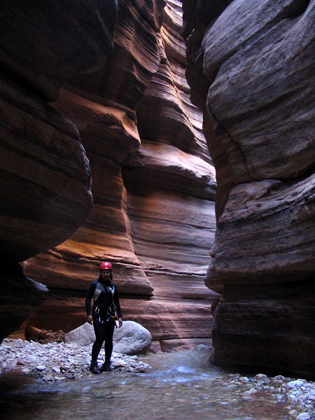
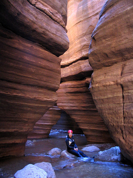
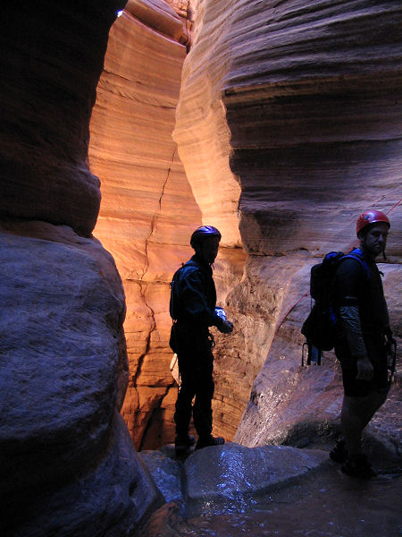
difficult traverse though. Walk down stream through spectacular narrows.
There are a few small water fall downclimbs, but no major obstacles. Just
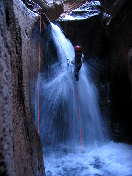
after you complete a short swim around a corner you hit rappel #2. An 85
foot double waterfall rappel from two good bolts up on the wall on the right
(there is a slight bend in the canyon at the second falls, so make sure the
last person in your group places the rope correctly for a smooth pull).
Immediately after these falls, you'll hit rappel #3 and will see daylight
just beyond at the big falls. Rappel #3 is a 20 footer from a single old
bolt and rusty hanger on a shelf on the right after a short traverse (this
bolt should also probably be backed up). You'll want to use your shorter
rope here since there isn't a lot of room at the top of the big rappel
below. This short rappel brings you right to the top of Deer Creek Falls
where the water makes a tight 90 degree right turn before making the plunge
to the pool below. Though the current isn't terribly strong and you can
stand, I'd suggest staying on rope until you can clip into the bolt station.
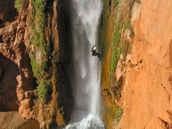
The last rappel is a spectacular 180 footer from two good bolts on the left.
I recommend lowering your rope instead of throwing it since the falls and
pool is a popular hangout for the lazy boater crowd. Watch your foot
placement and try to minimize any damage to the travertine wall on which
you're descending. Photographers note: there's a good ledge high on the wall
to the left of the falls that's makes a great camera platform for taking
pictures of your friends. Once everyone is down and your ropes are pulled
you can return to camp via a trail which exits from the stream below the
falls on the right. |
| Rating
(1-5 stars): |

The author and his wife have gone through the canyon twice each on 2
occasions. Despite the very long approach for what amounts to a very short
canyon, I rate this amongst the top 3 canyons I have ever done. |
| Maps: |
None |
| Books: |
None |
| Photos: |
Click picture for larger
view, click your browser's 'Back' button to return to this page. |
 |
 |
 |
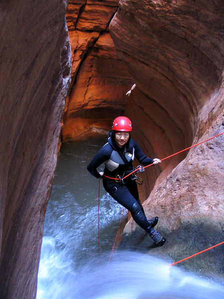
| Rappel #1. |
View in the narrows. |
Another view in the narrows. |
 |
 |
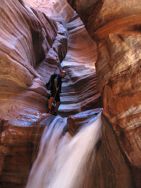 |
| The top of rappel #2. |
The first falls of rappel #2. |
The 2nd falls of rappel #2. |
 |
 |
 |
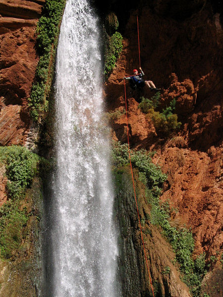
| The big falls. |
Half way down. |
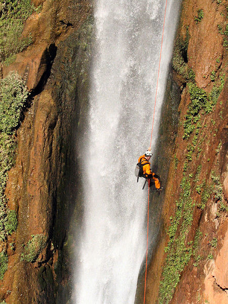
The author almost down. |
|
|
