| |
New Hance (aka Red Canyon) Trail - Grand
Canyon National Park
| Summary: |
A surprisingly remote and infrequently traveled rim
to river route on the south rim of the Grand Canyon. Keep your eyes pealed
for cairns and take care where you place your feet. Lots of crumbly loose
gravel on the path makes a fall a real possibility. |
| Directions: |
The New Hance Trail is located mid-way between the
Buggein Picnic Area and Moran Point on the East Rim Drive. The path begins
on the north side of the road (it would be quite a surprise if it were on
the south side eh?) near a small dirt pull out with logs and a 'No Parking'
sign. There is no road side sign marking the trailhead. Since you can not
park at the trailhead, the next best place would be on the side of a service
road that lies 0.5 miles west of the trailhead on the south side of the East
Rim Drive. This is not a parking lot, but there are no signs indicating you
can't park here either. Alternatively you could park at the Buggein Picnic
Area or Moran Point, but you'll have to hoof it another mile along the road. |
| Road
Conditions: |
Passenger Car - paved all the way |
| Navigation: |
Moderate - some faint trail and parallel paths |
| Length: |
14 miles |
| Date
Hiked: |
October, 2002 |
| Weather
Conditions: |
All 4 seasons were experienced on this hike: sun, heat,
rain, hail, wind, cold & snow |
|
Required Skills: |
 |
| Hike
Description: |
From the pull out, logs and 'No Parking' sign head north
towards the rim. A short walk will bring you to a sign marking the beginning
of the New Hance Trail. You'll have good views of the Sinking Ship formation
to the west and Coronado Butte directly in front of you. The path
immediately begins a steep descent through the Coconino sandstone. Get used
to the angle, there is a lot more to come. After a bit, the trail levels off
and heads east briefly to a break in the cliff, then bends sharply to the
left and continues it's steep descent towards the east of Coronado Butte.
The path heads into the drainage east of the butte, then follows this wash
on one side or the other out towards the prominent knob which sits high
above you at the end of the butte. There are some parallel paths in this
area, but they all lead in the same direction, keep your eyes pealed for
cairns and choose the most prominent trail. The path leads out to a little
promontory with great views and a small camp site, then bends sharply to the
right to skirt a deep drainage. The trail then contours along the right side
of Red Canyon in a meandering fashion heading northeast, sometimes gaining &
sometimes losing altitude. I found this section somewhat confounding since
my expectation was that the path would simply continue downwards towards the
drainage. However, as is often the case in the Canyon, the trail is simply
heading towards a break in a lower cliff band that will allow you to
continue your descent. Finally the path finds the break, then begins
dropping steeply once again. At the base of this steep drop, the angle of
the path becomes more reasonable as you reach the Muav Limestone (though the
small crumbly pieces of stone which comprise this layer continue to
challenge your balance). The trail continues descending on the east side of
the canyon, before skirting a prominent drainage coming in from the right,
eventually dumping you into the stream bed of Red Canyon itself. It's still
a few miles to the river, but the walking is easy (look for use trails
around the few drop offs you encounter along the way). There are good
campsites at the river on either side of the canyon where you'll have the
roar of the rapids to lull you to sleep. From this point you could also
follow trails up river towards Tanner or down river towards Grandview. If
you are doing this as an out and back trip like I did, simply return the way
you came. |
| Rating
(1-5 stars): |

Another great canyon hike. Several respectable sources have listed this as
one of the more challenging trail hikes in the Canyon. I have no reason to
issue any dire warnings regarding this route, however, I believe it is
probably better suited to the more experienced desert hiker. The author
completed this hike with a group of folks from work. On the way out we were
greeted with hard pelting hail, wind and horizontally blowing snow. Partly
due to this inclement weather and a late start, the author completed this
hike hurriedly in 6 hours. |
| Maps: |
Trails Illustrated -
Grand Canyon National Park |
| Books: |
Canyon
Hiking Guide to the Colorado Plateau -
Michael Kelsey |
| Photos: |
Click picture for larger
view, click your browser's 'Back' button to return to this page. |
 |
 |
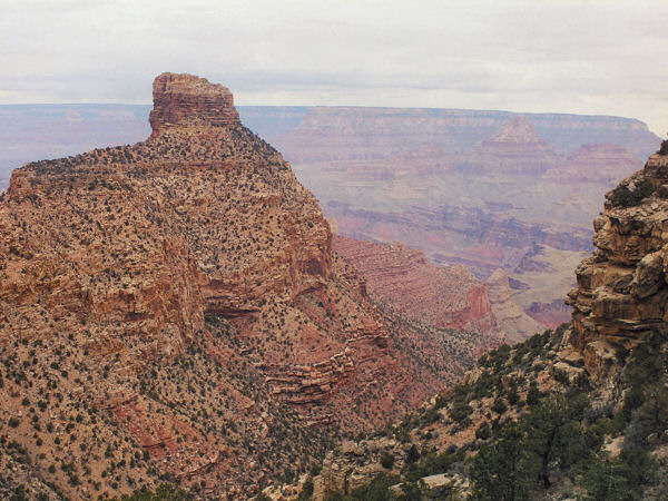
| Coronado Butte. |
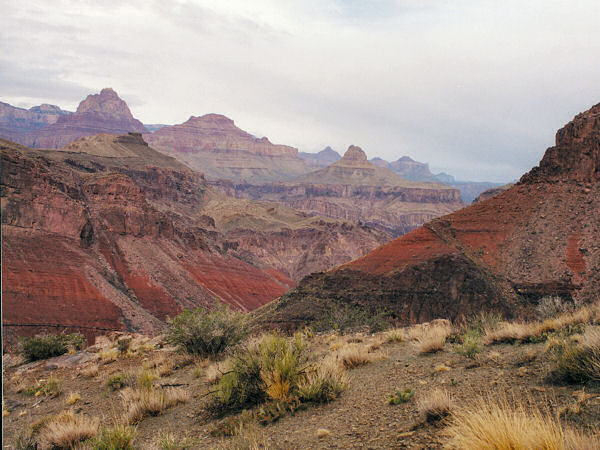
Prominent ridge as you near
the creek bed. |
 |
|
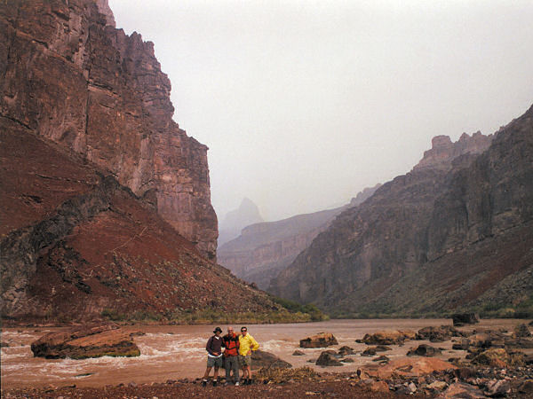
| Colorado River |
|
|
|
