| |
Rider Canyon - Marble Canyon
| Summary: |
A very nice and scenic canyon with
narrows and potholes. Some steep scrambling required to get in and out
of the canyon. |
| Directions: |
Follow these directions closely
to find Rider Canyon (ignore any minor dirt tracks as you go). From Flagstaff
drive north on Highway 89. Turn left on Highway 89A towards Jacob Lake
and follow it across the Navajo Bridge. Turn left on a dirt road just past
mile post 557. Zero the trip meter on your car and head south on this dirt
road. In 2.1 miles bear left at a road junction and cattle guard, at 3.3
miles stay left again. At 4.6 miles you'll reach the Kram Ranch, turn right
and pass through a fence. The road heads south for about a half mile then
bends east. At 5.6 miles you'll reach another fork, stay left and continue
driving. You'll pass a few signs in this section urging you to protect
the Brady Pincushion Cactus which grows along the rim in this part of Marble
Canyon (please keep your vehicle on established roads). At 11.9 miles from
the highway bear left at a junction following a faded brown hiker's sign.
At 12.2 miles follow the hiker's sign right. This section of the road has
a few rough, rocky sections and you'll follow it right to the canyons edge
at 14.2 miles. |
| Road
Conditions: |
High Clearance Vehicle |
| Navigation: |
Easy |
| Length: |
~6 miles |
| Date
Hiked: |
February, 2002 and October 2004 |
| Weather
Conditions: |
Nice |
|
Required Skills: |

 |
| Hike
Description: |
Update (Spring 2019): Evidently a
landslide (likely from the exceptionally wet winter of 2018-2019) has taken out
the entire trail down into Rider Canyon. The route is now just one big scree
slope. Lots of loose material. Use care!!
At the car park, you'll be right
at the edge of Rider Canyon. Look to the left and you'll see a brown hiker's
sign pointing the way in, along a crack in the rock. The trail is steep,
but easy to follow as it descends through the Kaibab limestone (passing
under two large boulders) into the canyon. When you reach the scree slope,
the trail fades considerably as it splits into multiple use tracks, all of which
lead to the creek
bed. Pick the most prominent trail and watch your footing as you descend.
Once in the stream bed make sure there are some cairns in place which mark
this spot as the way out, otherwise you could walk right by it. When ready
head right and walk down canyon. It's easy and pleasant walking down canyon
with little climbing required. You'll make good time, particularly on the
many slick rock sidewalks along the way. After a while you'll reach a
12' dry fall. You could either attempt to jump down, but it might be better
to look for the fairly well defined trail on the right which leads around
this obstacle (though you have to stay up on the side of the canyon for
quite a ways before reaching a break that will allow you back into the
canyon bottom). Lower down you'll reach a choke stone and drop off into
a narrow pool. Backtrack a short ways from this section and look for a
cairn and route up and around on canyon left (the left side of the canyon
when facing down stream). In the lower part of the canyon you'll pass through
some very nice narrows. There are several pour over pools, drop offs and
potholes, but you'll be able to bypass all of these obstacles by climbing around on one side of the canyon
or the other. Just before reaching the river you'll reach a large pool that may
require you to do a thigh deep wade for 20 ft or so if it is full. I suggest
removing your shoes and socks to keep them dry through this section. The canyon then opens up and it's a short walk to the Colorado
River and House Rock Rapids. There are some large flat rocks next to the
river that make for a nice spot for a break. When ready return the way
you came. |
| Rating
(1-5 stars): |

This is one of the best hikes in the Marble Canyon area.
Be aware, however, that some mud in the canyon that looks dry, may in fact
be deep and squishy. The author and his wife completed this hike in 4 1/2 hours
the first time we did it and 5 1/2 the second (spending an hour at the river
watching kayaks and rafts navigate the rapids). |
| Maps: |
Trails Illustrated - Grand Canyon
National Park |
| Books: |
Canyon Hiking Guide to the Colorado
Plateau - Michael
Kelsey |
| Photos: |
Click picture for larger
view, click your browser's 'Back' button to return to this page. |
 |
 |
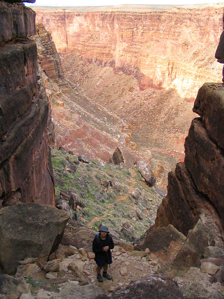
| The descent. |
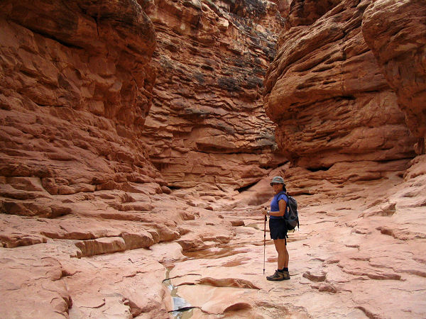
Nice section of narrows. |
 |
 |
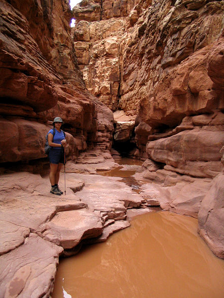
| Narrows and pool. |
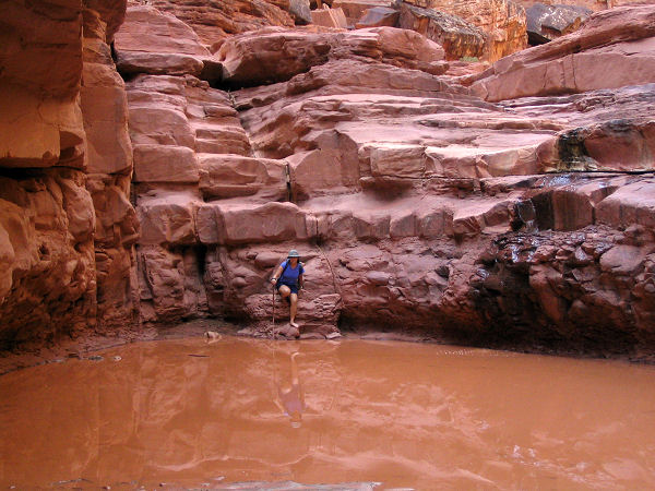
Possible wading section. |
|
|
