| |
Trail #17 to Supai Falls -
Coconino National Forest
| Summary: |
An out and back hike from the
north side of West Clear Creek to a nice
waterfall. This hike uses Trail #17 to access
the creek, then heads off trail up the stream
bed. |
| Directions: |
From Phoenix take
I-17 north to Camp Verde to exit 285. Turn
right (east) onto Highway 260 (you can also use
the General Crook exit as a shortcut to access
260). Follow 260 for about 7 miles. Between
mile posts 226 & 227, turn left (north) onto
Forest Road (FR) 618 following the signs for
Bull Pen Ranch. After about 4.2 miles turn
right onto FR 214. Follow FR 214 for 5.3 miles
and turn right onto rocky FR 214A. Follow this
rough road 1.1 miles to a signed pull off on the
right. (Bald Hill Trailhead (UTM 441498mE,
3824502mN)) |
| Road Conditions: |
High Clearance Vehicle
(required for FR 214A) |
| Navigation: |
Moderate - there is one very
tricky turn involved |
| Length: |
5-7 hours |
| Date Hiked: |
October
2004 |
| Weather Conditions: |
Cool and sunny |
|
Required Skills: |


 |
| Hike Description: |
From the parking area, begin
walking on the flat, well established trail as
it heads through the juniper trees. After 5
minutes you'll pass a sign marking the boundary
of the West Clear Creek Wilderness area and the
trail begins descending steeply towards the
broad basin of an unnamed side canyon of West
Clear Creek. Just before reaching the basin, the
path bends right and begins heading along the
right slope of the side canyon as it descends
towards the creek. When it nears the creek,
Trail #17 bends right and travels along a bench
above the creek heading down stream. Our
destination lies upstream, so we must diverge
from the established path to get into the
drainage. Trail #17 approaches West Clear Creek
perpendicularly. When the path nears the creek
you will see a prominent red sandstone cliff
band directly ahead of you. At this point, where
Trail #17 begins to bend right heading down
stream, look for a cairn on the left. Leave the
path to the left and begin following a faint to
non-existent route towards the center of the
side drainage you have been following. The path
becomes more distinct as it winds down into this
side drainage and across to the other side,
heading upstream and eventually dropping down to
enter the West Clear Creek at an established
camp site (this spot is marked with cairns).
Congratulations, you've managed to complete the
difficult route finding part of the hike! Now,
begin bush whacking and boulder hopping your way
upstream. There is no trail for this part of the
hike and you'll have to cross the stream several
times, so don't bother trying to keep your feet
dry. The routine for hiking in West Clear Creek
is to boulder hop up one side of the stream
until you're forced into the creek. Wade across
the stream, struggle through the vegetation on
the other side, and repeat. If you're trying to
avoid swimming, like I was on this chilly
October day, you'll have to climb up onto the
Supai layer on two occasions to avoid sections
where the walls close in to form deep pools.
About an hour or so of rock hopping, brush
thrashing and wading will bring you to a
nice waterfall cascading over picturesque red
sandstone. You can get up to the falls by
climbing a hill on the right (facing up canyon).
Enjoy the view, take some pictures and when
ready, return the way you came. |
| Rating (1-5 stars): |

The author completed this hike solo,
spending quite a bit of time route finding and
avoiding the deeper pools in 7 hours. |
| Maps: |
None |
| Books: |
Portions of this hike is contained in:
Canyoneering Arizona
- Tyler Williams |
| Photos: |
Click picture for larger view, click your browser's 'Back' button to return to this page. |
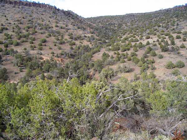 |
 |
Juniper dotted basin on
the way to the creek. |
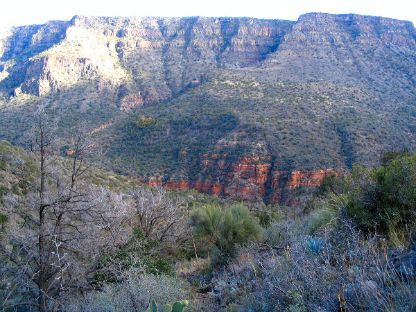
Descending towards
West Clear Creek. |
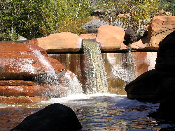 |
 |
| Supai
Falls. |
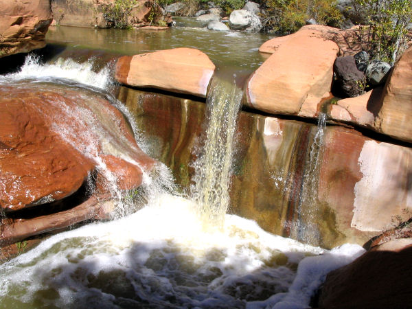
Another view of the falls. |
|
|
