| Page 1
Page 2
Page 3
Home
Trip Reports |
| |
Next stop on the whirl wind tour is
Geneva, Switzerland, where a friend from my old skydiving days agreed
to put us up (or is that - put up with us) for a week as we traveled
about the country. For those of you, who like me, are geographically
challenged, Switzerland is a rather tiny country located between
France (to the west), Italy (to the south), Austria and Liechtenstein (to the east) and
Germany (to the north). One result of all these influences is that the
country is split into French, German and Italian sections which don't
actually mix a great deal. If you are traveling in the country and lingually challenged like
myself, these three simple phrases will help you immensely. Keep using
them until you get an affirmative response.*
German: Sprechen Sie Englisch?
French: Parlez-vous anglais?
Italian: Parla inglese? |
| |
|
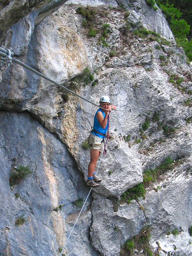
Our first task was to try out for the high wire act
in the Swiss circus. Actually this is a via ferrata,
which means 'iron path' in Italian or 'climbing for dummies' in
English. Basically you climb a series of cables and ladders that have been
installed into the mountain while you wear a line clipped in for
safety. |
 |
|
|
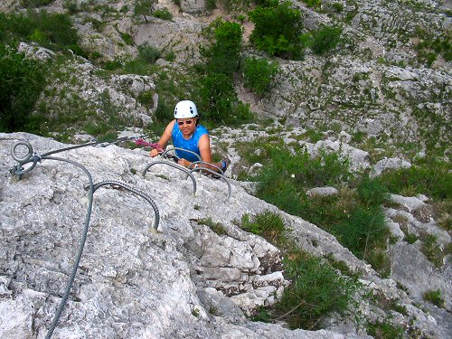
| Here's an example of the steel rungs
along the route. Via ferrata is a good way to get the feel of climbing
and exposure for those that don't want the risk. I'm sure there are those in the climbing community
that would look down on this type of activity, but it's quite fun. |
 |
| |
|
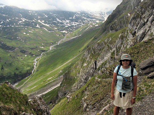
Leaving the city, we move along to a four day trek through the Swiss Alps. Based upon recommendations
and current snow levels, we decide upon a a portion of the Alpine Pass Route beginning
at the town of Kandersteg and ending in Montreux. The route is
Switzerland's classic long walk and according to the guide book (we
used the Lonely Planet Guide to Walking in Switzerland) is a good
introduction to the Swiss Alps' highest and most spectacular scenery.
It also passes through many small villages in the valleys, simplifying logistics and supplies. |
 |
| |
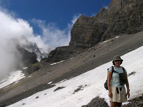
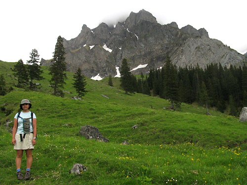
| The weather is overcast as we begin
our first big climb. There is a slight break in the clouds as
we approach the Bunderchrinde, a narrow pass which at 2385 meters is
the highest point along our route. We hurry up the talus slope in the
hopes that the clear sky will afford us some of those great mountain
views described in the guidebook. |
 |
|
|
|
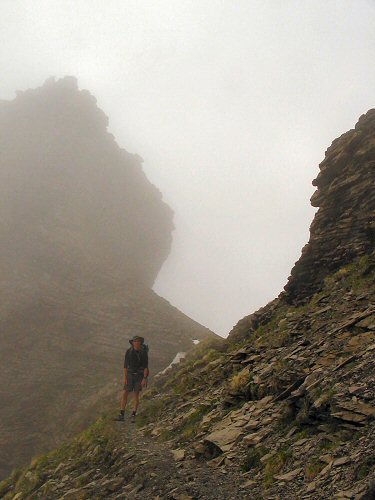
No such luck. Visibility is reduced to a few hundred
feet as we head through the pass then down the big snowfield covering the
north side of the slope. |
 |
|
|
|
Our feet are soggy as we hit the meadows descending
from the pass, but we're glad to be out of the snow. |
 |
|
|
|
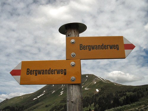
This is a typical trail sign in the German section of
Switzerland (signs alternately read 'Bergwanderweg', 'Wanderweg',
'Bergweg' and 'Weg', which one they choose, I guess, depends upon how
many letters will fit on the sign). All GR routes are marked with the red and
white bands. I found the trails to be fairly well marked and
maintained, though a few ill maintained sections
exist. |
 |
|
|
|
* Before I am taken to task for being culturally
arrogant, I'm simply making a little joke. Having said that, there is
certainly some truth to the premise that English is, in fact, becoming
a global language. |
|
|
| Page 1
Page 2
Page 3
Home
Trip Reports |
