| |
Icehouse / Kellner Trail Loop Hike - Tonto National Forest
| Summary: |
A steep loop hike (~3000 feet
elevation gain) in the Pinal Mountain Recreation
Area south of Globe using the Icehouse and
Kellner Trails. |
| Directions: |
From Phoenix,
drive east on route 60 to Globe. Just past mile
marker 251, after crossing the one major bridge
in town, turn left at the light onto Hill Street
(zero your odometer). You will soon hit a stop
sign, turn right, then left over a small bridge,
following the brown signs for Pinal Mountain
Recreation Area. After 1.2 miles, turn right
onto Icehouse Canyon Road (Forest Road 112).
Drive 1.8 miles to a stop sign, go straight
through the intersection and continue another 2
miles to the end of the pavement. Another 0.5
miles will bring you to the signed left branching turn
off (FR 112B) for the CCC Camp picnic area. Turn left and
drive a short distance to the picnic area and
park. The picnic area has picnic tables and a
bathroom, and seems to have been cleaned up
somewhat since I was here in Oct 2003. |
| Road Conditions: |
Passenger Car |
| Navigation: |
Moderate - a few use roads
and trails to choose from |
| Length: |
~10
miles |
| Date Hiked: |
December 2004 |
| Weather Conditions: |
Sunny, windy and cool |
|
Required Skills: |
 |
| Hike Description: |
From the CCC Camp picnic
area (0 miles, 4500 ft), walk west across the
road you drove in on (FR 112B) and look for the
sign that indicates the beginning of Trail #192
(Telephone Trail). The path winds its way
through desert chaparral consisting of scrub
oak, manzanita, sugar sumac and agaves soon
crosses FR 112. After 5 minutes of walking
you'll reach a signed junction, the Telephone
Trail continues straight and the Icehouse Canyon
Trail #198 branches right. Turn right and walk a
short distance to an old road, unfortunately the
road is the lower portion of the Icehouse Trail.
Before turning left and hiking up the road, be
sure to turn around and identify the spot where
the trail enters, you'll need to find it on your
return. Walk up the road a short distance to a
Dead End sign. You can continue right up the
road, but if you'd like to skip a short section
of it, look for a path on the left. The path
winds through the chaparral, joining the road a
short distance later. Continuing up the
moderately steep road (which is less than
scenic, and features a thick black hose running
next to it) for a mile to several steel water
tanks, you'll reach a signed junction with the
right branching Kellner Trail #242 (3 miles to
FR #651). To do this loop counter clockwise (the
way I will describe), turn right onto the
Kellner Trail which traverses the hillside to
the west with views south of the Pinal
foothills, Globe, Miami and the copper mine. The
path eventually bends left (north) and begins
climbing moderately to steeply. As you climb the
chaparral slowly gives way to mixed oak and pine
forest, then completely to pine forest. About 15
minutes before reaching the end of the Kellner
Trail you'll hit a spot with some old rusty
machinery. The path, which is then marked at
frequent intervals by cairns, winds to the top
of the hill next to a small wash to FR #651 (4
miles, 7150 ft). Turn left and follow the road
about a mile or so to the large sign on the left
marking the Icehouse Canyon Trail (5 miles, 7500
ft). Look for the trail on the left (resist the
temptation to continue straight down the ridge
which separates Icehouse Canyon from Sixshooter
Canyon), which switchbacks steeply down into
Icehouse Canyon. Once in the canyon the path
heads down through the forest beside the creek
bed, eventually reaching a junction with the
right branching Telephone Trail heading uphill
at the remains of an old cabin (7 miles, 5900
ft). A few hundred feet later, you'll see the
downhill portion of the Telephone Trail on the
right as well. In both cases, continue straight
on the road that is the Icehouse Canyon Trail.
The rocky road descends through the forest a
short distance before breaking out onto the
sunny slope, reaching the tanks you passed
earlier 2 miles later (9 miles). Follow the path
you hiked earlier the remaining mile back to the
CCC Picnic Area and your vehicle (10 miles, 4500
ft). |
| Rating (1-5 stars): |

Nothing exceptional, but this is a nice enough
hike. The trip was complicated somewhat by snow
and ice in the upper elevations when I did this
hike in December. The hike was completed at a
quick pace in 4 hours. |
| Maps: |
Tonto
National Forest Map (not very good for this
hike) |
| Photos: |
Click picture for larger view, click your browser's 'Back' button to return to this page. |
 |
 |
|
View along the Kellner Trail. |
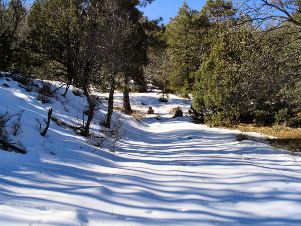
Snow in the Pinal Mountains. |
|
|
