| Summary: |
A hike/scramble to the top of
a prominent landmark in the southern
Superstitions. |
| Directions: |
From Phoenix
take US 60 east to Exit 196 for Idaho Road and
Highway 88. Drive northeast on State Highway 88
as it winds its way past the Superstition front
range until you cross the second one lane
bridge. Just past the bridge on the right hand
side you'll see a sign for the Boulder Canyon
Trail. Parking is available at the Canyon Lake
Marina on the left hand side. |
| Road Conditions: |
Passenger Car
- paved all the way. |
| Navigation: |
Moderate
- some off trail hiking required |
| Length: |
~ 13 miles |
| Date Hiked: |
December 2012 |
| Weather Conditions: |
Sun and clouds |
|
Required Skills: |

 |
| Hike Description: |
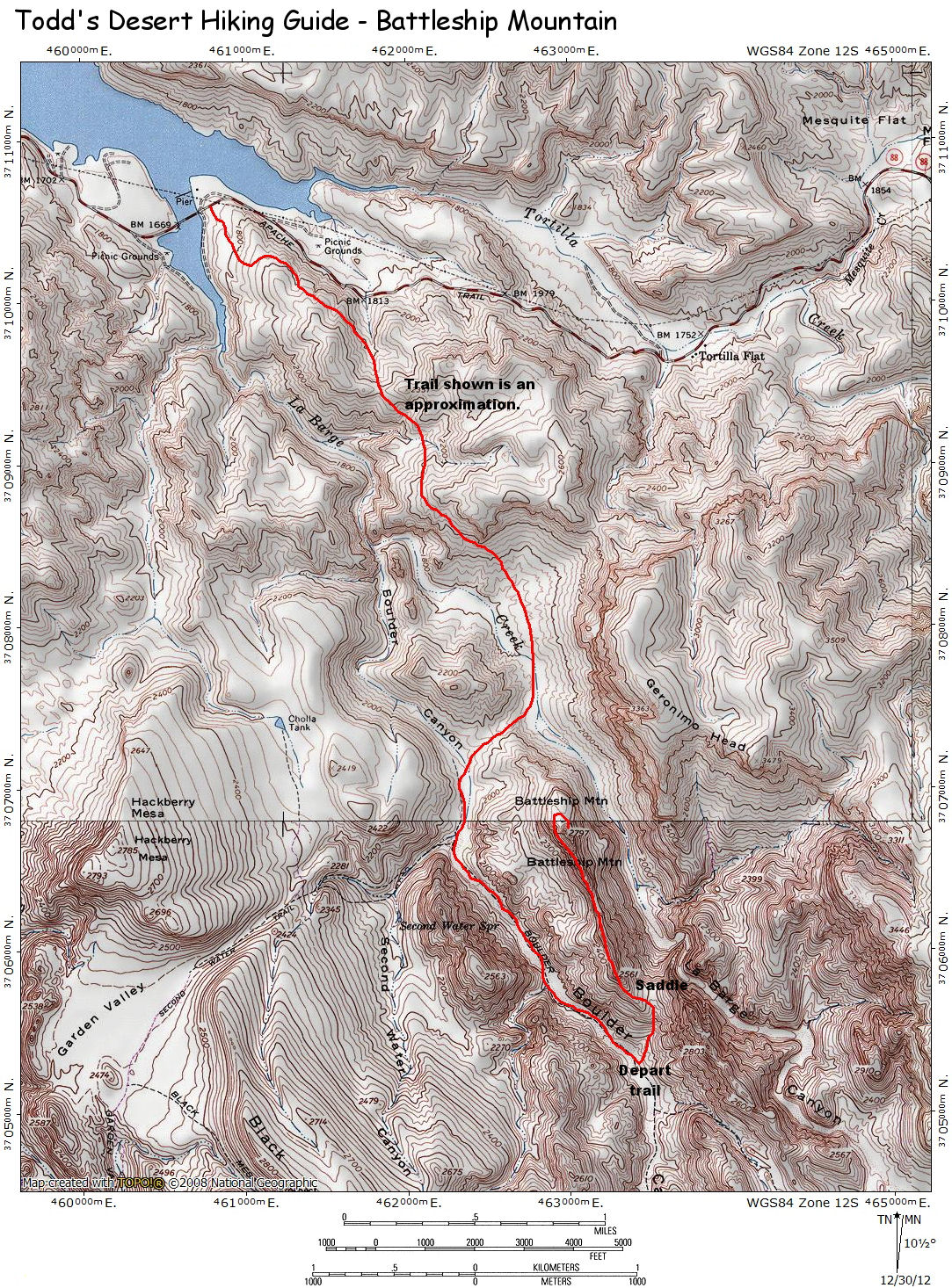
From the
parking area at the marina, cross the road and
begin hiking on the rocky Boulder Canyon
Trail. The trail ascends moderately with views
down into the outlet of La Barge Creek to the
right. Eventually the trail bends left then
climbs somewhat more steeply until topping out
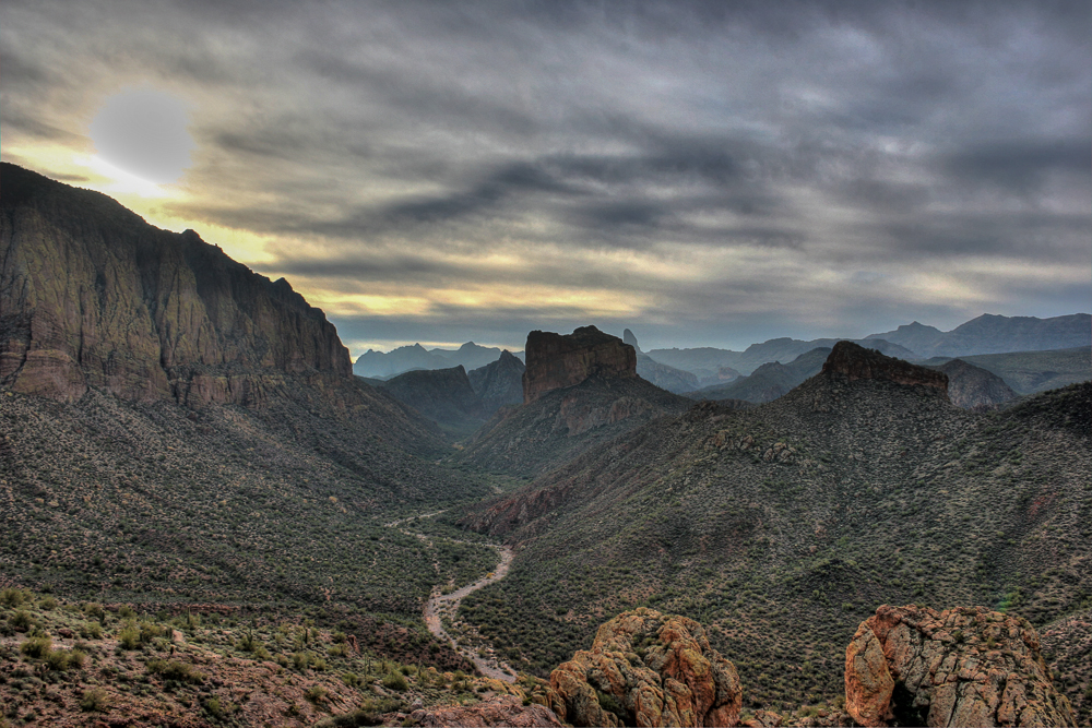
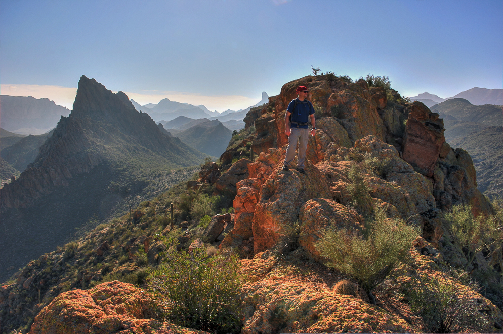
at an unnamed hill with nice views to the
southeast of Geronimo Head and Battleship
Mountain with Weavers Needle poking over the
hills in the distance. The trail descends
somewhat, swings to the left, then right and
winds it's way along the hill side before
dropping steadily down into the drainage of La
Barge Creek. The trail crosses the creek
(look for cairns) to climb up and over a low
saddle to drop down into Boulder Canyon. The
path follows the drainage southwards a short
distance to arrive at a signed junction with the
right branching Second Water Trail. Stay
straight on the Boulder Canyon Trail as it
parallels Battleship Mountain (which will be
quite obvious to your left). Continue along the
trail, keeping a lookout to the left for a point
where the steep hillside gives way to a long
slope leading up to a saddle at the southern end
of the mountain. Depart the trail, taking the
path of least resistance up to the saddle. From
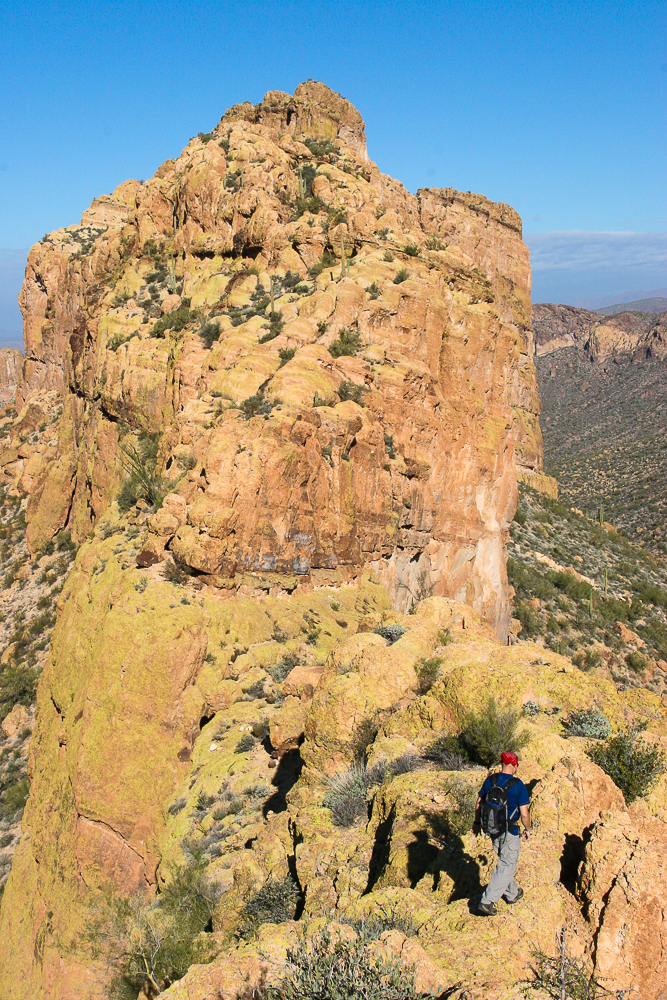
here, your path leads north along the ridgeline.
Some climbing and scrambling is required as you
follow the ridge (sometimes on top, other times
on the left). Remain on the fairly obvious hiker
trail at any point where the route becomes
confusing. The route remains on the left (west)
side of the ridge as you near the peak, then
circles clockwise to climb the remaining
distance to the top. The summit makes for a
pleasant spot for a snack and features excellent
views in all direction. When ready, return the
way you came. |
| Rating (1-5 stars): |

The author and a friend completed the hike at a
brisk pace in 6.5 hours visiting LaBarge Box on
the return. |
| Maps: |
Click
here for a
map.
Beartooth Maps - Superstition Wilderness Topographic Map |
| Photos: |
Click picture for larger view, click your browser's 'Back' button to return to this page. |


