| Summary: |
An easy hike for the whole family to a nice set of petroglyphs. The parking area near the trailhead fills up early on weekends, best to get an early start. |
| Directions: |
From Phoenix drive east on Highway 60 to Apache Junction. Turn north on Kings Ranch Rd. and follow it for 2.8 miles to Baseline. Turn right on Baseline, left on Mohican then left again on Valleyview Rd. Follow this road for 1.4 miles and turn right on Cloudview Rd. Drive a short distance on this unpaved road until it ends and park. |
| Road Conditions: |
Passenger Car |
| Navigation: |
Easy |
| Length: |
3.5 miles |
| Date Hiked: |
February 2002 |
| Weather Conditions: |
Nice |
|
Required Skills: |
None |
| Hike Description: |
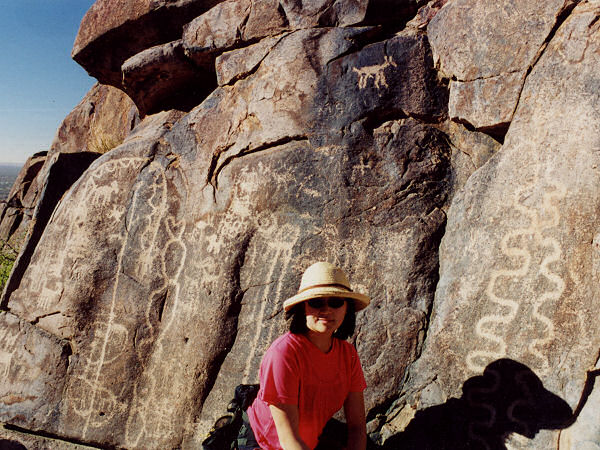
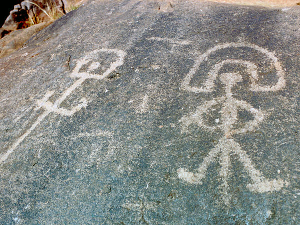
The trail starts on the east side of the parking area. This wide and rocky path heads east through typical upper Sonoran vegetation. In about 5 minutes you will come to a green steel gate and sign urging visitors to respect the pools and petroglyphs in Hieroglyphic Canyon. A short distance later the trail bends north and begins climbing gradually to a signed intersection with the right branching Lost Goldmine Trail (5.5 miles to the Peralta Trailhead Rd). Stay left at this junction towards Hieroglyphic Canyon. The path continues upwards towards the prominent drainage to the Superstition Mountains you see above you. As you enter the mouth of the canyon, you will pass a couple mediocre campsites before reaching an area of pink slickrock with (perhaps) a few small pools. Petroglyphs line the rocks around this area, some of which are in very good condition (though, as is typical, some intellectually challenged individuals have defaced a few areas). Please do not walk on or touch these objects, as it only hastens their decline. The trail ends here, though if you're determined you can continue to rock hop your way up canyon (though it becomes brushy and overgrown rather quickly). When ready, return the way you came. |
| Rating (1-5 stars): |
 
The author and his wife completed this hike with a small group of people at a leisurely pace in just under 2 hours. |
| Maps: |
Beartooth Maps - Superstition Wilderness Topographic Map |
| Photos: |
Click picture for larger view, click your browser's 'Back' button to return to this page. |