| |
Siphon Draw to Flat Iron and Superstition
Peak - Tonto National Forest
| Summary: |
A steep climb up the rugged front range
of the Superstitions to some terrific views. |
| Directions: |
This hike is within Lost Dutchman State
Park. From Phoenix drive east on Highway 60 to
Apache Junction. Take the Idaho Rd. exit and head east on State Highway
88 (keep an eye out for where 88 turns right at a light). Just past the
fake and commercial Goldfield Ghost town you'll see a large sign for the park on the
right. Turn right into the park to the rangers station, pay the $5 per
carload entry fee and pick up a map of the area. Following the map you
just received, continue past the rangers station and take your first right
(signed for Siphon Draw) and follow this road around the camping area,
staying to the right, to the small parking area at the Siphon Draw
Trailhead (better get here early, there are spaces for only a few cars). |
| Road
Conditions: |
Passenger Car - paved all the way |
| Navigation: |
Moderate - the trail is not maintained |
| Length: |
5 miles |
| Date
Hiked: |
December 2001 |
| Weather
Conditions: |
Nice & cool, but quite breezy &
chilly at summit |
|
Required Skills: |
None |
| Hike
Description: |
From the Siphon Draw Trailhead, begin following the wide and rocky Siphon Draw Trail #53 towards the front range of Superstition Mountain. After a short stroll you'll pass through a couple fences before reaching the Tonto National Forest Boundary. All trails are signed and well marked in this area, stay (straight) on Trail #53 at any junctions. Vegetation in the area is typical of the Upper Sonoran Desert: mesquite, jojoba, brittlebush, prickly pear, creosote bush, paloverde, saguaro & hedgehog cactus etc. The trail becomes steeper as it begins to climb towards the draw. As you get higher you will find that some well intentioned imbecile has taken it upon themselves to spray paint white dots & arrows to mark the path. Excuse me while I digress for a moment: it breaks my heart to see evidence such as this of vandalism in wilderness areas. While this behavior is likely illegal, it is certainly wrong and incompatible with a wilderness experience. Please do not bring this ignorant behavior into the wilds with you, if you are concerned about someone losing their way placing a few cairns would better serve the public. For those that can not find their way without spray paint, simply hike elsewhere. OK - enough said, back to the hike. The well trodden tail climbs steeply up to slick rock chute, continue up the rock. At the top, numerous use trails make the path a little confusing. Look up above you and you'll see the huge rock outcropping of Flat Iron - the trail passes up a draw just to the left of this prominent formation. To stay on the trail simply head up the draw that leads in that direction (there are really only 2 draws in the upper part of this canyon, stay in the one on the right). The trail becomes more distinct again as you continue higher. It also becomes an extremely steep climb requiring the use of your hands in many spots. Just before you reach the summit, you'll see a well defined trail heading off to the right, this leads to the top of Flat Iron (a great lunch stop if this is your destination). At the top of the hill you can look for a cairned use trail that heads off to the left - this leads to the summit of Superstition Mountain.
When ready, return the way you came. |
| Rating
(1-5 stars): |

The author has completed this hike on several occasions & has spent
time checking out Superstition Peak and Flat Iron. |
| Maps: |
Beartooth Maps -
Superstition Wilderness Topographic Map |
| Photos: |
Click picture for larger
view, click your browser's 'Back' button to return to this page. |
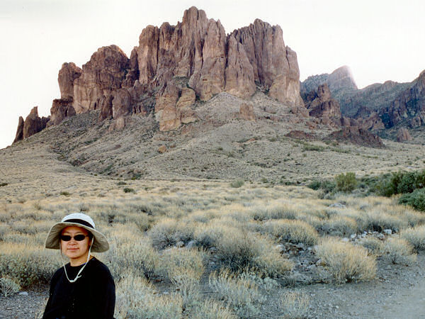 |
 |
Superstition Mountain from
the Siphon Draw Trail. |
The draw. |
 |
 |
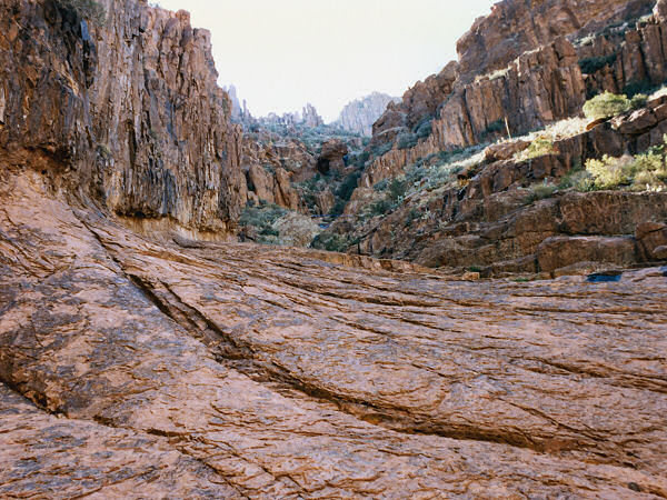
| Slickrock. |
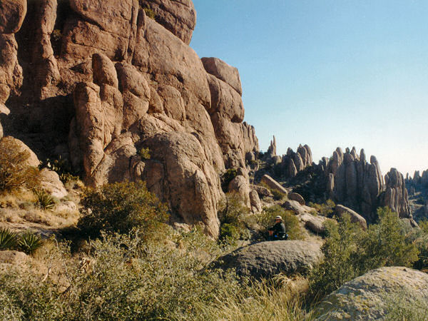
Hoodoos at the summit. |
|
|
