| |
Haigler Creek - Tonto National
Forest
| Summary: |
A strenuous, multi-day
backpacking trip along the rugged, water-filled
drainage of Haigler Creek. The trip requires a
considerable amount of climbing, wading and
swimming to complete. Most groups should be able
to finish the hike between 2 - 3 days, though it
could take longer. In order to enjoy this hike,
it helps to be well prepared. To that end here
are a few tips:
1. Keep all your critical gear in waterproof
containers. This includes food, dry clothes and
sleeping bag. Most dry bags leak, so it helps to
double dry bag these items or use a
dry keg. I do not suggest carrying an
inflatable boat or inner tube. These items are
heavy and easily punctured. Another advantage of
dry bags is that they will also add floatation
to your pack, which is essential for the long
swims. With a buoyant pack, you can swim by
either laying on top of it and kicking, or
wearing it with the hip belt fastened and doing
the back stroke (my personal preference).
2. Water is very heavy, you do not want to be
lugging several gallons of Haigler Creek water
out with you after every swim. Carry a pack that
drains well and that lacks open cell foam
padding that can absorb water. Grommets should
be placed in the bottom of the pack to allow
water to escape.
3. Do the hike when temperatures are very hot
(above 100 F). Swimming is unavoidable. You will
be soaked much of the time and can easily become
chilled. A wet suit may be desirable during
cooler weather or for skinny people.
4. Wear shoes that have good traction even when
they are wet. The rock in the canyon is
extremely smooth and slick. A walking stick may
be useful for balance.
5. Do the hike during periods of dry weather.
Rains churn up the mud making the creek run
brown. The hike will be considerably more
difficult if you can not see the rocks beneath
the water.
6. Purify all water before drinking.
7. Plan your camping about an hour in advance.
Campsites are few and far between in the canyon.
Be flexible as to where you stop and be ready to
settle for a site that isn't ideal. |
| Directions: |
Car Spot:
From Payson,
drive east on Highway 260 for 11 miles to mile
marker 263. Turn right just past the mile marker
and drive 0.5 miles on a well graded dirt road
to a clearing on the right. There is a large
Forest Service sign next to a fence for
the Hellsgate Wilderness.
Trailhead: From Payson, drive east on
Highway 260 for approximately 24 miles. Turn
right at the sign for Colcord Road (which is
also Forest Road (FR) 291. Follow this road
(which turns to dirt after 2 miles) for 4 miles
to FR 200. Turn right on FR 200. Travel on FR
200 for 9 miles, passing through the Haigler
Canyon Recreation Site to FR 202A. Turn right
and follow this unpaved road for 0.5 miles to
the Alderwood Recreation Site. |
| Road Conditions: |
Passenger Car |
| Navigation: |
Easy |
| Length: |
17 miles |
| Date Hiked: |
September 2007 |
| Weather Conditions: |
Warm and mostly sunny |
|
Required Skills: |


 |
| Hike Description: |
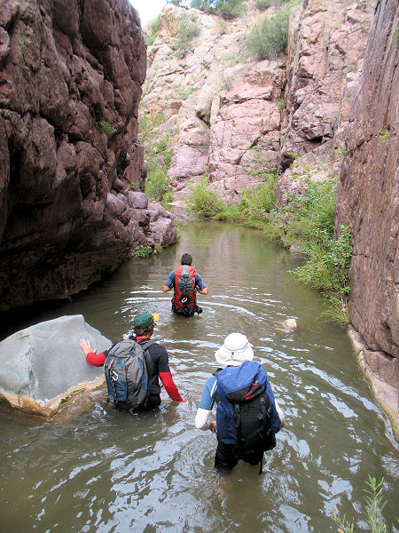
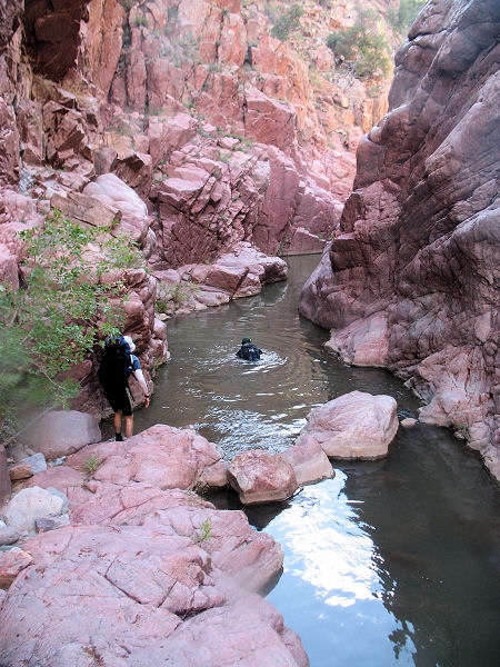
Haigler Creek: From
the Alderwood Recreation Site, walk through a
fence and simply head downstream. After a short
hike you will arrive at a nice section of red
quartzite narrows which contains a few deep
pools. If you're not quite ready to get wet, the
narrows can be bypassed by climbing up and
around on the left side of the canyon. The
diversion only delays the inevitable and soon
you'll be forced to perform a deep wade. The
canyon opens up somewhat, choose a route that
offers the least resistance. Sometimes a bench
appears on one side or the other that allows for
easier travel, other times the least brushy path
is the streambed itself. As you progress, the
canyon slowly begins to deepen which will force
you into the water on a more frequent basis.
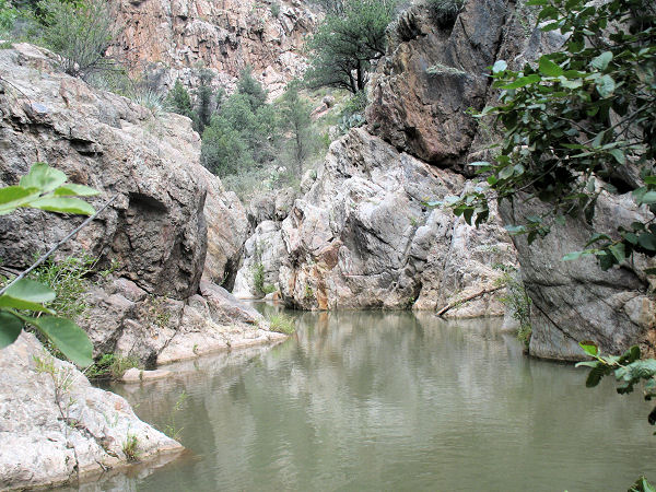
Occasionally a short swim is required. After
several hours of hiking, the walls of the canyon
fade and the stream enters a wide riparian area
which displays evidence of ranching. Quick
progress can be made through this section by
hiking along the wide bank on one side of the
stream or the other. Soon, the canyon walls
close in again and wading and swimming become
more frequent. The slick, unstable rocks,
coupled with brush and swimming make for slow
and tiring progress. Do not expect to exceed a 1
mile per hour pace through this section. Just
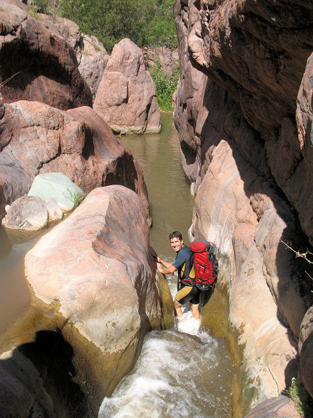
after passing Last Camp Canyon (a fault line
which crosses the canyon) a 10 foot waterfall is
encountered. It is possible to downclimb this
obstacle with care. Just beyond is another short
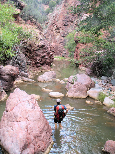
falls that empty into a deep pool. Below this
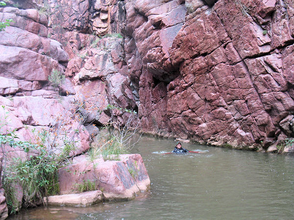
point, swimming becomes a regular occurrence as
the creek passes through a deep and pretty
gorge. Keep your eyes open for Salt Canyon and
Leo Canyon, which enter from the right offering
visual cues of your progress. As you near the
junction with Tonto Creek the walls of Haigler
Creek begin to diminish. Just before the
confluence, look for a use trail on the right
that leads up to a wide, flat bench and camping
area. If you camp on the bench - look for a bare
spot on the ground. The ground cover has tiny,
sharp spines which can puncture an air mattress.
There is another decent campsite just north of
the bench on the south side of Tonto Creek.
Exit Trail: Cross Tonto
Creek and pick up the Hellsgate Trail #37, which
begins just upstream from a small side drainage.
The rocky path climbs steeply for the first half
mile as it ascends out of Hellsgate to
eventually travel through open grassland. The
path skirts a prominent side drainage of Tonto,
then bends left, climbing up to El Grande Tank
(which has a perpetual green scum covering
its surface). The trail skirts the tank to the
left, then continues climbing along Hellsgate
Ridge to eventually reach a sign marking the
boundary of the Hellsgate Wilderness. The path
becomes less steep as it heads north along
Apache Ridge, look for the trail as it skirts a
few minor peaks to the left. After about 2 hours
of walking the trail tops out at a shoulder,
then drops steeply down the other side along an
old road. Follow the road as it travels at a
gentle grade through the forest. There are a few
short cairned side paths along the route, these
detours provide shortcuts to the road you are
following and are recommended. The path ends at
a junction with another forest road and sign for
the Hellsgate Trail pointing back the way you
came. Turn right and continue along this road.
Eventually, the road begins descending at a
fairly steep grade, jogging left, then right to
arrive at the Hellsgate Trailhead and the car
you spotted earlier. |
| Rating (1-5 stars): |

The author completed this hike as a group of
four. On day one we hiked the length of Haigler
Creek from Alderwood Campground to the
confluence with Tonto Creek in 10 hours. On day
two we hiked out on the Hellsgate trail in 3
hours. |
|
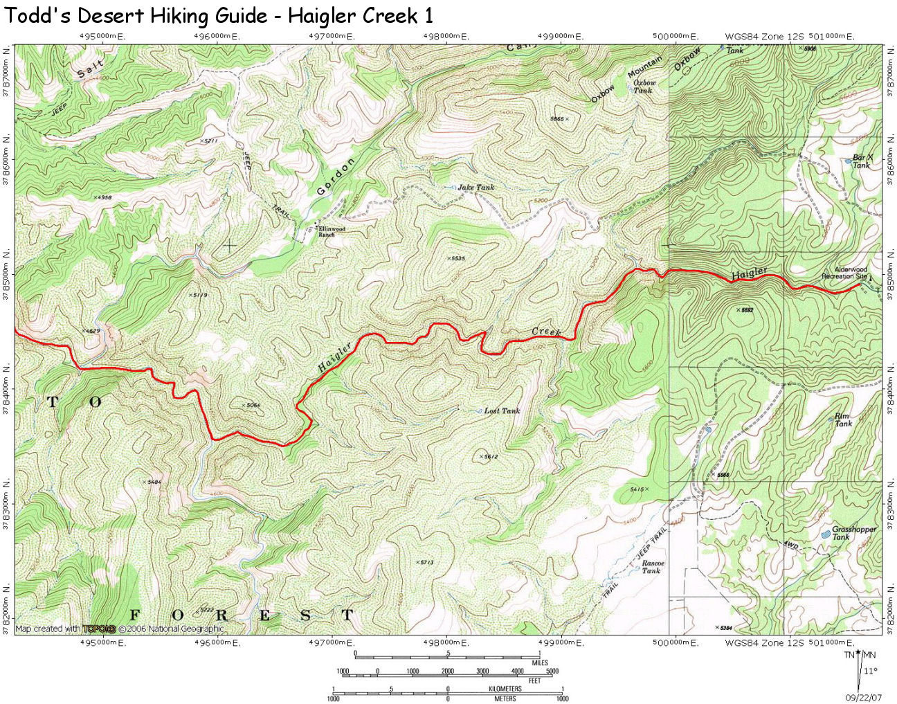
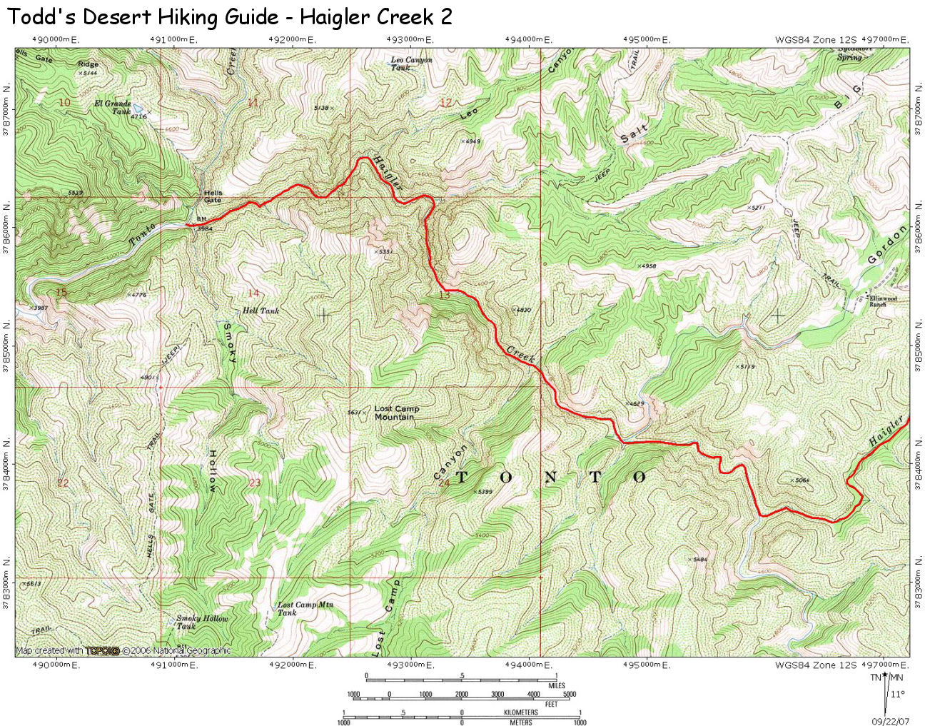
Maps: |
A map of the canyon may be
found here: Map 1,
Map 2 |
| Photos: |
Click picture for larger view, click your browser's 'Back' button to return to this page. |
|
|


