| |
Wilderness of Rock Loop, Santa
Catalina Mountains
| Summary: |
A nice loop hike which passes through the
pretty Wilderness of Rock section of the Catalinas. Not a terribly long
hike, but some good climbs at altitudes of 7-9000ft adds some challenge. |
| Directions: |
From Phoenix drive south
on I-10 to Tucson. Take the Grant Rd exit and drive east (left) on
Grant for 8.7 miles. Turn left onto Tanque Verde and drive 3.4 miles to
the Catalina Highway. Turn left onto the Catalina Highway (note: there is
now a fee station located at the 5 mile point, $5 per car if you plan on
stopping at any of the trailheads, view points or to use a public toilet
along the highway) and drive ~30 miles to the town of Summerhaven.
Continue through town on the main road until it dead ends in a small
parking lot with rest room at the Marshall Gulch Trailhead. |
| Road Conditions: |
Passenger Car - paved all
the way |
| Navigation: |
Easy - well defined trail with sign posts
at all trail intersections. |
| Length: |
13.4 miles |
| Date Hiked: |
July, 2001 |
| Weather Conditions: |
Overcast & humid with occasional
sprinkles. Cool temps near the summit. |
|
Required Skills: |
 |
| Hike Description: |
From the Marshall Gulch parking lot (0
miles) begin climbing on the Aspen Trail (#93) which is located on the
west side of the parking lot to the left of the restrooms. The trail
begins climbing moderately and passes a few nice camp sites on the left
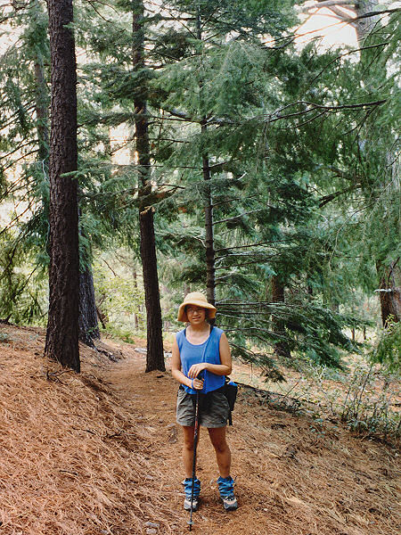
after 5 minutes or so. The trail continues upwards through a forest
consisting mainly of Douglas Fir and Ponderosa Pine. As you gain some
elevation, oak becomes part of the mix. After 2.7 miles (2.7 miles), the
trail descends to a signed multi-trail junction: Marshall Gulch Trail (#3) heads
back to the right, Mint Spring Trail (#20) heads directly right, Aspen
Trail (#93) continues straight, and the Wilderness of Rock Trail (#44)
heads left. Turn left onto the Wilderness of Rock Trail and descend
gradually through more pine forest, crossing a stream bed (flowing from
recent rains when the author was there) a few time along the way. After
1.7 miles (4.4 miles) you will reach the right branching Lemmon Rock
Lookout Trail - if you want to shorten this hike by 3.8 miles you can take
this trail 2 miles to the summit of Mt. Lemmon, however, you'll be missing the
best part of the hike (the author has never taken this route). Continue
straight on the Wilderness of Rock Trail which, after a short walk, brings
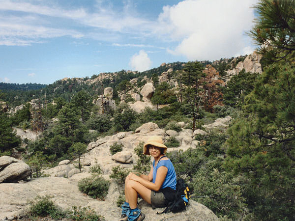
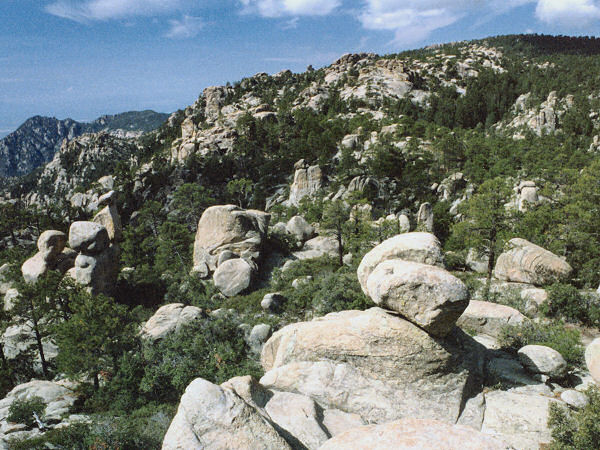
you to (can you guess?) the Wilderness of Rock - a very pretty area of
interesting pale rock formations surrounded by the greens and browns of
manzanita and pine. The trail through this section generally
continues it's gradual descent, with a few low hills mixed in. An hour or
so of hiking, and 2.3 miles from the Lemmon Lookout turn off, the trail
will ascend to a 'T' junction with the Mt. Lemmon Trail (#5) which heads
left and right (6.7 miles). Turn right and walk through some more
interesting rock formations as the trail begins to ascend gradually (at
first), then more steeply to the ridgeline of Mt. Lemmon. Once on the
ridge the trail bends right and continues climbing moderately to steeply
upwards for 2.4 miles, passing into a more forested area, then into an
area badly damaged by fire. Shortly after passing back into an unburned
section of forest you will reach the junction with the left branching
Sunderland Trail (#6) (9.1 miles). Continue straight on the Mt. Lemmon
Trail which becomes an old jeep road at this point. The jeep trail
continues it's ascent of Mt. Lemmon (with a few nice level sections to
catch your breath) for 0.7 miles (9.8 miles) to a signed junction with the
left branching Meadow Trail (#5A). You can continue up the uninteresting
jeep road to the summit, but a better route is to turn left onto the
Meadow Trail. The meadow trail heads back into the forest for the final
0.8 mile climb to the summit of Mt. Lemmon (10.6 miles). Near the end of
the trail you will pass through a nice forested meadow (covered with lady
bugs when the author was last here), then past what appears to be a fenced
in military communications station, followed by an observatory run by the
University of Arizona. The trail then rejoins the Mt. Lemmon road and
passes through an old brown gate. Stay to the right and walk down a path
that parallels the road (that's right, you could have driven up here and
saved yourself a walk  ). The
path heads around a large electrical transformer, passes through a parking
lot then meets up with the road. Stay right and walk down the road for
about a minute to the large dirt pull off on the right hand side (10.9
miles) with a gate which blocks access to a dirt road and a radio tower
which looms above the trees. Pass through the gate and walk down the dirt
road past a few more radio towers, buildings and propane tanks and
eventually the ski lift (which provides yet another effort free means to
the spot you are now standing). Stay to the right at the end of the road
(following the brown & white 'Trail' signs), walk past a puke green
building with a "High Voltage" sign on the door to the signed
junction with the Aspen Trail (11.3 miles). The Aspen Trail switchbacks
steeply down the mountain for 0.9 miles to the multi-trail junction you
had passed earlier (12.2). Turn left onto the Marshall Gulch Trail which
descends 1.2 miles through the forest, eventually paralleling the contour
of a stream back to the parking lot (13.4 miles). ). The
path heads around a large electrical transformer, passes through a parking
lot then meets up with the road. Stay right and walk down the road for
about a minute to the large dirt pull off on the right hand side (10.9
miles) with a gate which blocks access to a dirt road and a radio tower
which looms above the trees. Pass through the gate and walk down the dirt
road past a few more radio towers, buildings and propane tanks and
eventually the ski lift (which provides yet another effort free means to
the spot you are now standing). Stay to the right at the end of the road
(following the brown & white 'Trail' signs), walk past a puke green
building with a "High Voltage" sign on the door to the signed
junction with the Aspen Trail (11.3 miles). The Aspen Trail switchbacks
steeply down the mountain for 0.9 miles to the multi-trail junction you
had passed earlier (12.2). Turn left onto the Marshall Gulch Trail which
descends 1.2 miles through the forest, eventually paralleling the contour
of a stream back to the parking lot (13.4 miles). |
| Rating (1-5 stars): |
  
The author and his wife have hiked this loop on three separate occasions.
On the last trip we drove down from Phoenix the night before and camped at
the spot mentioned above just inside the Aspen Trail. We then woke and got
an early start the next morning, completing the loop in 7
hours. There were a dreadful number of gnats on this hike along the
Wilderness of Rock Trail to about halfway up the Mt. Lemmon Trail. |
| Maps: |
Santa Catalina Mountains
- Rainbow Expeditions Inc. |
| Photos: |
Click picture for larger
view, click your browser's 'Back' button to return to this page. |
 |
 |
 |
Pine forest
on the
Aspen Trail. |
The
Wilderness of Rock. |
Another view. |
|
|

