| Summary: |
A couple nice climbs to
the tops of small mountains with views of the Sedona red rock. Bear requires
considerably more effort than Doe (which is quite easy), but worth it. |
| Directions: |
From the intersection of
Highways 179 and 89A in Sedona, proceed west on Highway 89A. After 3.1 miles turn
right at milepost 371 onto Dry Creek Rd. After 2.9 miles you will come to a fork in
the road - turn left onto Forest Service (FS) Road #152C & drive 1.6 more miles. Turn
left onto the dirt Boynton Pass Road (bumpy but ok for passenger cars). Drive 1.2
miles to the parking area on the right. Bear Mt. trailhead is on the north side of
the road (same side as the parking area), Doe Mt. is on the south side. |
| Road
Conditions: |
Passenger Car |
| Navigation: |
Bear Mt. - moderate
Doe Mt. - easy |
| Length: |
Bear Mt. - 6 miles, 1676
ft elevation change
Doe Mt. - 3.6 miles, 400 ft elevation change |
| Date
Hiked: |
Bear Mt. - March, 1997
Doe Mt. - June, 1998 |
| Weather
Conditions: |
March is a nice time of
year for hiking in Sedona, June gets quite warm. Spring and Fall are probably the
best times for these hikes. |
|
Required Skills: |
None |
| Hike
Description: |
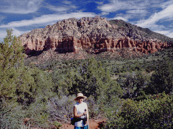
Bear Mt: The trail
first crosses a couple of washes on it's way to the base of the mountain, then begins to
climb steeply. Cairns mark the way to the top, but may be a little difficult to
follow in places, scout ahead as you go & you shouldn't have too much trouble.
As you climb higher you will be treated with views to the east into Fay Canyon. The
last section of the climb consists a scramble up some slickrock to the top with views of
the Secret Mountain Wilderness and San Francisco Peaks to the north and Sedona to the
east, west and south. Return the way you came.
Doe Mt: Not much to say about this short hike. Follow the well
graded (and well traveled) trail up to the top of this short flat topped hill. At
the top you will have nice 360 degree views of red rock typical of the Sedona area.
Stay on established paths once on the top, footsteps will destroy the delicate desert
flora in the loose soil. |
| Rating
(1-5 stars): |
 
Two nice, if short, hikes with good views of the surrounding red rock. |
| Maps: |
Bear Tooth Maps: Sedona |
| Books: |
'The Favorite Hikes:
Flagstaff & Sedona' by Cosmic Ray |
| Photos: |
Click picture for larger
view, click your browser's 'Back' button to return to this page. |