| Summary: |
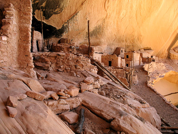
A hike to one
of the best preserved Anasazi ruins
in the state. The buildings were constructed
and occupied between A.D. 1250 and 1300 by
people who farmed the plateaus and bottom lands
of the canyons in the area. While there is no
fee, reservations are required for the hike to
Keet Seel. Call the monument at: 928-672-2700 to
reserve a slot. Permits are limited to 20 people
per day between Memorial Day through Labor Day.
You must sit through an orientation to receive
your permit. Orientations are held each day at
the visitor center, at either 4:00 PM the day
before your hike or at 8:15 AM on the day of the
hike. The hike may be done as a day trip or an
overnight hike. |
| Directions: |
Navajo National Monument is
located east of Page or west of Kayenta on
Highway 160. Between mile post 374 & 375 on
Highway 160, turn north at the sign for the
Monument on Route 564 and drive 9 miles to the
Visitors Center.
Surprisingly enough, there is no fee to enter,
camp or hike in the Monument. |
| Road Conditions: |
Passenger Car - paved all the way |
| Navigation: |
Moderate |
| Length: |
17 miles |
| Date Hiked: |
May, 2006 |
| Weather Conditions: |
Warm |
|
Required Skills: |
None |
| Hike Description: |
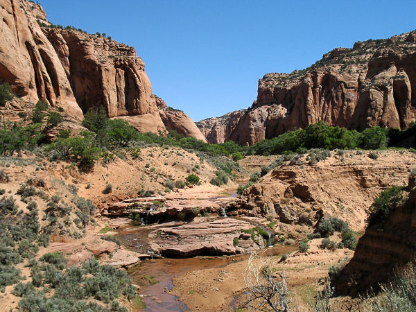
From the
Visitors Center you will drive about a mile to
the Keet Seel parking lot, then hike the rest of
the way down the road to the trailhead. The path follows an old road for the
first part of the trip until you arrive at a
sign which warns you as to the strenuous nature
of the Keet Seel trip. The path becomes more of
a trail at this point as it drops ~700 feet
along a series of switchbacks. At the bottom of
the descent you'll reach a trail junction at a
white post - left
for Keet Seel, right for Betatakin. Head left
and follow the path down a 300 foot sandy hill
to the creek bed below. From creek bed it's very
level and easy hiking up a series of canyons. It
is necessary to cross streams occasionally so be
prepared to get your feet wet. Unfortunately the
route is rather smelly, due to cattle grazing in
the canyon bottom. The path is marked by white
posts and mile markers at semi-frequent
intervals. Follow these markers to the Keet Seel
drainage then walk up this creek along an ATV
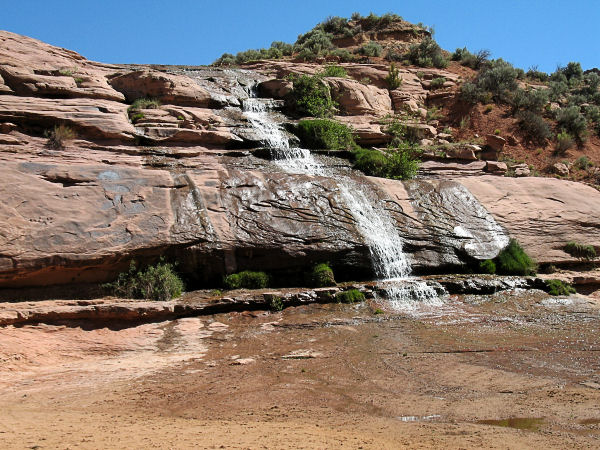
track which frequently crosses the stream. Just
past the 2.5 mile signpost (Note: the signs
indicate the distance to the ruins, not the
distance you've traveled) you'll reach a
waterfall. Walk up a drainage on the right
(facing up stream) to a path that leads to the
top of the falls. Not long after the falls is a
sign on the right which instructs you to follow
a trail up and out of the drainage to travel
along the bench above the watercourse. There are
a few ups and downs in this section as the path
winds in and out of some minor side drainages.
Shortly after passing the 0.5 mile sign the path
drops back into the streambed to a junction with
a trail that branches right to the camp sites
for those doing the hike as an overnight trip.
To get to the ruins, stay to the left and climb
a hill to a fence. Walk through the fence and
you will see the rangers hogan on the left. Let
the ranger know that you are there and hang out
at some picnic tables until he's ready. The
ranger will take you up a steep ladder at the
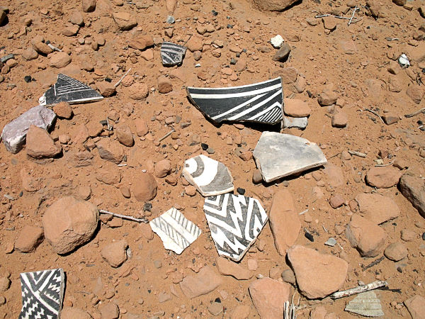
entrance to the ruins and explain some of the
history behind the area. When ready, return the way you
came. |
| Rating (1-5 stars): |

Though the hike itself is not terribly exciting,
the ruins are really nice and offer insight into
how people lived in the area (without the
benefit of air conditioning, fast food and
convenience stores) 800 years ago. |
| Maps: |
Provided at the orientation
session. |
| Books: |
Canyon
Hiking Guide to the Colorado Plateau -
Michael Kelsey |
| Photos: |
Click picture for larger view, click your browser's 'Back' button to return to this page. |