| |
Eagletail Mountains Wilderness
- Eagletail Peak
| Summary: |
The Eagletail Mountains
Wilderness (which was created with the adoption
of the Arizona Desert Wilderness Act of 1990) is located just south of I-10 about
50 miles west of Phoenix. The 15 mile range of
the Eagletail Mountains (the remnant of a
volcanic dike that formed nearly 20 million
years ago) form the northern boundary to the
wilderness, while the southern portion consists
mainly of open desert and washes. Trails are
faint to non-existent in the area and water is
scarce. Map, compass and maybe a gps are
necessary for cross country travel. A hike to
the summit (almost) of Eagletail Peak is
described. This trip is suitable for hikers
comfortable with exposure and off trail route
finding. |
| Directions: |
Courthouse Rock Trailhead: From Phoenix, drive
west on
I-10 to exit 81 (Harquahala Valley Road & Salome
Road). From the exit ramp turn left (south),
drive across the bridge over I-10 and turn right
onto Harquahala Valley Rd. After 5.3 miles turn
right onto Courthouse/Centennial Rd (which is well graded
dirt). After 6.9 miles you'll hit a fork in the
road with a sign for the Eagletail Wilderness on
to the left. Look for a dirt road on the left
before the kiosk which leads diagonally to the
southeast. Follow this somewhat bumpy dirt road
for 0.5 miles, then turn right (south) on a
somewhat rougher road and follow it 0.5 miles to
a 'T' junction. Park here. |
| Road Conditions: |
High Clearance Vehicle |
| Navigation: |
Difficult |
| Length: |
~10 miles roundtrip |
| Date Hiked: |
February 2007 |
| Weather Conditions: |
Partly cloudy |
|
Required Skills: |

 |
| Hike Description: |
From the parking spot walk
due south across the creosote flats to soon hop
a barbed wire fence. Head south to skirt the
eastern ridge of the Granite Mountains which you
will see before you just to the east. Once
around the Granite Mountains and the Eagletails
come into view, turn your path in a
southwesterly direction to head towards an
obvious break in the cliffs of the Eagletail
Mountains at GPS Point UTM 284988mE,
3699612mN. Looking up the slope that leads to
this break in the cliffs you will see a large
rock formation about half way down the slope,
you'll want to work your way up the slope to the
right (west) of this formation. Be aware that
the slope is quite steep and the footing is
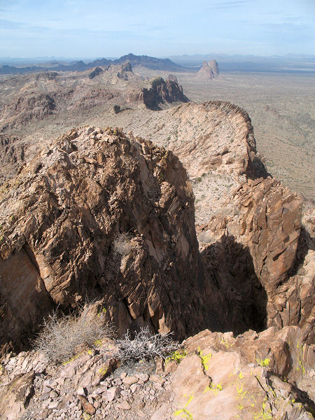
loose in places. Once at the top of the
ridgeline, turn left and continue uphill to a
point where you can see Eagletail Peak. From
this vantage point you will notice that there is
a deep saddle which separates you from your
goal. The best route to the saddle, though
perhaps not the most intuitive, is to
follow the steeply sloped ridgeline (which has
huge drop offs and great views to the desert
floor to the north). At the end of the ridge,
route find down a slick rock slope to reach the
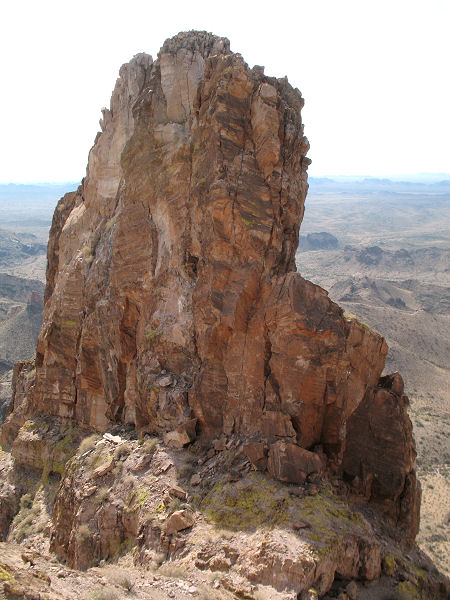
saddle at the base of the peak. Looking up to
the summit from this point, you will see two
main peaks, separated by a deep cleft. Follow
the ridge on the right (south) side of the cleft
up to a point near the summit where you can
climb down into the saddle between the peaks.
Hikers can continue a short distance up the
north peak to a small rock cairn. Unfortunately
this point is as far as hikers will be able to
go without ropes. There are 3 vertical fins of
rock (the 'feathers' of the Eagletail) that are
slightly higher. The western most fin is the
tallest and rises ~50-60 feet above the highest
point that can be reached on foot. The route up
to the summit has a few bolts and can be reached
by those with technical climbing skills and
vertical gear. The total climb appears to be
approximately 120 feet. When ready retrace your
steps returning the way you came. |
| Rating (1-5 stars): |

The author hiked to the summit, but was not
prepared for technical climbing. Total hike time
was 6 hours. |
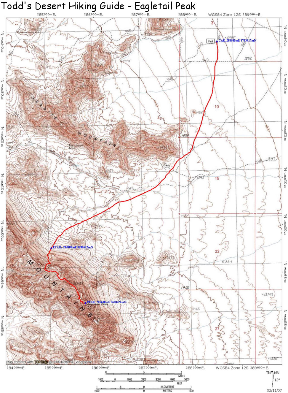
| Maps: |
A map of the hike can be found
here. |
| Books: |
None |
| Photos: |
Click picture for larger view, click your browser's 'Back' button to return to this page. |
|
|


