| Summary: |
A nice north rim hike to
a huge gushing spring and waterfall. |
| Directions: |
The trail begins at
Monument Point on the North Rim. Take I-89A to it's intersection with state highway
67 at Jacob Lake. Follow 67 south past the Kaibab Lodge. About a mile past the
lodge turn right on Forest Road 422 (the sign is labeled 22). All
roads in this area are prominently labeled so you shouldn't have much trouble - the Arizona
Road and Recreation Atlas is a good investment as reference book for routes on Forest
Service roads like this one. Follow 422 for 10.5 miles until you reach FR (Forest Road) 206, turn
left on 206. After 3.6 miles, keep an eye out for FR-214 on the right, turn right on FR-214.
Drive for 2.7 miles, when you reach a branch with FR-272, turn right on FR-272. After
6.6 miles turn left onto FR-292 which leads a short distance (stay straight
at all junctions) to Monument Point. |
| Road
Conditions: |
Passenger Car - the dirt roads are well
graded, however they may be rutted or difficult to negotiate after heavy
snow or rain storms |
| Navigation: |
Moderate - cairns mark
much of the way when confusing |
| Length: |
19 miles |
| Date
Hiked: |
September, 1999 |
| Weather
Conditions: |
A little too warm |
|
Required Skills: |
 |
| Hike
Description: |
From Monument Point
follow the Bill Hall trail along the rim for a short distance then steeply down into the
canyon until it reaches the Esplanade bench (a wide flat area consisting of red
sandstone). At the Esplanade bench the Bill Hall trail intersects the Thunder River
trail, turn left on this path at the unsigned junction. The trail remains flat as it
winds along the bench for a few miles. There are long stretches where there is no
visible trail (since you will be walking on sandstone much of the way), however cairns
have been placed at frequent intervals making route finding a fairly easy task.
Eventually the trail curves towards the main canyon where it drops steeply to the Tonto
Plateau in an area called Surprise Valley. Once on the plateau the Thunder River
trail intersects the Deer Creek trail, turn left on the Deer Creek trail at an unsigned
junction. Follow the Deer Creek trail to Thunder Spring, return the way you came. |
| Rating
(1-5 stars): |

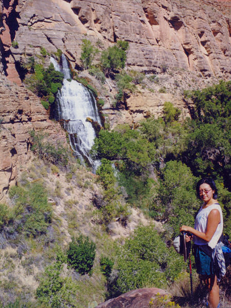
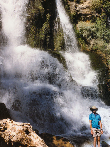
The author and his wife hiked down to Thunder Spring, spent a half hour
poking around (including a climb up to the exit cave where the left spring leaves the
canyon wall) and taking pictures, then hiked back. Total trip time was 9 1/2 hours. |
| Maps: |
Trails Illustrated -
Grand Canyon National Park |
| Photos: |
Click picture for larger
view, click your browser's 'Back' button to return to this page. |