| |
Mt. Baldy Wilderness - Apache /
Sitgreaves National Forest
| Summary: |
A very
nice loop hike through forests and meadows to a
spot near the summit of Mt. Baldy (the highest
peak in the White Mountain range). The path is
graded for horses & you will see evidence of
their passage throughout the hike.
Unfortunately, the Mt. Baldy summit is located
on White Mountain Indian reservation land and is
closed to all entry. |
| Directions: |
From
Springerville/Eager in eastern AZ, drive west on
Highway 260 for 4-5 miles, then turn south
towards Big Lake on Highway 261 (near mile
marker 393). Follow 261 for 17.9 miles to where
it ends in Highway 273. Turn right on 273 and
follow it 4.5 miles to the short, rough dirt
road on the left for the East Fork Trail (also
called Phelps Cabin Trailhead), or drive another
2.6 miles to the West Fork Trail (also called
the Sheep Bridge Trailhead). Parking is
available on the right side of the road just
after you cross a small bridge. |
| Road Conditions: |
Passenger Car - except for
the short dirt road to the East Fork Trailhead
(which requires a High Clearance Vehicle) |
| Navigation: |
Easy |
| Length: |
16.5 miles |
| Date Hiked: |
June
2003 |
| Weather Conditions: |
Nice & cool with sun, rain,
thunder & hail |
|
Required Skills: |
 |
| Hike Description: |
I will describe this as a
loop hike going clockwise from the East Fork
Trailhead. You could hike it the other way if
you want, or just hike out and back on one of
the paths.
From the East Fork Trailhead, the East Baldy
Trail #95 (0 miles, 9200 feet) heads straight
and the Crossover Trail #96 heads right. Stay
straight and begin walking on the double track
as it heads through a nice grassy meadow. In
about 5 minutes you'll pass a fence line at
which point the road becomes more trail-like.
Soon you'll pass a sign indicating that Mt.
Baldy is 7 miles ahead and shortly after that, a
sign indicating you're entering the Mt. Baldy
Wilderness. The path soon begins to ascend
moderately, then splits at an unsigned junction.
Stay right at this split as the path continues
upwards at a moderate grade through meadows and
into the spruce-fir forest that is
characteristic at this elevation. Soon you'll
reach an area with some interesting basalt
pinnacles which rise out of the forest. Mt.
Baldy is actually an extinct volcano that last
erupted 10 million year ago. Hiking past the
rock, you enter the forest again and soon attain
the top of the ridge that you will be following
the rest of the way to the summit. The path
heads up the ridge and you'll be faced
alternately with some moderate climbing followed
by some extended flat sections (there were a few
patches of snow in the upper sections when I was
here in June). After a bit, just before crossing
a short meadow, you'll reach the site of an Army
plane that crashed into the mountain back in the
late 1940's or early 1950's. The wing and
fuselage are visible just off the trail on the
right (5.5 miles, 10990 feet). The path
continues up hill and soon reaches the junction
with the West Fork Trail (5.9 miles, 11180 feet)
which enters on the right (note: there are a few
sign posts, but no signs marking this junction).
The trail continues left up to a prominent ridge
with great views past a few large cairns. It
follows the ridge a short distance, drops down
to a saddle, then climbs a low hill to the Mt.
Baldy summit (6.7 miles, 11403 feet). You need
to turn around at some point before reaching the
summit, but when I was here, there was no sign
or evidence to indicate where that turn around
point lies. I'm guessing it's somewhere on the
ridgeline near the large cairn pile (there are
great views from this point, so don't feel badly
that you are not on the summit, the views aren't
any better from there). When ready, backtrack a
short ways, and stay left at the junction and
begin descending on the West Fork Trail. The
path descends along a short ridge, then performs
a few switchbacks & begins descending along the
side of a steep slope. After some walking, it
eventually drops down, passes through an area of
dead trees, then crosses a stream on a bridge
consisting of corrugated steel pipe (rather
inelegant considering how nice the rest of the
scenery is). Past the stream crossing, the trail
becomes a gentle slope, crosses a few more
streams, then leaves the forest and enters a
meadow which follows the West Fork of the Little
Colorado which you can see flowing off on the
right. You may see fishermen in the area,
looking to bag a brook, rainbow or native
cutthroat trout. After a bit of pleasant meadow
hiking, you'll arrive at a junction with a right
branching trail and wooden sign which reads:
Phelps Cabin 3.25 miles (13.3 miles, 9350 feet).
Unfortunately, the sign doesn't tell you, but
this is actually the Crosscut Trail. Turn right
on the Crosscut Trail, cross the Little
Colorado, and begin climbing into the forest
once again. This stretch of trail adheres to the
following formula: climb a low ridge, drop down
the other side, pass through a meadow, repeat.
Meadow #3 in the above equation is quite a large
one, meadow #4 brings you back to your car at
the East Fork Trailhead (16.5 miles, 9200 feet).
|
| Rating (1-5 stars): |

A very nice and enjoyable summer hike. The
author completed the loop solo, at a fast pace,
in 6 hours. |
| Maps: |
Coconino National Forest Map |
|
Books: |
Exploring Arizona's Wild
Areas - Scott S. Warren |
| Photos: |
Click picture for larger view, click your browser's 'Back' button to return to this page. |
 |
 |
|
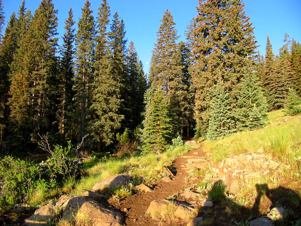
The start of the East Fork Trail. |
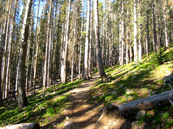
Much of the hike looks
much like this. |
 |
 |
|
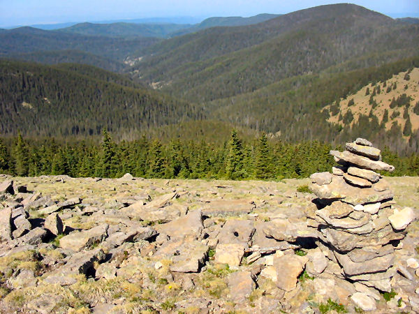
View from near the summit. |
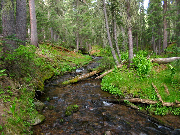
The scenic
West Fork
of the Little Colorado. |
|
|
