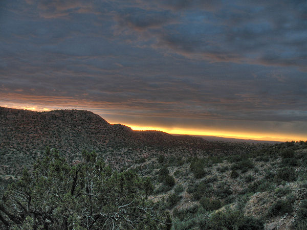
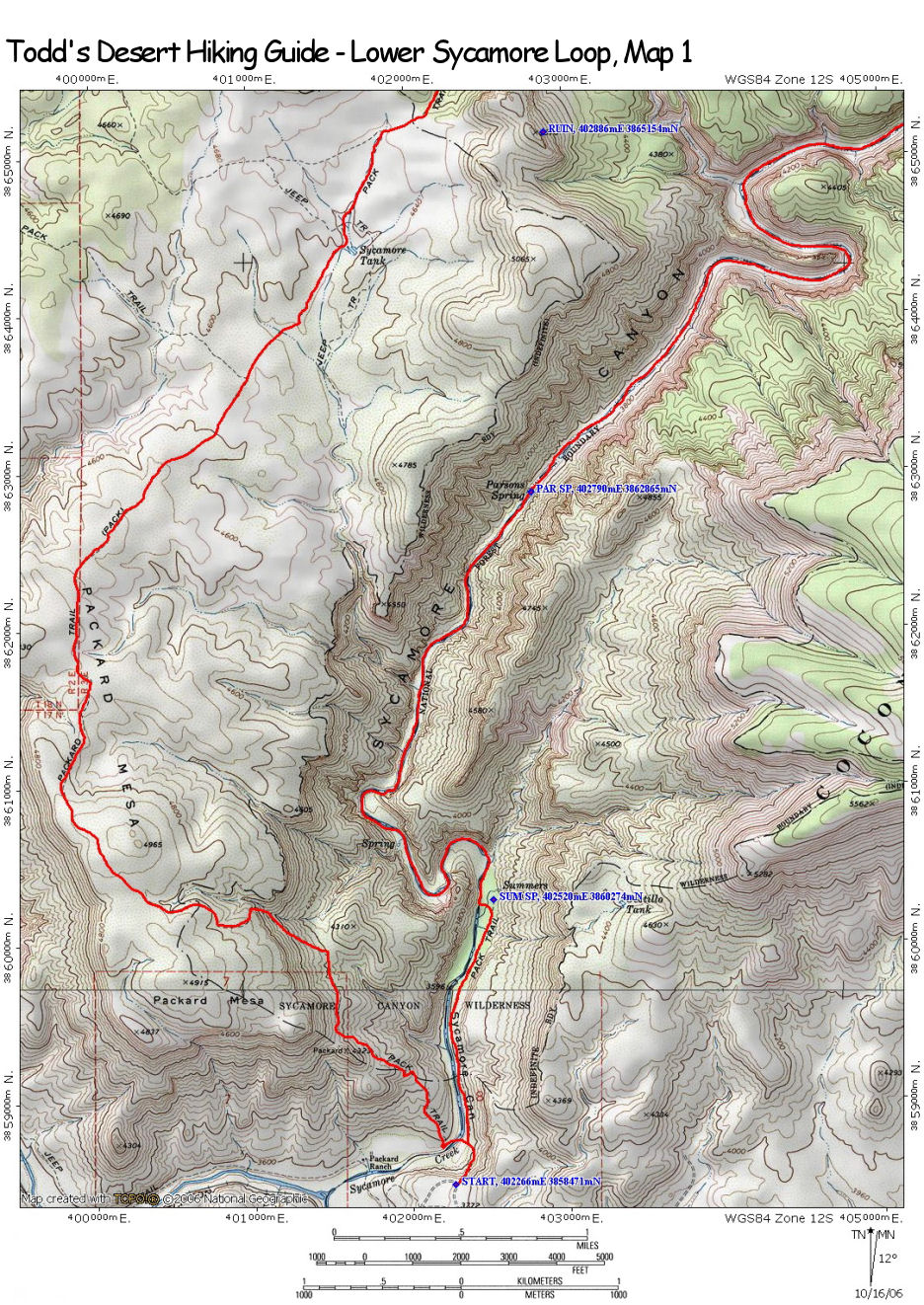
| Hike Description: |
From
the trailhead, pick up the Parsons Trail #144 as
it drops down a hill to Sycamore Creek to an
unsigned, left branching junction (the Parsons
Trail continues straight). Turn left and walk
across the cobbles (the path disappears) to
locate a route across the creek. Once on the
other side, look for a trail that leads a short
distance downstream to a signed junction with
the right branching, and well maintained,
Packard Mesa Trail #66. Turn right onto rocky
Trail #66 which begins climbing moderately to
eventually level out at a bench above Sycamore
Creek. Before long, the path bends west and
climbs more steeply up to the top of Packard
Mesa through a break in the cliffs. At the top
of the mesa, the trail becomes flat and the
rocks diminish (making for fast, easy walking)
as it heads through the juniper grasslands. As
you make the long trek across Packard Mesa, the
path devolves into a series of braided trails
which all seem to head in approximately the same
direction (a classic sign of a horse trail).
Stick to the main path and keep your eyes peeled
for cairns and signposts which are interspersed
at infrequent intervals. Eventually you will
reach a signed junction with the Sycamore Canyon
Trail #63 which heads left and straight. Stay
straight on the Sycamore Canyon Trail. Just
beyond this junction is a fence line and
Sycamore Tank. Walk through the fence to
Sycamore Tank, then back out of the fence
(continuing in a northerly direction) to a dirt
road and signed junction with the Sycamore Tank
Trail #97 which heads to the right. Cross the
road and continue north on the path on the other
side to soon reach another road and fence line.
There is a trail sign and register on the fence.
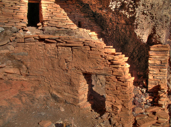
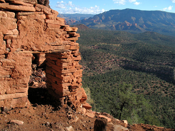
Optional Detour (1.4 miles): To
visit a nice, well preserved Indian ruin, turn
right at the fence and follow the dirt road to
its end. Look for a trail which crosses a
shallow dry wash to the right and follow it as
it climbs moderately up through a minor saddle
in the hills above. At the saddle, the path
crosses and begins dropping down behind the left
most hill to soon reach a ruin with an excellent
view of Sycamore Canyon far below. Remember,
ruins are fragile and irreplaceable, please
leave the area as you found it. It is also
illegal to remove artifacts from these historic
sites. When ready, return the way you came.
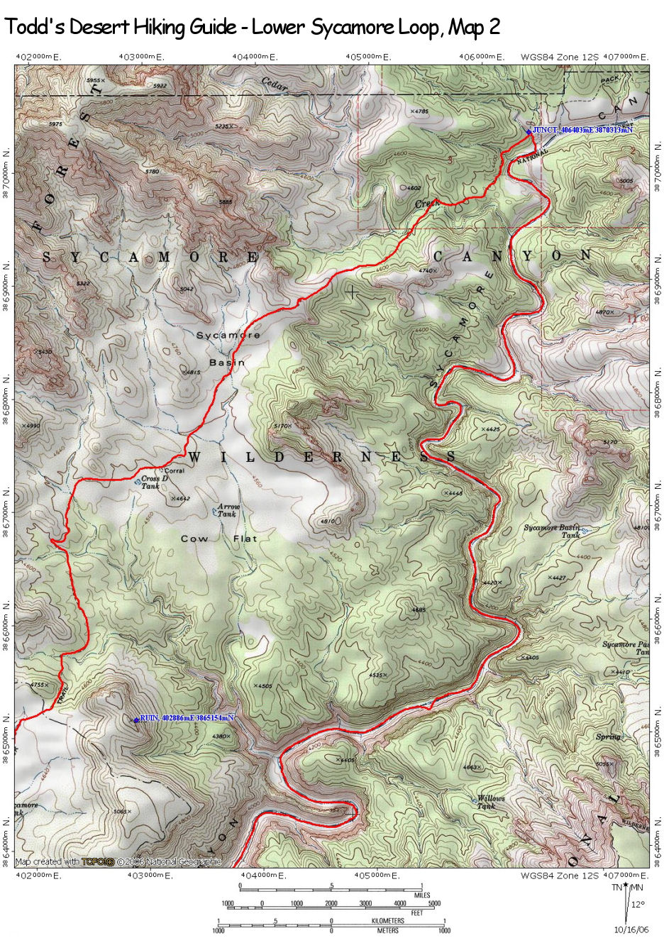
Head
through the fence and continue north on Sycamore
Canyon Trail #63 towards Cow Flat (2 miles) and
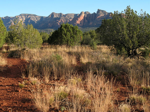
Taylor Cabin (8 miles). The path is well
maintained and easy to follow as it passes
through Sycamore Basin with nice views of red
rock formations in the distance to the left.
Eventually you will reach a confusing spot at a
fence line. Continue north, keeping the fence on
your left and soon you will pass an old corral
made from mesquite branches tied together with
cable. More hiking will bring you to a signed
junction with the left branching Yew Thicket #52
(which is invisible). Continue straight on trail
#63. At the northerly end of Sycamore Basin the
path begins descending moderately to a junction
with the left branching Cedar Creek Trail #116.
Stay straight once again, crossing a dry wash to
eventually reach a junction with the right
branching Dogie Trail #116. Turn right on the
Dogie Trail and follow it a short distance down
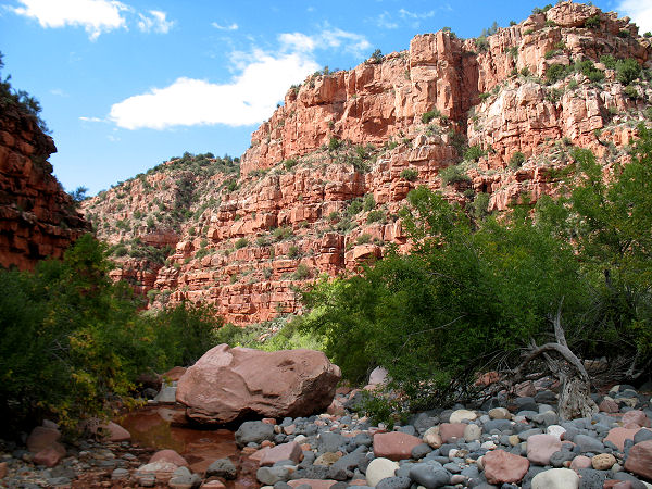
to the dry, rocky bottom of Sycamore Creek. Once
in the creek, leave the trail and begin rock
hopping down the creek bed. There's not much to
report about the long hike down Sycamore Canyon,
other than it's a bit tedious, though it is
thankfully free from brush above the springs and
offers little in the way of elevation change.
Many of the rocks are loose and will roll under
foot, so it's important to watch your footing.
Normally the canyon will be totally dry, but if
you do this hike after recent rains there may be
large pools that you'll need to avoid to keep
your feet dry, and mud. These conditions will
make the hike somewhat slower. If you are forced
into the brush along side the creek to avoid a
pool, keep your eyes out for poison ivy. After
hours of rock hopping you will eventually reach
a thick stand of trees and brush at Parsons
Springs. You'll have to push through the foliage
for a short distance, but just beyond you'll
find a trail, that becomes better the further
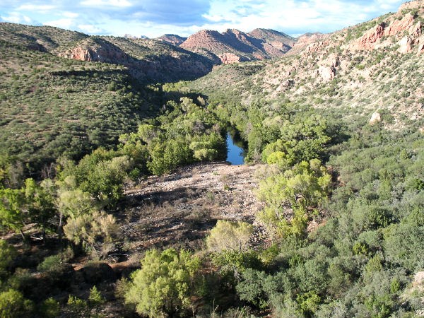
down canyon you hike. Below Parsons Springs the
creek flows vigorously. To keep your feet dry,
look for cairns marking spots where the path
changes sides. The path eventually settles on
the left side of the canyon (facing down stream)
as it passes through a very pleasant riparian
area on a flat path that is welcome relief from
the rocks. From Parsons Spring it is 3.6 miles
back to the trailhead and your car. |
