| |
Towel Creek Trail #67 -
Coconino National Forest
| Summary: |
An out and back hike near
Camp Verde through the cow pies to some decent
ruins. |
| Directions: |
From Phoenix take
I-17 north to Camp Verde to Exit 285 for the General Crook
Trail. At the bottom of the exit ramp turn right
towards Camp Verde. At the end of this road turn
right again (east) onto Highway 260. Drive 8.8
miles to between mile markers 228-229 and turn
right onto the well graded, dirt Fossil Creek
Road (which is also Forest Road 708). Drive 9
miles to the Towel Creek Trailhead, which is on
the right side of the road a short distance past
Needle Rock. The trailhead is a bit difficult to
spot since there is no parking area and the
Forest Service sign pointing out the trailhead
faces the other direction. Park on the side of
the road or at a nearby pull off if you can find
one. |
| Road Conditions: |
Passenger Car |
| Navigation: |
Moderate |
| Length: |
~13 miles |
| Date Hiked: |
February
2006 |
| Weather Conditions: |
Partly cloudy and cool |
|
Required Skills: |

 |
| Hike Description: |
From the trailhead, walk
through the metal gate, across the dry wash and
up the hill on the other side to a 'T' junction.
Turn left (following the arrow on the wooden
post) and begin climbing at a moderate grade on
a well established path to top out at a saddle.
The path then bends slightly right and follows
an old road that traverses the hillside. After
about 2.5 miles the trail enters a broad pasture
and travels beside a fence to a stock pond
(Towel Tank) and corral. Follow the flagging
tape (which is colored bright pink or blue and
white striped) past the tank and through a
fence. The trail then begins descending beside
Towel Creek, which is brushy, shallow and dry in
this section, along a very rocky track. In this
area you will begin to see considerable evidence
of cattle ranching which becomes more prevalent
as you hike. After about 10 minutes of walking
the path leaves the road to the right. This
split is marked by flagging tape and a cairn.
The path descends steeply on the left side
(facing down canyon) of the dry creek to a point
near the mouth of Brushy Prong (which comes in
from the left), at which point it switches over
to the right side of Towel Creek and descends at
a moderate grade. Keep your eyes open for cairns
in this section as you hike. The cows have
created a number of braided trails that may
prove to be confusing. After following the right
bank for a while the trail makes a sharp left
turn and becomes rather indistinct as it drops
down and crosses the creek to the left side once
again (keep an eye out for cairns). Continue
down canyon until you pass through an old
electrified fence (~6.5 miles). If you look
across the canyon to the escarpment on the other
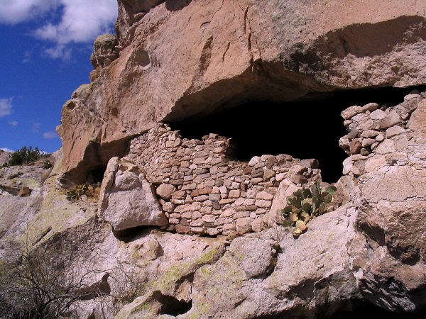
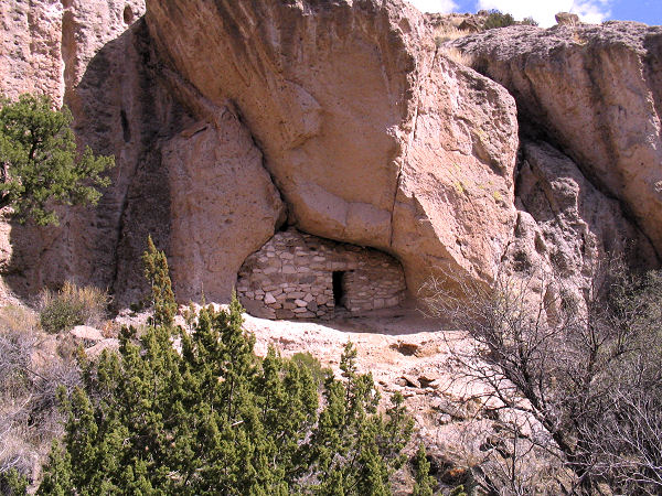
side you should be able to spot a few old walls
that have been built to seal off alcoves in the
rock. There is no trail to the ruins, but if you
continue to follow the trail a few minutes past
the fence it is possible to work your way down
into the stream bed, then up and out the other
side to visit the site. According to the
reference below, the walls were built between
A.D. 1125 - 1300. Be careful as you walk around
the area, there are a number of potsherds
littering the ground (some of which have been
placed on rocks in little piles by people, like
they always do),
and though I probably do not need to remind the
reader, please do not disturb, touch or climb on
ruins. It should also be mentioned that
bats have taken up residence in the alcoves
covered by the walls. Please don't disturb the
bats if they are roosting. If the bats are not
present (like when I was here) you will not want
to enter the alcoves anyway, since the piles of
guano on the floor smell very bad. After you're
finished poking around and taking pictures
return the way you came (~13 miles). |
| Rating (1-5 stars): |
  
The author completed this hike at a fast
pace in about 5.5 hours. |
| Maps: |
Click
here for a map of
this route. |
| Books: |
A different route to these ruins in
described in: Hiking Ruins Seldom Seen - Wilson, Dave |
| Photos: |
Click picture for larger view, click your browser's 'Back' button to return to this page. |
 |
 |
|
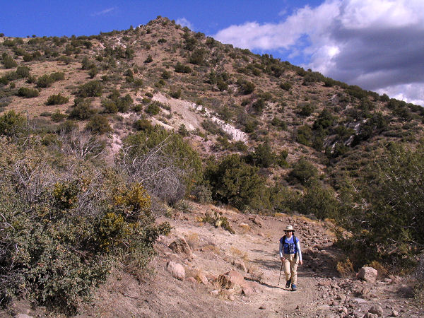
Typical view along the trail. |
View
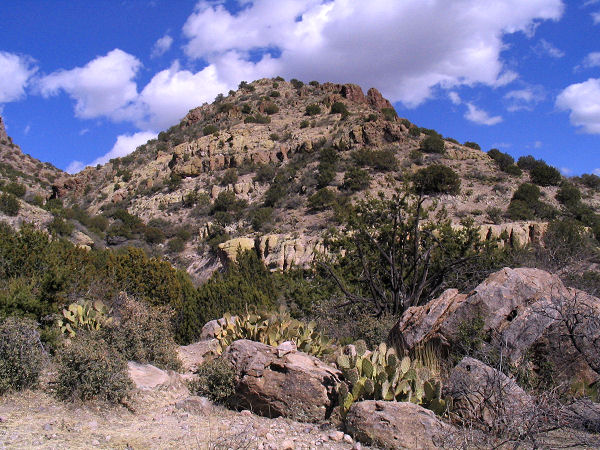
descending Towel Creek. |
 |
 |
|
Ancient wall. |
Another ruin. |
|
|

