| Summary: |
Most people just do the nice
stroll along the trail from the lower end of the
West Fork of Oak Creek. More serious canyon
hikers can walk the length of the canyon, a task
which involves much rock hopping, wading and a
swim or two. If attempting the latter be aware:
you are not supposed to camp in the lower 6
miles of the canyon (it's a wilderness study
area), no open fires are allowed, the water is
cold - you will likely want a wet suit in all
but the hottest weather, a hiking stick will
help for balance, you will need to spot a car. |
| Directions: |
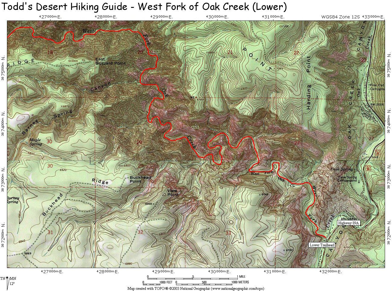
Lower:
From Phoenix,
take I-17 north to Sedona (exit for 179). Turn
left on 179 and follow it through the town of
Oak Creek to Sedona. At the 'T' intersection
turn right onto Highway 89A and follow it up Oak
Creek Canyon just past mile marker 385 to the
Oak Creek Trailhead which is on the left (west).
Parking is currently $7 per car, be aware that a
Red Rock pass is not valid towards this fee.
Also note that the gate to the parking area is
locked at 8pm.
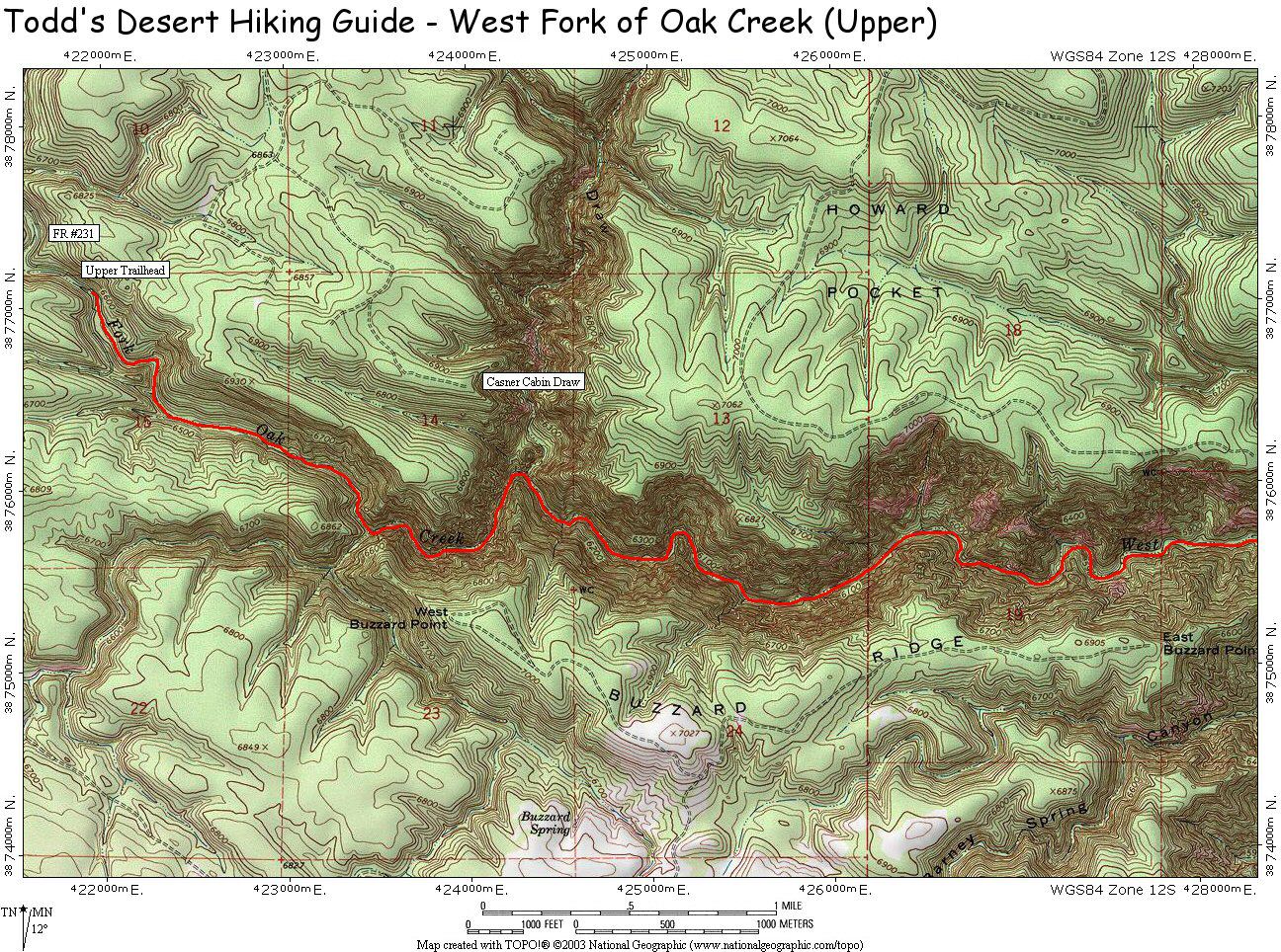
Upper:
From Phoenix, take I-17 north to Flagstaff. Head
west on I-40 to the first exit (Flagstaff Ranch
Road, exit 192). Turn left at the bottom of the
exit ramp, drive a short distance to a 'T'
intersection and turn left. After a couple miles
you'll come to a stop sign, turn right onto
Woody Mountain Road (Forest Road #231) which
becomes a well graded dirt road shortly
thereafter. Drive for 18.1 miles to where the
road crosses the Left Fork of Oak Creek. |
| Road Conditions: |
Lower: Passenger Car
Upper: High Clearance Vehicle |
| Navigation: |
Easy, just follow the stream |
| Length: |
~14 miles for the entire
canyon or just hike as far as you want for an
out and back trip. Plan on 9-13 hours to hike
the full length. |
| Date Hiked: |
July
2004 (latest) |
| Weather Conditions: |
Rainy |
|
Required Skills: |

 |
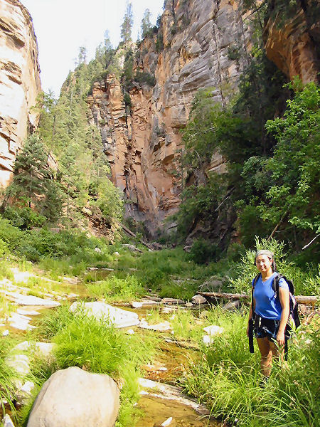
| Hike Description: |
From the lower car park and
trailhead, pick up the West Fork Trail (#108) as
it leads over a bridge and past the remnants and
apple grove of the Mayhew Lodge, a resort which
opened in 1926 and destroyed by fire in 1980.
The path then bends right and heads up Oak Creek
Canyon. In this section in the summer you'll
likely see many people, some who have come to
fish and others to swim. The path is flat and
easy and the dense trees provide welcome shade
from the harsh desert sun. The trail lasts about
3 miles and crosses the stream several times.
Those who have good balance and want to keep
their feet dry should be able to hop rocks at
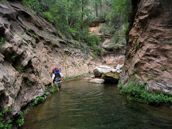
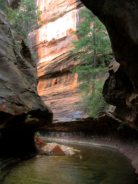
each of these crossings. The path ends at a
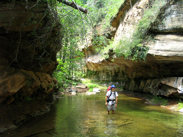
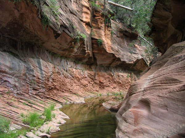
mandatory wade through a fairly narrow canyon in
the Supai Sandstone, this is the turn around
point for most people. The more adventurous can
continue exploring upstream where there are
short stretches of trail, but more often travel
consists of rock hopping, wading and pushing
through vegetation. The further upstream you go,
the less defined the route becomes. In the upper
reaches of the canyon there are several deep
wades and a couple swims. Make sure you stay
left at the junction with Cassner Cabin Draw (it
actually looks like a bigger drainage than the
West Fork), then turn right at the next drainage
you come to (left is just another fork in the
upper portion of the creek). Towards the upper
most part of the creek you will encounter a use
trail which leads the rest of the way to where
the creek crosses FR #231. |
| Rating (1-5 stars): |

The author has walked the entire length of
the canyon as well as done several shorter
excursions from the lower trailhead. |
| Maps: |
West Fork of Oak Creek
Canyon: Lower,
Upper |
| Books: |
Canyoneering Arizona
- Tyler Williams |
| Photos: |
Click picture for larger view, click your browser's 'Back' button to return to this page. |
