| |
Long / Bell Loop - Coconino
National Forest
| Summary: |
A long loop
hike with long sections of invisible trail, which connects
the Long Canyon Trail with the
Bell Trail near Wet Beaver Creek. If you decide
to do this hike you will need good route finding
skills. I'd also recommend wearing gaitors to
protect your socks from the many unpleasant
grasses. |
| Directions: |
From Phoenix,
take I-17 north to Sedona (exit 179). Turn
right (east) at the end of the exit on to Forest
Road (FR) #618. Drive past the turn off for Wet
Beaver Creek, then past the picnic area and turn
left at the sign for Web Beaver Ranch. Drive
about 0.5 miles down this well graded dirt road
to the prominent car park on the left. To avoid
the road walk, it is advisable to spot another
car at the Wet Beaver Creek Trailhead. |
| Road Conditions: |
Passenger Car |
| Navigation: |
Difficult |
| Length: |
~16 miles |
| Date Hiked: |
May 2003 |
| Weather Conditions: |
Sunny & hot with a nice
breeze |
|
Required Skills: |

 |
| Hike Description: |
From the car
park walk across the road and through the gate.
The sign at the trail head reads 'Long Canyon
Trail #63, Bell Trail #13 - 10 miles, Notice:
Trail difficult to find after 2 miles'. Begin
climbing through the chaparral up some fairly
steep switchbacks until you finally arrive at
the top of the mesa. The path levels out at this
point as it travels across the mesa through
grasses, juniper and prickly pear (the scenery
looks much the same for the next 10 miles).
There are a few cairns encased in wire mesh (to
keep the stupid cows from knocking them over)
and later, some plastic trail signs to follow.
The mesa has clearly been decimated by years of
overgrazing. All that remains are unpalatable
grasses, which unfortunately, are also the kind
that produce seed pods that cling to your socks,
making walking uncomfortable. The trail is
mostly easy to follow at first until you reach a
sign that says 'Trail difficult to find behind
this area, use with caution'. Sure enough, the
trail becomes extremely faint and difficult to
follow and the spacing of cairns is just far
enough apart to create some confusion. Keep
truckin' using my GPS points below if you'd
like. When you reach a cow tank, the path seems
to disappear. Stay to the right around the tank
(don't enter the enclosed fence) and look for
cairns and sign posts. From here the path is
non-existent, and it's up to you to locate the
next trail marker as you essentially head cross
country. After some more hiking, you'll reach
two cairns which are close together and the
welcome sight of an old road. The path bends
right and follows the faint road for a while.
The trail leaves the road on the left after a
mile or so. Keep an eye out for cairns on the
left as you hike (this occurs at GPS point #3
below). If the road begins to become well
traveled, you've probably gone too far. Turn
left and leave the road at the cairn. At this
point, you'll be able to see the drainage of
Long Canyon off to your left. The cairns (no
trail once again) follow the edge of the canyon
(crossing a fence along the way that you'll have
to jump over) until you reach a spot near the
head of the drainage. The path then bends left,
passes through another fence then heads down
into the canyon (this is the left upper fork of
Long Canyon), becoming surprisingly distinct as
it descends (likely the result of cattle walking
down to the creek for a drink). Once in the
canyon bottom, cross and look for a route out
the other side. Note: I lost the trail briefly
exiting the canyon, but soon picked it up about
half way up the other side. Once on the mesa,
the path passes through a fence then enters a
grassy area where I lost the path once again. I
believe the trail heads up and around the left
fork of Long Canyon to meet up with the Bell
Trail. I crossed the left fork prematurely, but
was eventually able to pick up the Bell Trail on
the other side. Either way, once you've found
the Bell Trail #13 (which unfortunately is in no
better shape than the Long), continue the same
routine of locating cairns or signs as you walk
across the grasslands. Be aware that when you
come to another tank, the trail bends right and
climbs a low rise. Finally, you will reach the
start of the distinct section of the Bell Trail
and the sign photographed below. It's easy
walking as the path descends a well maintained
trail with views to the right down into Wet
Beaver Creek. You'll eventually cross to the
left side of the ridge as you descend with views
down into the lower sections of Long Canyon
until the path terminates at Wet Beaver Creek at
the mouth of Long Canyon. Those that still have
some energy at this point, may want to walk up
Long Canyon about 15 minutes to check out a
short section of Supai sandstone narrows. You
may have to wade a few times and do some
climbing around on the left to avoid some deeper
pools if you're not up for a swim. When ready,
cross Wet Beaver Creek and pick up the well
trodden footpath on the other side. Follow it
the remaining 4 miles to the Wet Beaver Creek
car park, where you've hopefully spotted a
vehicle. Otherwise, you've got a couple more
miles of road walking ahead of you to get back
to the car park at the Long Canyon trail head.
UTM Coordinates for the hike:
1) 12S,437582mE, 3836369mN
2) 12S,439240mE, 3835574mN
3) 12S,440615mE, 3834900mN
4) 12S,441644mE, 3834065mN
5) 12S,443231mE, 3834432mN
6) 12S,441976mE, 3835396mN
7) 12S,440727mE, 3836109mN |
| Rating (1-5 stars): |

Not really a pleasant hike or one that I'd
recommend.
The author was dropped off at the Long
Canyon trail head, then hiked at a brisk pace to
the Wet Beaver Parking area in 6 hours where he
was picked up again. |
| Maps: |
Coconino National Forest Map |
| Photos: |
Click picture for larger view, click your browser's 'Back' button to return to this page. |
 |
 |
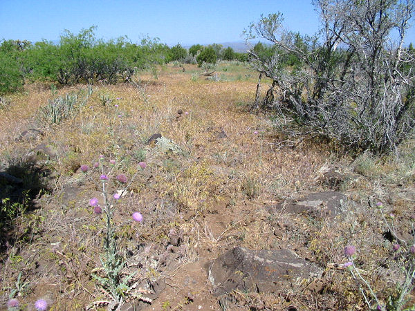
Most of the hike looks just like this.
The 'trail' runs through the center
of the photo. |
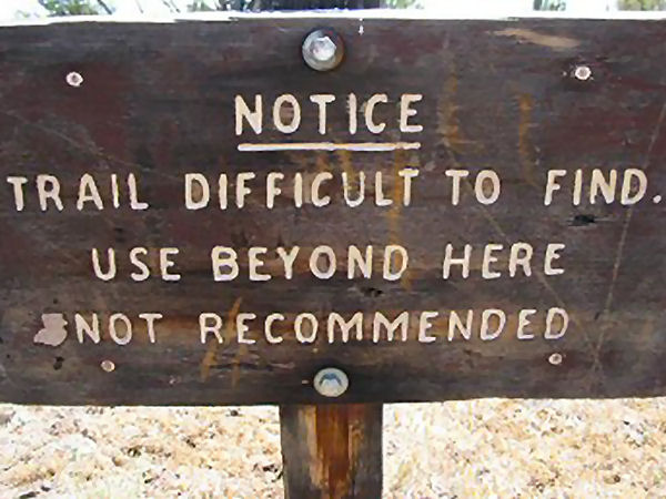
Sign pointing back the way you
came on the Bell Trail (too late
 ). ). |
 |
 |
|
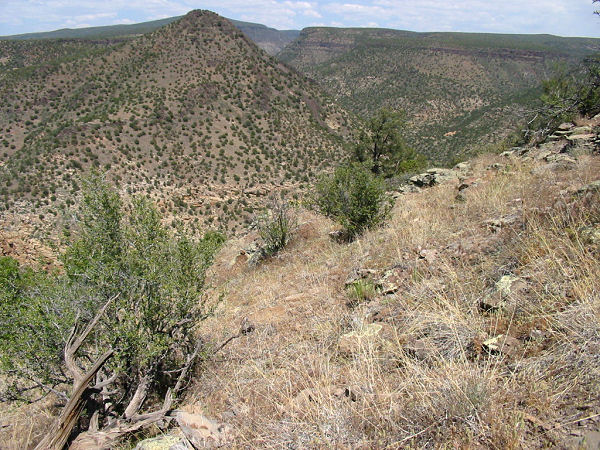
The drainage of Wet Beaver Creek. |
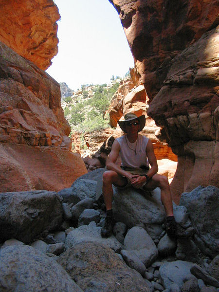
The short
Supai narrows
in Long Canyon. |
|
|
